Weekend Weather Warm Start Wind Shift Coming
Weekend Weather Warm Start Wind Shift Coming
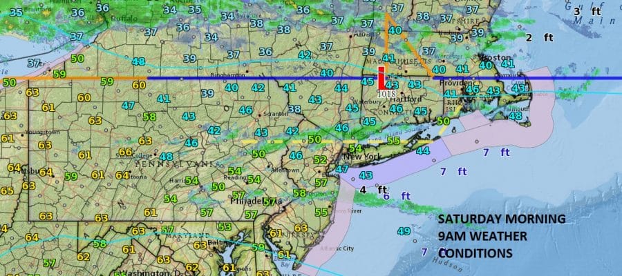
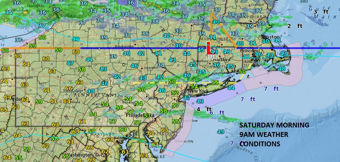
We are starting out this morning on the warm side of a weather front that sits across upstate NY this morning. Temperatures are in the 50s and some 60s are already showing up while to the north of the front it is in the 30s with a northeast wind. There are some clouds around and some narrow bands of showers showing up on the radar but for most of the area this morning it is dry. There is a storm that is centered back in Western Missouri which is creating severe weather in the Middle Mississippi Valley. That storm center will be moving northeast and weakening somewhat but there is enough there to create issues with rain and drizzle here on Sunday and some showers Sunday night into Monday.
SATELLITE LOOP

REGIONAL RADAR

LOCAL RADAR NEW YORK CITY

LOCAL RADAR PHILADELPHIA


Areas north of NYC in Northern New Jersey, Hudson Valley and Connceticut will begin to see the front move through from north to south late this morning. Look for the weather front to drop southward and begin to move through early this afternoon around NYC and late this afternoon or evening in Southern New Jersey southeastern Pennsylvania. Once the front passes temperatures will stop going up and begin to ease as low clouds from the northeast and east begin to move in from off the Ocean. Temperatures will top in the 50s and 60s today and then it will be much chillier on Sunday with a wide temperature variation from north to south.
SUNDAY FORECAST HIGH TEMPERATURES
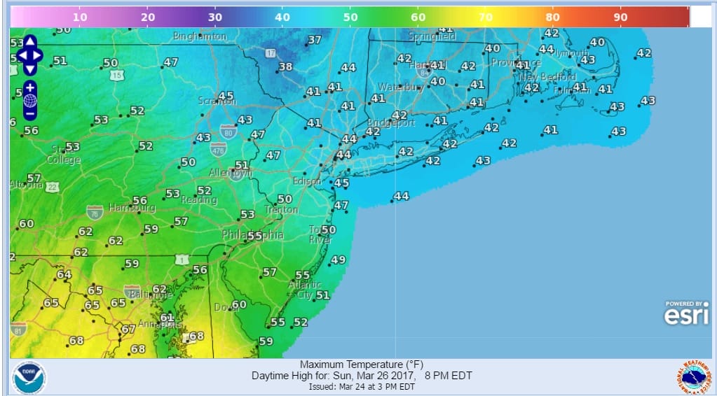
Monday the front returns back northward with showers around and temperatures rising to the 50s and 60s..Low pressure moves east on Tuesday with a period of rain before it finally begins to dry out on Wednesday.
 GET JOE A CIGAR IF YOU LIKE

SNOW REMOVAL COMPANIES FOR YOUR WINTER NEEDS
LONG ISLAND ROCKLAND COUNTY Connecticut

![]()

ROCKLAND COUNTY TRI STATE SNOW REMOVAL JOHNSTOWN PA


FiOS1 News Weather Forecast For Long Island
FiOS1 News Weather Forecast For New Jersey
FiOS1 News Weather Forecast For Hudson Valley
NATIONAL WEATHER SERVICE SNOW FORECASTS
LATEST JOESTRADAMUS ON THE LONG RANGE
Weather App

Don’t be without Meteorologist Joe Cioffi’s weather app. It is really a meteorologist app because you get my forecasts and my analysis and not some automated computer generated forecast based on the GFS model. This is why your app forecast changes every 6 hours. It is model driven with no human input at all. It gives you an icon, a temperature and no insight whatsoever.
It is a complete weather app to suit your forecast needs. All the weather information you need is right on your phone. Android or I-phone, use it to keep track of all the latest weather information and forecasts. This weather app is also free of advertising so you don’t have to worry about security issues with your device. An accurate forecast and no worries that your device is being compromised.
Use it in conjunction with my website and my facebook and twitter and you have complete weather coverage of all the latest weather and the long range outlook. The website has been redone and upgraded. Its easy to use and everything is archived so you can see how well Joe does or doesn’t do when it comes to forecasts and outlooks.
Just click on the google play button or the apple store button on the sidebar for my app which is on My Weather Concierge. Download the app for free. Subscribe to my forecasts on an ad free environment for just 99 cents a month.
Get my forecasts in the palm of your hand for less than the cost of a cup of Joe!


