Weekend Weather Outlook Promising

Weekend Weather Outlook Promising
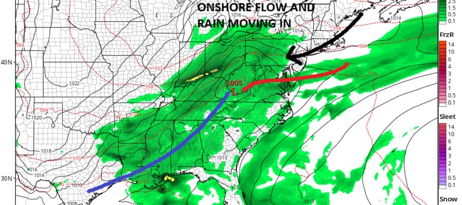
As we draw toward the weekend we see some signs that weather conditions could turn out to be okay for most of the area for a good part of the time. Saturday is not an issue at all. We should see plenty of sunshine on Saturday with nothing more than a few passing clouds with temperatures in the 70s. That is the easy part of the forecast. Sunday has been in question all week due to low pressure approaching us from the Great Lakes. A few subtle changes in track of that low makes all the difference in the Sunday outcome. As we have gotten closer and closer to the weekend the low is tracking further north. This changes the profile for much of the area from one waiting for an onshore flow to develop and a warm from setting up, to a cold front coming in from the northwest.
WEEKEND WEATHER OUTLOOK FROM TUESDAY’S GFS MODEL
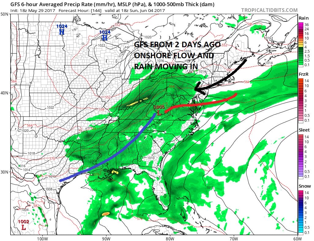
Above was the GFS from 2 days ago setting us up for another wet onshore flow on Sunday with rain and a raw northeast wind. The New GFS model (along with the NAM and European models) have all adjusted to the weather system being further north with no onshore flow.
WEEKEND WEATHER OUTLOOK FROM TODAY’S GFS MODEL RUN
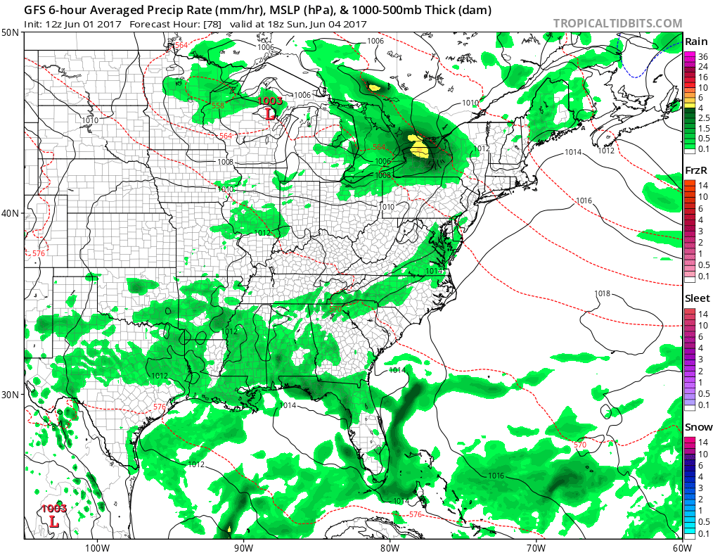
What a huge difference on today’s model run. Yes there may be clouds but it looks like there will be no showers of consequence until at the earliest late Sunday afternoon and evening across the Hudson Valley and sometime Sunday night everywhere else. If this verifies Sunday may not be too bad for much of the day.
GFS MODEL EARLY NEXT WEEK CLICK TO ANIMATE

The onshore flow issue may wind up setting up early next week as low pressure looks to form just offshore to our south but here too there are some model differences. A lot will depend on whether the upper air feature with this winds up dropping as far south as indicated. Either way given the strength of the jet stream in the east and its placement south of normal suggests that no hot weather is in the forecast anytime soon.
MANY THANKS TO TROPICAL TIDBITS FOR THE WONDERFUL USE OF THE MAPS

GET JOE A CIGAR IF YOU LIKE!
LANDSCAPE COMPANIES FOR YOUR SPRING SUMMER FALL NEEDS
LONG ISLAND ROCKLAND COUNTY Connecticut

![]()

ROCKLAND COUNTY TRI STATE SNOW REMOVAL JOHNSTOWN PA


FiOS1 News Weather Forecast For Long Island
FiOS1 News Weather Forecast For New Jersey
FiOS1 News Weather Forecast For Hudson Valley
NATIONAL WEATHER SERVICE SNOW FORECASTS
LATEST JOESTRADAMUS ON THE LONG RANGE
Weather App

Don’t be without Meteorologist Joe Cioffi’s weather app. It is really a meteorologist app because you get my forecasts and my analysis and not some automated computer generated forecast based on the GFS model. This is why your app forecast changes every 6 hours. It is model driven with no human input at all. It gives you an icon, a temperature and no insight whatsoever.
It is a complete weather app to suit your forecast needs. All the weather information you need is right on your phone. Android or I-phone, use it to keep track of all the latest weather information and forecasts. This weather app is also free of advertising so you don’t have to worry about security issues with your device. An accurate forecast and no worries that your device is being compromised.
Use it in conjunction with my website and my facebook and twitter and you have complete weather coverage of all the latest weather and the long range outlook. The website has been redone and upgraded. Its easy to use and everything is archived so you can see how well Joe does or doesn’t do when it comes to forecasts and outlooks.
Just click on the google play button or the apple store button on the sidebar for my app which is on My Weather Concierge. Download the app for free. Subscribe to my forecasts on an ad free environment for just 99 cents a month.
Get my forecasts in the palm of your hand for less than the cost of a cup of Joe!
![]()


