
WEEKEND WEATHER BRINGS CLOUDS
WARMER SUNDAY BEFORE WEAK COLD FRONT PASSES
WARM NEXT WEEK WATCHING FOR TROPICAL STORM DEVELOPMENT
The weekend weather looks relatively uneventful with clouds on the satellite today. A weak warm front is moving northward but other than clouds there should not be much else going on today. Temperatures will likely top in the upper 60s to some lower 70s in most places. The warm front passes overnight and that sets us up for a warm Sunday under partly sunny skies. Highs will be in the 70s to near 80 before another weak cold front comes through.
EASTERN SATELLITE

REGIONAL RADAR

Much of the shower activity today will be across upstate NY. There really isn’t a whole lot of moisture today play with this weekend for either the warm front today or the cold front Sunday. The week ahead looks to be warm with an upper high along the East Coast and an onshore wind on Monday. This will likely keep us in clouds and temperatures in the upper 60s and lower 70s. Then as the surface high shifts southward it will turn warmer into midweek with dry weather into Wednesday.
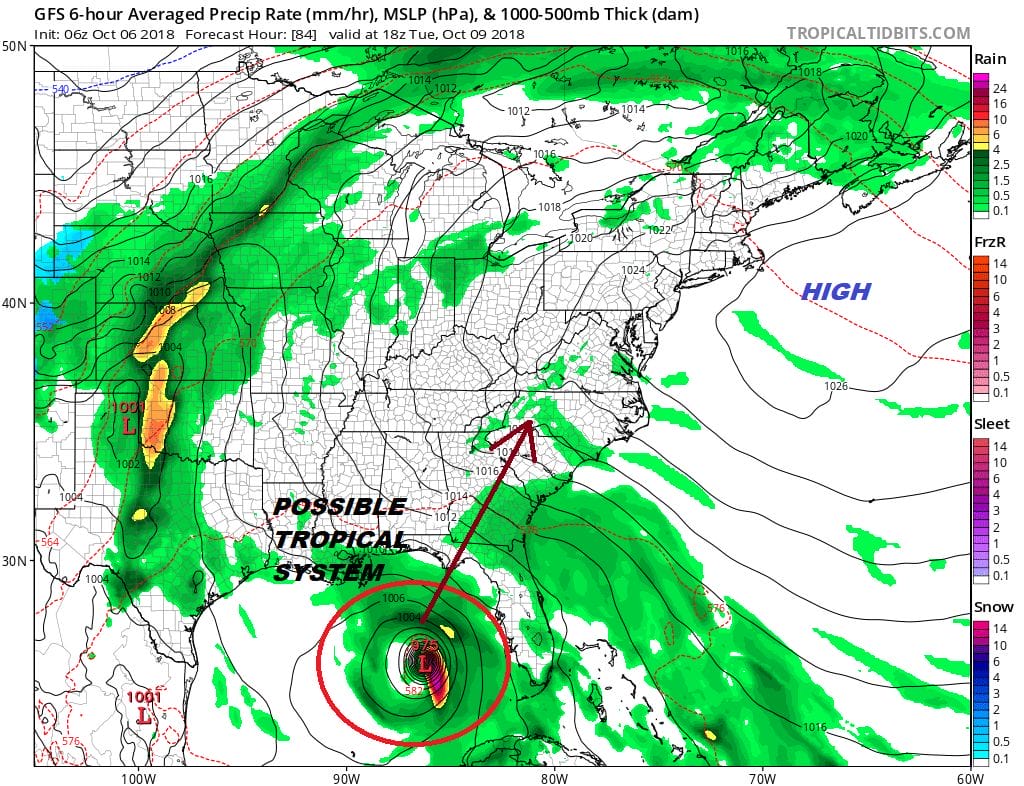
Meanwhile in the Gulf of Mexico we are likely to see a tropical cyclone develop early next week as conditions are going to become favorable for development. We have a system in the Northwest Caribbean today which remains somewhat disorganized but low pressure has developed and upper air winds are beginning to relax somewhat to allow for some additional organization.
We could see this system become a tropical depression later today. The weather pattern next week favors this system moving up the East Coast east of the Appalachians next week and will have impact on the longer range weather pattern. We will explore this and more later today.
SUBSCRIBE TO PATREON FOR A WEATHER EXPERIENCE FREE OF ADS, EXCLUSIVE VIDEOS FOR MEMBERS ONLY AND MUCH MORE…STARTS AT $2 A MONTH..MESSAGE ME AT ANY TIME

MANY THANKS TO TROPICAL TIDBITS FOR THE USE OF MAPS
Please note that with regards to any tropical storms or hurricanes, should a storm be threatening, please consult your local National Weather Service office or your local government officials about what action you should be taking to protect life and property.
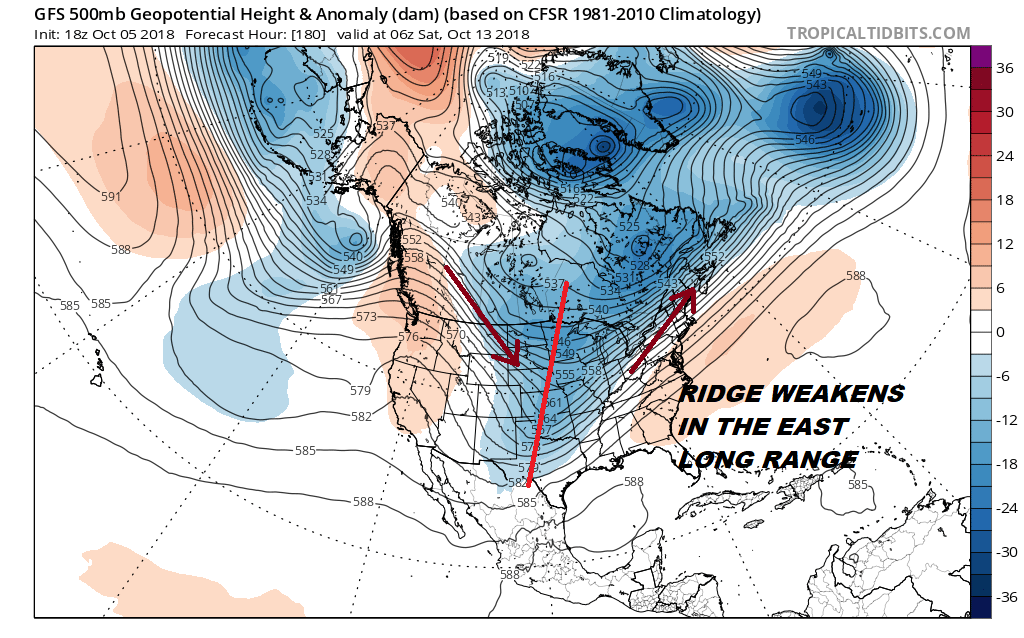
LATEST JOESTRADAMUS ON THE LONG RANGE

