
Weekend Warmth Arrives Rain Monday Tuesday
Weekend Warmth Arrives Rain Monday Tuesday
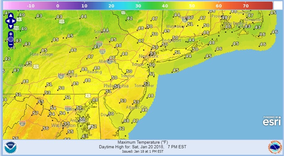
Warmth is a relative term here. We will see sunshine today and we will see temperatures up around 50 for highs but it is not off the wall warmth by any means. But a nice day is a nice day and the temperatures near 50 with sunshine will quite nice indeed. It will give many of you the opportunity to perhaps take down Christmas decorations that are still out doors or even just take a nice stroll in the fresh air. Whatever your choice is enjoy the day. The satellite loop shows some high clouds out to the west but that reall is about it as far as complications are concerned. No worries from any showers as the radars will be nice and quiet.
US SATELLITE

REGIONAL RADAR

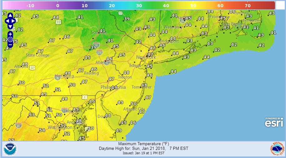
Now comes Sunday and we will see temperatures perhaps a bit lower than today thanks to a weak weather front easing through and winds that will go more north or northeast as the day wears on. Highs however will still be in the 40s.
Monday begins the process of low pressure heading for the Great Lakes and moving through the Northeast. This for is is a warm front cold front combination with the warm front approaching Monday and Monday with with clouds and showers ahead of it and temperatures in the 40s. Then we will see cloudy skies with showers on Tuesday with highs reaching into the 50s.
GFS RAINFALL FORECAST THROUGH TUESDAY

Rainfall from this frontal system should be on the order of a half inch to an inch in some places. Everything moves along so that it turns colder and dry for Wednesday through Friday of next week with some sunshine and temperatures trending back toward average for this time of year. There doesn’t appear to be any pattern change back to the arctic express coming through all of next week at least and perhaps a bit beyond next week.
 GET JOE A CIGAR IF YOU LIKE

FiOS1 News Weather Forecast For Long Island
FiOS1 News Weather Forecast For New Jersey
FiOS1 News Weather Forecast For Hudson Valley


