
Weekend Begins Some Sunshine Thunderstorms Severe Weather Risk Late Sunday
We are at the weekend and we are seeing two weather systems. One is off the Virginia Coast and moving slowly eastward. To the north there is a weak cold front that is moving slowly southward through upstate New York We see some showers in upstate NY in a narrow east west band and we have some showers down near the Virginia coast. This will put us in clouds but there will certainly be some sunshine today. Temperatures this afternoon will be in the mid 70s along the coast and upper 70s to lower 80s as you head inland. we don’t expect any serious issues from either system. There might be a shower or isolated thunderstorm well inland this afternoon. The front to the north will arrive tonight and there could be a few passing showers mainly overnight and widely scattered. The vast majority of us won’t see anything tonight from this weak system. Temperatures overnight will be in the 50s to near 60,
SATELLITE

REGIONAL RADAR

Sunday brings a second and stronger cold front. Until it arrives late in the day we should see clouds and some sunshine with highs reaching the upper 70s and lower 80s. Behind the front is a rather robust cool air mass moving southward from Canada. The front itself is being supported by a very strong short wave trough that will be moving across the Great Lakes and Northeast. The upper air is supportive of the potential for severe thunderstorms late Sunday afternoon and evening. The Storm Prediction Center has outlined an area of risk.
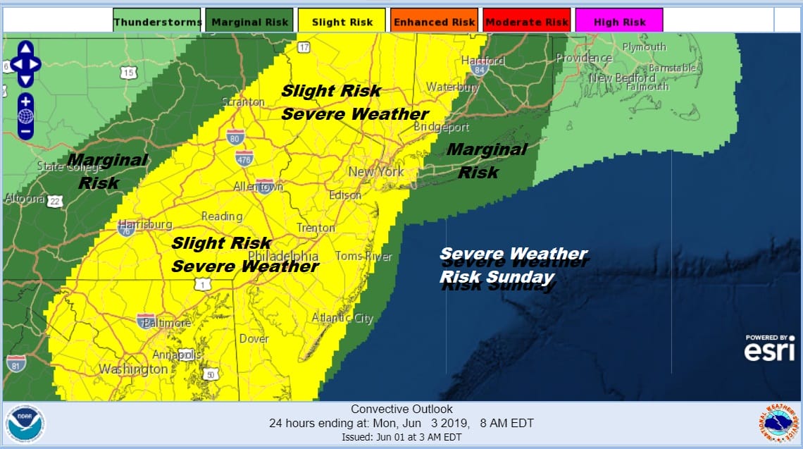
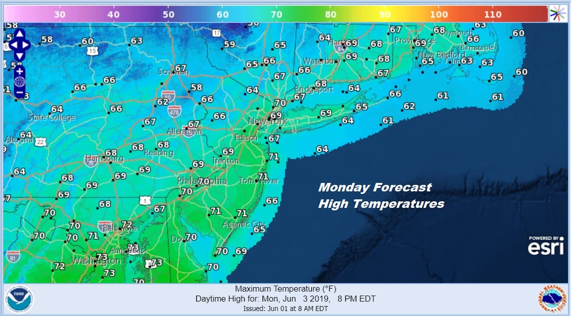
Threat time for thunderstorms Sunday will be from roughly 3pm to 9pm from west to east. Then once the thunderstorms move offshore with the cold front, we will see a very cool air mass set up in the Northeast for early June. Monday will be a day of clouds with some sunshine but there will be a gusty wind and temperatures that will be hard pressed to get out of the 60s in most areas.
Tuesday sees sunshine much of the day with highs reaching back into the lower 70s on average though areas north and west of the coast will struggle to get back to 70. The high moves off the South Atlantic Coast so a west wind brings warmer temperatures Wednesday with some sun. Highs will be in the mid 70s to lower 80s. A weather front will be moving through and this could be setting us up for onshore flow issues and some rain chances late next week. We will explore those possibilities later today.
MANY THANKS TO TROPICAL TIDBITS FOR THE USE OF MAPS
Please note that with regards to any tropical storms or hurricanes, should a storm be threatening, please consult your local National Weather Service office or your local government officials about what action you should be taking to protect life and property.


