Week Ahead Warm Above Normal Temperatures
Pattern Change to Autumn Chill Looms Late Week

Week Ahead Warm Above Normal Temperatures
Pattern Change to Autumn Chill Looms Late Week
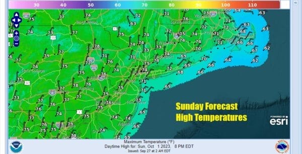
After days of gloom and doom and record rainfall, genuine improvement has settled into the Northeast. The system that brought the record rainfall remains an obvious feature on satellite loops show the low center is well to the southeast offshore and it is finally far enough east to allow high pressure to build in. This has brought in drier air and it continues to overspread the area. The coast is the last to see the improvement with some lingering clouds earlier today but sunshine is increasing as the afternoon wears on. Temperatures are responding to the sun and highs will reach the low and middle 70s this afternoon.
SATELLITE WITH LIGHTNING STRIKES
WEATHER RADAR
The flow is still somewhat onshore which is impacting tides and we continue to see higher than normal tides coming off the full moon. Coastal flooding at high tide should subside some Monday as the onshore flow relaxes. Lows tonight will be in the mid 50s inland with a few 40s in cold spots and warmer lower 60s in warmer urban areas.
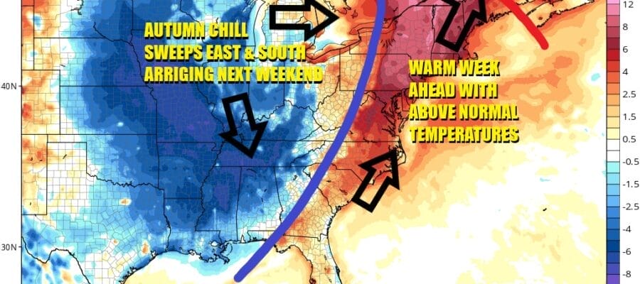
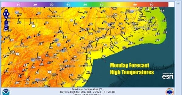
Monday will be a sunny day with a summery feel to it. This will at least help in drying out the heavy rains from Friday and Saturday. Lots of sunshine will take highs well into the 70s to around 80 degrees. All this week the pattern in the Eastern US will be dominated by a ridge of high pressure aloft, holding high pressure in place in the Eastern US.
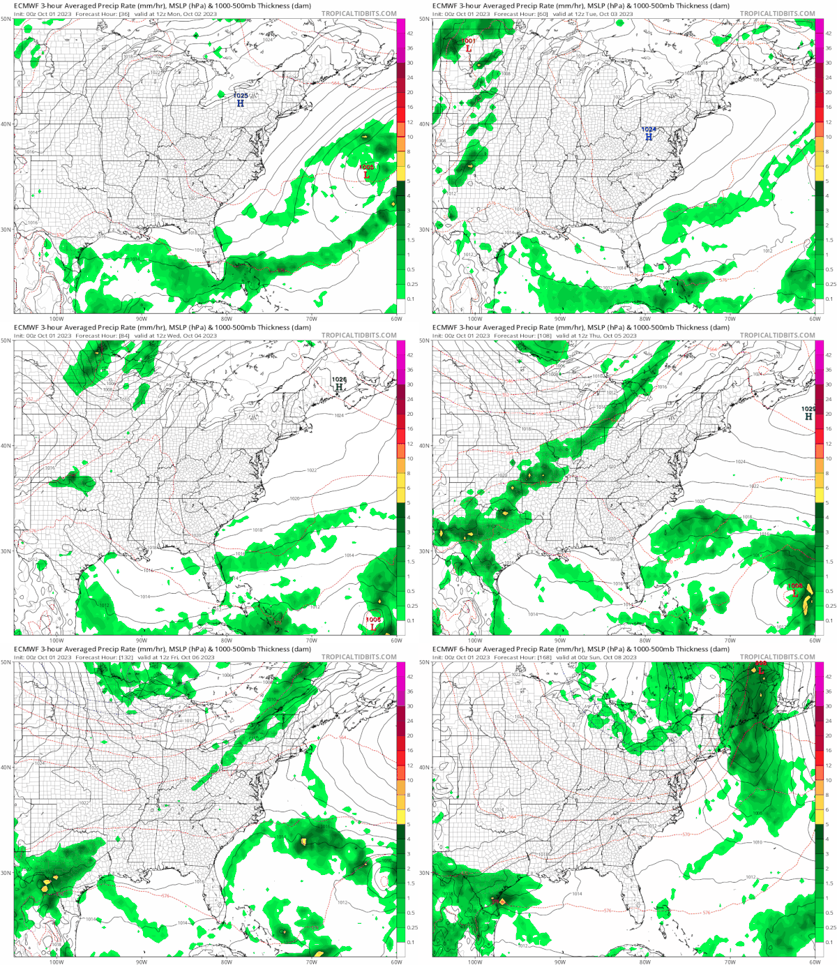
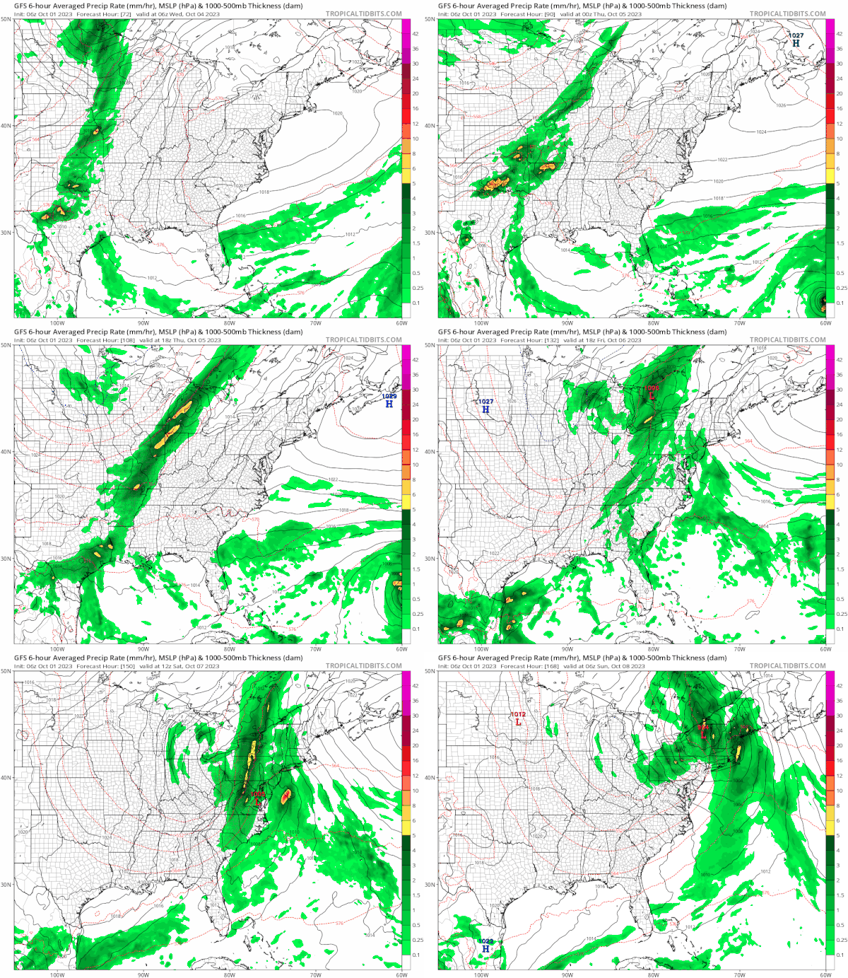
That ridge in the Eastern US will break down late this week and a deep trough will be driving southeast from Canada and push a cold front through here Friday night or Saturday. The faster European brings the front through late Friday while the slower GFS slows the front down and a developing wave brings rain late Friday and much of next Saturday as much cooler air rushes in behind it.
The timing issue of the front will be the forecast challenge for this week but either way, we will see temperatures turn colder and below average over the weekend and into next week. We may start to see the first frosts of the season in some areas inland next week. However before we get there we have warm weather Tuesday with sunshine and highs reaching the upper 70s to lower 80s
Humidity levels will be rising beginning Tuesday and coupled with lengthening warm nights we will likely see low clouds and fog during overnight and early morning periods this week. Wednesday and Thursday we will continue with warm and somewhat humid conditions with sunshine both days and highs in the upper 70s to lower 80s. Then we will deal with the cold front and some showers possible late Friday which may continue into at least part of Saturday before the autumn chill arrives. Enjoy the warm week ahead.
BE SURE TO DOWNLOAD THE FREE METEOROLOGIST JOE CIOFFI WEATHER APP &
ANGRY BEN’S FREE WEATHER APP “THE ANGRY WEATHERMAN!
MANY THANKS TO TROPICAL TIDBITS FOR THE USE OF MAPS
Please note that with regards to any severe weather, tropical storms, or hurricanes, should a storm be threatening, please consult your local National Weather Service office or your local government officials about what action you should be taking to protect life and property.
(Amazon is an affilate of Meteorologist Joe Cioffi & earns commissions on sales.)

