Sunshine Warm Temperatures Through Thursday
Cold Front Brings Late Friday into Early Saturday

Sunshine Warm Temperatures Through Thursday
Cold Front Brings Late Friday into Early Saturday
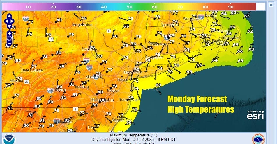
The new week has a touch of late summer to it. We will see warmer than average temperatures all week long. Last week’s flood producing system is well offshore but still visible on satellite loops. It is holding high pressure running up and down the Eastern Seaboard in place and that leaves with a Monday of sunshine. Highs today will be in the middle 70s to around 80 degrees. Radars are quiet and we have no rain issues to concern ourselves with through Thursday.
SATELLITE WITH LIGHTNING STRIKES

WEATHER RADAR

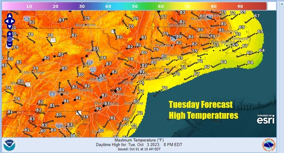
Nights are longer than days as we move deeper into the Autumn season. A ridge in the Eastern US and a stable atmosphere will likely cause low clouds and fog to develop in some aeras during nighttime and early morning hours during this week. Temperatures at night will be in the mid 50s to lower 60s. Tuesday sunshine will rise to the upper 70s and lower 80s
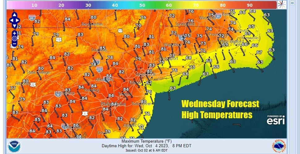
Wednesday morning lows will be in the upper 50s to mid 60s and this sets us up for the warmest day of the week with sunshine after morning low clouds and fog burn off. We could see highs reaching the low and even middle 80s in some places we could make a run for record high temperatures. Dew points will be coming up into the low and middle 60s so it will be somewhat uncomfortable but not along the lines of summer discomfort.
Thursday we are looking at another warm day but the wind from the south southeast likely takes temperatures down a few degrees and away from record highs. There also may be more clouds around as the high becomes a bit “dirty” or stale and moves further east and offshore. Thursday highs will be in the mid to upper 70s.

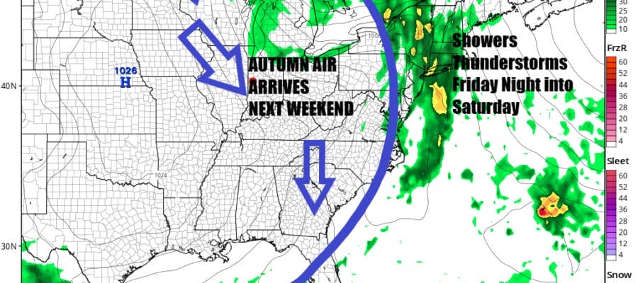
Friday a cold front will be approaching and that could mean some scattered showers during the day but most of the day will be rain free. Showers and some thunderstorms will become more numerous later Friday night and during the day Saturday. This front and the upper trough that goes with it will change the pattern completely as we go for late summer weather to mid Autumn weather. Friday highs will be in the 70s but Saturday highs will be in the 60s thanks to the rain. A rather chilly air mass will arrive behind the front and that will be the dominating pattern for Sunday and next week. Sunday should see some sun returning but it will be quite cool with highs just in the 50s to at best near 60. Next week we are looking at a strong flow from Canada dominating the weather pattern leading us to below average temperatures beginning Sunday and likely lasting for all of next week.
BE SURE TO DOWNLOAD THE FREE METEOROLOGIST JOE CIOFFI WEATHER APP &
ANGRY BEN’S FREE WEATHER APP “THE ANGRY WEATHERMAN!
MANY THANKS TO TROPICAL TIDBITS FOR THE USE OF MAPS
Please note that with regards to any severe weather, tropical storms, or hurricanes, should a storm be threatening, please consult your local National Weather Service office or your local government officials about what action you should be taking to protect life and property.
(Amazon is an affilate of Meteorologist Joe Cioffi & earns commissions on sales.)


