Week Ahead Sees Weather Systems Moving Again,
New Tropical Storm/Hurricane to Form Gulf of Mexico Late Week

Week Ahead Sees Weather Systems Moving Again,
New Tropical Storm/Hurricane to Form Gulf of Mexico Late Week
We still have low pressure off the coast of Southeastern New England for the 4th day in a row but finally this system will be moving southward. At the same time we have high pressure nosing southward from Eastern Canada. This will keep weather systems to the west from making much eastward progress today though as we move through this week we will start to see some progression resuming across the US.
The onshore flow however continues over the next few days and that means we will continue to see coastal flooding at high tide along the coast. Otherwise today will be a nice day with sunshine and an east wind. The air to the north is slightly cooler and drier so temperatures will be lower in the coming days. Highs this afternoon will be in the low to mid 70s with 60s along the coast. Radars are quiet for the most part other than the leftover rain off the Coast of Southeastern New England and that area will continue to fade as the offshore low head south.
SATELLITE WITH LIGHTNING STRIKES

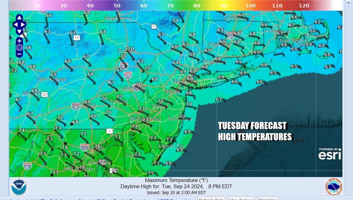
WEATHER RADAR

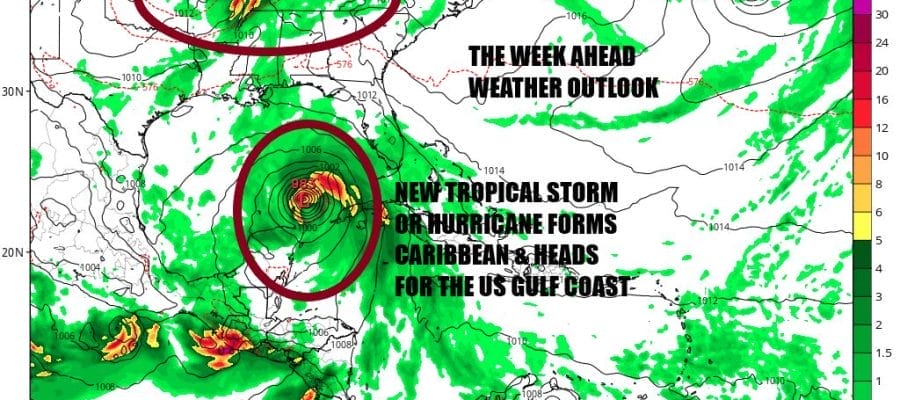
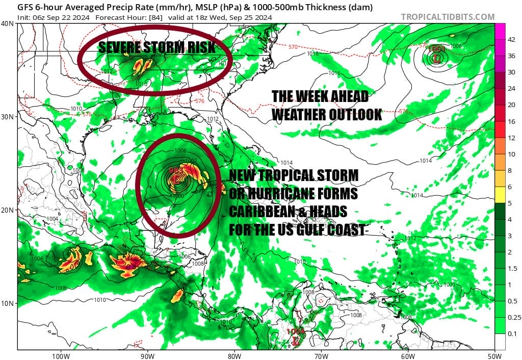
To the west we have a weather front from the Great Lakes that extends south to Lower Mississippi Valley back to the Gulf Coast. This will likely produce showers and thunderstorms along with some isolated severe weather this afternoon and again Monday. We also have lower than normal pressures in the Western Caribbean and by midweek we will probably have a developing tropical depression or tropical storm forming there and heading northward toward the Gulf of Mexico.

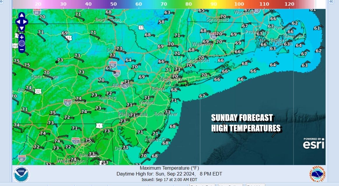
While showers could making it to Western NY south to Pennsylvania early next week, the high holds on and that leaves much of Eastern Pennsylvania to Southern New England dry through Tuesday. Nights will see clouds developing and patchy fog while the dayside Monday and much of Tuesday should be no worse than partly sunny.
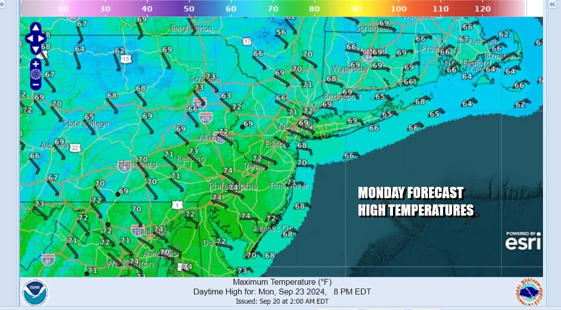
Monday highs will likely range in the upper 60s and lower 70s area wide. Tuesday most highs will be in the upper 60s to around 70 as there might be more in the way of cloud cover and the onshore flow continues to feed in cooler air from the northeast and east. We will also probably see showers in Pennsylvania and Western NY southward and some of those showers will likely move in sometime Tuesday night.
Wednesday we will likely see cloudy skies with occasional showers and perhaps the odd thunderstorm or two though severe weather risks are not indicated at this time. Highs will reach the upper 60s to some lower 70s. Another high will build south and east from Canada Thursday and into the weekend. To the south at this point in the Gulf of Mexico we will likely have a tropical storm or hurricane bringing risks to areas from Louisiana to Florida though how elevated those risks are remains a mystery at this time. Conditions due seem favorable for a strong system to develop in Gulf of Mexico but we will have more information available in a couple of days. It would see that if another blocking high develops in the Northeast, rains from this system will remain south but here too likes some uncertainty regarding events for late next week and next weekend. Right now it would seem that we may be back in a dry seasonal pattern for the late week and the weekend.
BE SURE TO DOWNLOAD THE FREE METEOROLOGIST JOE CIOFFI WEATHER APP &
ANGRY BEN’S FREE WEATHER APP “THE ANGRY WEATHERMAN!
MANY THANKS TO TROPICAL TIDBITS FOR THE USE OF MAPS
Please note that with regards to any severe weather, tropical storms, or hurricanes, should a storm be threatening, please consult your local National Weather Service office or your local government officials about what action you should be taking to protect life and property.
(Amazon is an affilate of Meteorologist Joe Cioffi & earns commissions on sales.)


