
Week Ahead Forecast Wet Times Ahead
Week Ahead Forecast Wet Times Ahead
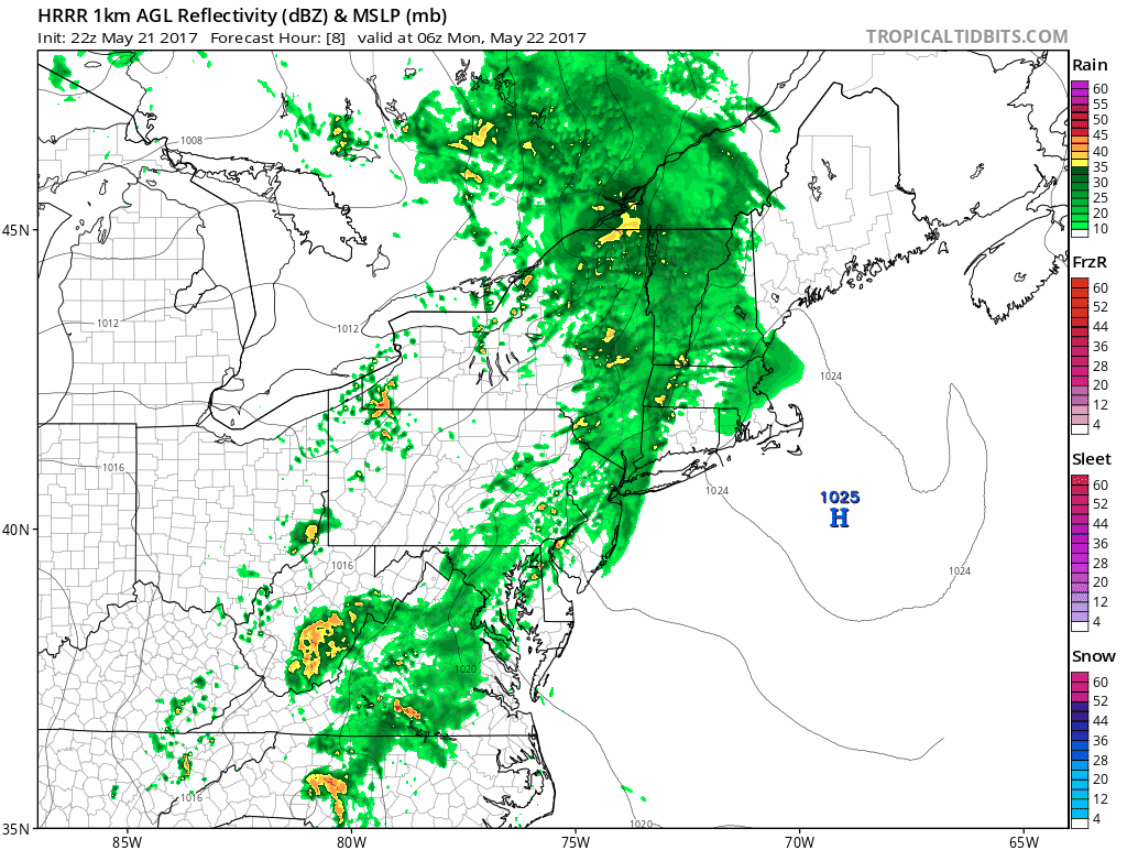
The week ahead forecast has wet times ahead of us. It is not going to be raining all the time however we do have 3 weather systems that are headed our way. There is a blocking pattern across the North Atlantic and while it is not as strong as the one from 2 weeks ago, it is strong enough to disrupt the normal flow of weather systems from west to east. We will see weather systems slowing down in the week ahead. The first system approaches tonight and Monday. Rain is showing up on the regional radar below and some of the lead showers are beginning to show up on the local radars as well.
SATELLITE LOOP

REGIONAL RADAR

LOCAL RADAR NEW YORK CITY

LOCAL RADAR PHILADELPHIA


When we look at the HRRR model for Monday morning you can see the first area of rain about to move out during the morning rush hour around NYC and Long Island, However a second area of rain generates to the south across Southeast Pennsylvania and Southern New Jersey.
WEEK AHEAD FORECAST HRRR MODEL MONDAY MORNING CLICK TO ANIMATE
That second surge will move northward and there could be some heavy downpours from this area until it plays its way through by Monday evening. Temperatures Monday will be struggling with an onshore flow. Highs in many areas will not get out of the 50s while some inland spots could break 60.
RGEM MODEL TUESDAY AFTERNOON
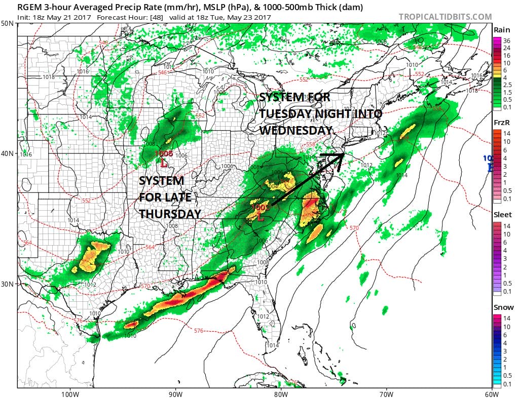
Tuesday night into Wednesday low pressure from the Southeast US will move up the coast. Models seem to be shifting westward with this system and that could bring more rain later Tuesday night into Wednesday. Then a third system swings east from the Great Lakes with the chance for more rain or showers later Thursday into Friday.
 GET JOE A CIGAR IF YOU LIKE

LANDSCAPE COMPANIES FOR YOUR NEEDS
LONG ISLAND ROCKLAND COUNTY Connecticut

![]()

ROCKLAND COUNTY TRI STATE SNOW REMOVAL JOHNSTOWN PA


FiOS1 News Weather Forecast For Long Island
FiOS1 News Weather Forecast For New Jersey
FiOS1 News Weather Forecast For Hudson Valley
NATIONAL WEATHER SERVICE SNOW FORECASTS
LATEST JOESTRADAMUS ON THE LONG RANGE
Weather App

Don’t be without Meteorologist Joe Cioffi’s weather app. It is really a meteorologist app because you get my forecasts and my analysis and not some automated computer generated forecast based on the GFS model. This is why your app forecast changes every 6 hours. It is model driven with no human input at all. It gives you an icon, a temperature and no insight whatsoever.
It is a complete weather app to suit your forecast needs. All the weather information you need is right on your phone. Android or I-phone, use it to keep track of all the latest weather information and forecasts. This weather app is also free of advertising so you don’t have to worry about security issues with your device. An accurate forecast and no worries that your device is being compromised.
Use it in conjunction with my website and my facebook and twitter and you have complete weather coverage of all the latest weather and the long range outlook. The website has been redone and upgraded. Its easy to use and everything is archived so you can see how well Joe does or doesn’t do when it comes to forecasts and outlooks.
Just click on the google play button or the apple store button on the sidebar for my app which is on My Weather Concierge. Download the app for free. Subscribe to my forecasts on an ad free environment for just 99 cents a month.
Get my forecasts in the palm of your hand for less than the cost of a cup of Joe!


