Weather Moving To Active Pattern Next Week

Weather Moving To Active Pattern Next Week
Next week we will be moving toward a more active pattern after a brief break in the last week or so. After Easter Sunday these brief tastes of very warm weather will be more of an exception rather than the rule Today we will use the European weather model view of the weather pattern going forward.
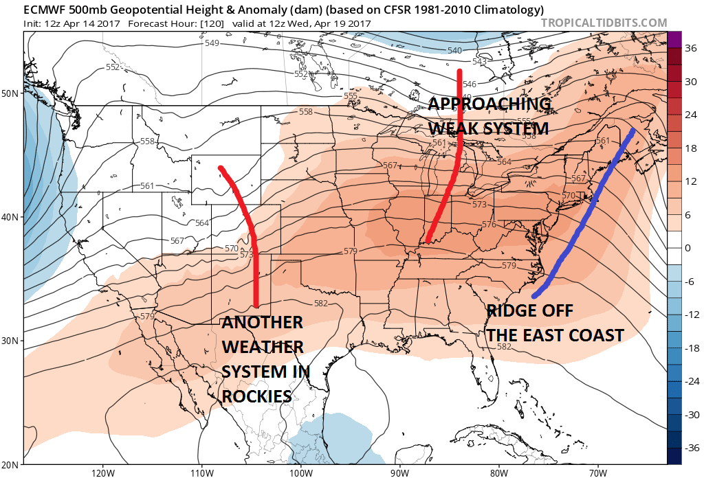
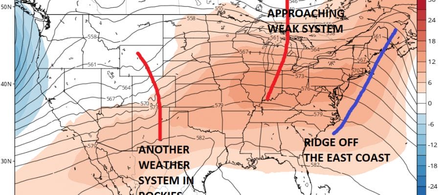
The flow across the country is mainly from west to east with relatively weak ridges and troughs moving along. This will mean the chance for some showers on Wednesday, The European brings the the system from the Rockies out right behind it and that brings in the chance for some rain Thursday into Friday.
Right behind this system is another stronger system coming in from the Pacific. The European model amplifies this as it moves eastward and would mean more chances for rain early next week. The addition of a blocky look will mean cooler temperatures and the possibility of something a bit more substantial as far as rain is concerned.
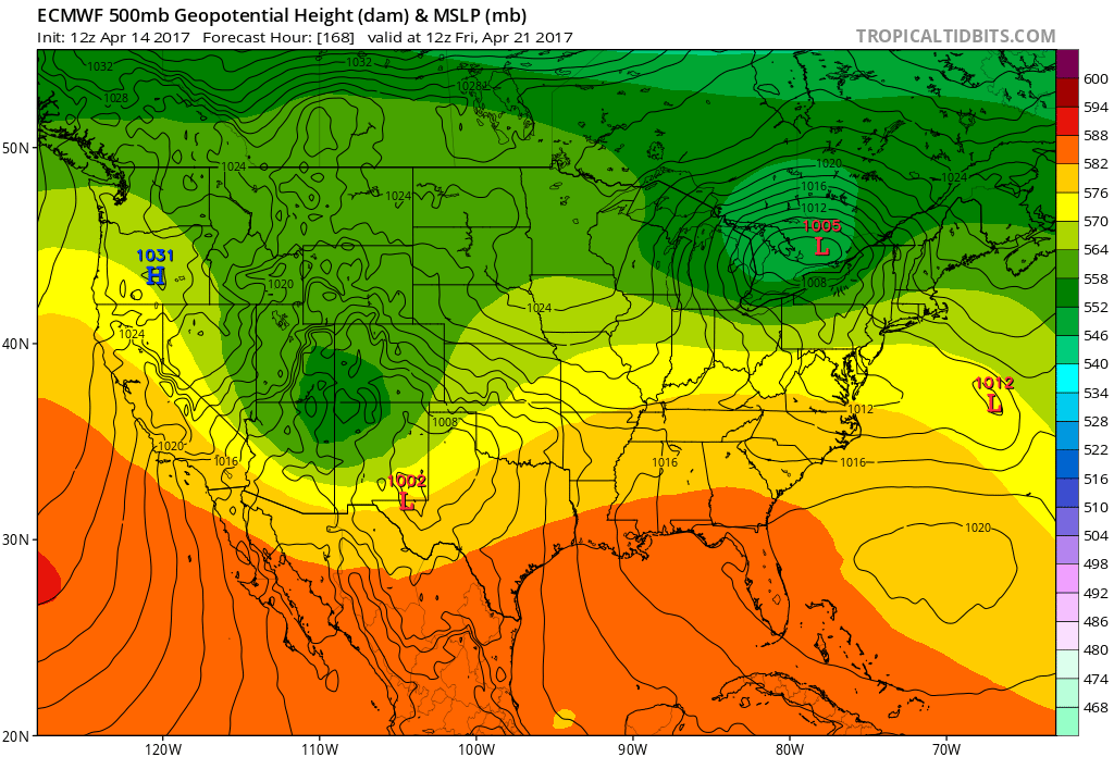
EUROPEAN MODEL NEXT WEEKEND CLICK TO ANIMATE

It appears the active pattern would hold through the end of the month. It also opens more possibilities for severe weather outbreaks in other parts of the country. Spring seems to me moving along in typical fashion this season.
MANY THANKS TO TROPICAL TIDBITS FOR THE WONDERFUL USE OF THE MAPS

GET JOE A CIGAR IF YOU LIKE!
LANDSCAPE COMPANIES FOR YOUR SPRING SUMMER FALL NEEDS
LONG ISLAND ROCKLAND COUNTY Connecticut

![]()

ROCKLAND COUNTY TRI STATE SNOW REMOVAL JOHNSTOWN PA


FiOS1 News Weather Forecast For Long Island
FiOS1 News Weather Forecast For New Jersey
FiOS1 News Weather Forecast For Hudson Valley
NATIONAL WEATHER SERVICE SNOW FORECASTS
LATEST JOESTRADAMUS ON THE LONG RANGE
Weather App

Don’t be without Meteorologist Joe Cioffi’s weather app. It is really a meteorologist app because you get my forecasts and my analysis and not some automated computer generated forecast based on the GFS model. This is why your app forecast changes every 6 hours. It is model driven with no human input at all. It gives you an icon, a temperature and no insight whatsoever.
It is a complete weather app to suit your forecast needs. All the weather information you need is right on your phone. Android or I-phone, use it to keep track of all the latest weather information and forecasts. This weather app is also free of advertising so you don’t have to worry about security issues with your device. An accurate forecast and no worries that your device is being compromised.
Use it in conjunction with my website and my facebook and twitter and you have complete weather coverage of all the latest weather and the long range outlook. The website has been redone and upgraded. Its easy to use and everything is archived so you can see how well Joe does or doesn’t do when it comes to forecasts and outlooks.
Just click on the google play button or the apple store button on the sidebar for my app which is on My Weather Concierge. Download the app for free. Subscribe to my forecasts on an ad free environment for just 99 cents a month.
Get my forecasts in the palm of your hand for less than the cost of a cup of Joe!
![]()
