Weather Models Trending South Backing Off Heavy Rains For Some
Weather Models Trending South
Backing Off Heavy Rains For Some Areas
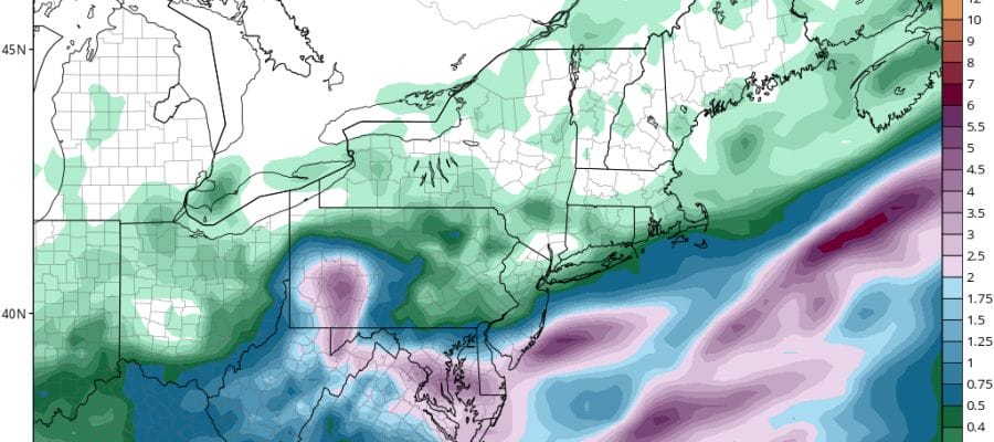
The model trend since earlier today has been further south with less rain and that trend continues overnight. For areas across Northern New Jersey to NYC & Long Island amounts have been cut in half to under an inch and just inland of the coast the sharp cut off line has moved further south. Areas just north and northeast of NYC might see very little rain from this if the southern trend continues. In addition the big rains indicated in areas to the south across Central & Southern New Jersey have been reduced to under 2 inches and in some cases even less. The upper air system responsible for this being forecast weaker and further south with every model run. If this trend continues during the day Friday it is likely that the FLASH FLOOD WATCH area as it stands now will likely be reduced. The further southern track also suggests that weather conditions could improve somewhat on Sunday for much of the area. We will have more on this later this morning.
SATELLITE LOOP

REGIONAL RADAR

LOCAL RADAR NEW YORK CITY

LOCAL RADAR PHILADELPHIA


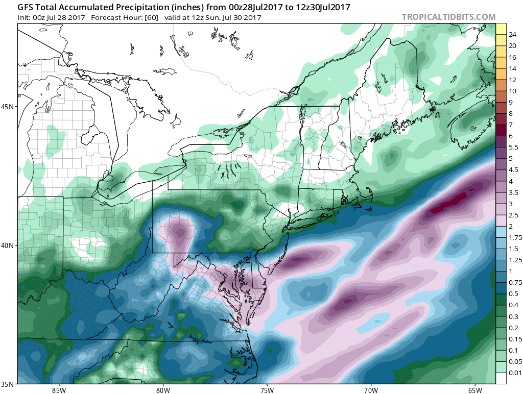
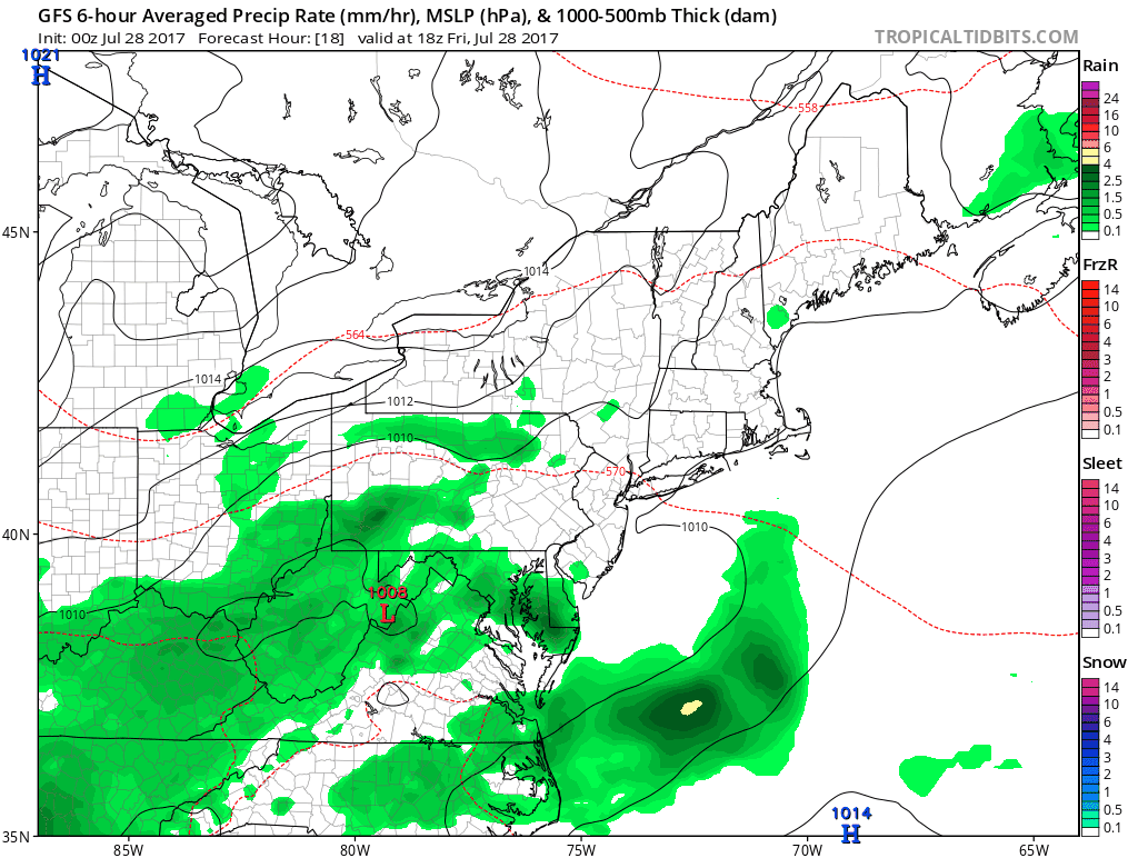
For much of the area very little should happen rain wise into the first part of Friday night before one shot of rain lifts up and around as low pressure moves off the Delaware coast and heads northeastward.
WEATHER MODELS GFS FRIDAY AFTERNOON INTO SUNDAY MORNING
CLICK TO ANIMATE
The profile of this event is going back to where it was a few days ago with a weaker system producing some rain but for the most part manageable. This is as difficult as trying to figure out a winter storm ni January. If all moves along improvement will occur for next week as temperatures warm up and humidity begins to rise as the new week progresses.
 GET JOE A CIGAR IF YOU LIKE

LANDSCAPE COMPANIES FOR YOUR NEEDS
LONG ISLAND ROCKLAND COUNTY Connecticut

![]()

ROCKLAND COUNTY TRI STATE SNOW REMOVAL JOHNSTOWN PA


FiOS1 News Weather Forecast For Long Island
FiOS1 News Weather Forecast For New Jersey
FiOS1 News Weather Forecast For Hudson Valley
NATIONAL WEATHER SERVICE SNOW FORECASTS
LATEST JOESTRADAMUS ON THE LONG RANGE
Weather App

Don’t be without Meteorologist Joe Cioffi’s weather app. It is really a meteorologist app because you get my forecasts and my analysis and not some automated computer generated forecast based on the GFS model. This is why your app forecast changes every 6 hours. It is model driven with no human input at all. It gives you an icon, a temperature and no insight whatsoever.
It is a complete weather app to suit your forecast needs. All the weather information you need is right on your phone. Android or I-phone, use it to keep track of all the latest weather information and forecasts. This weather app is also free of advertising so you don’t have to worry about security issues with your device. An accurate forecast and no worries that your device is being compromised.
Use it in conjunction with my website and my facebook and twitter and you have complete weather coverage of all the latest weather and the long range outlook. The website has been redone and upgraded. Its easy to use and everything is archived so you can see how well Joe does or doesn’t do when it comes to forecasts and outlooks.
Just click on the google play button or the apple store button on the sidebar for my app which is on My Weather Concierge. Download the app for free. Subscribe to my forecasts on an ad free environment for just 99 cents a month.
Get my forecasts in the palm of your hand for less than the cost of a cup of Joe!


