
Weather Models Show Blocking Returning Next Week

Weather Models Show Blocking Returning Next Week
One thing about early summer weather patterns that appear in May; they don’t last for more than a few days. Highs reached the lower 90s in many areas today and we will reach 90 to 95 on Thursday. Friday will be the last day of the early heatwave with highs in the 80s before a cold front comes through. The weekend will be much cooler with most highs in the 60s to near 70 at best and it will be dry. Another front approaches on Monday with the chance for showers and thunderstorms. Then after that the pattern goes back to something like what we saw last week which is a blocking pattern developing in the North Atlantic.
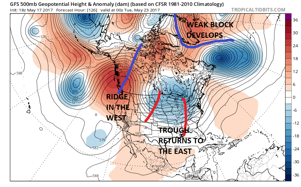
We are going to jump to next Monday night and you can see that there is a weak block developing over the North Atlantic near Greenland. It is not as strong as the one last week but it is strong enough to force troughing in the east again. This suggests that the hot weather of today through Friday will be gone for awhile. The bigger question is whether this block and pattern change will last through the Memorial Day holiday weekend.
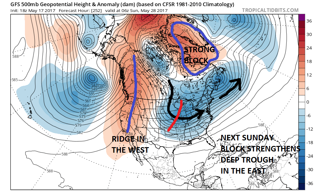
If weather models are correct the blocking pattern actually strengthens as we get into the holiday weekend. This would certainly mean cooler than average temperatures going forward. In fact for the entire holiday weekend temperatures could average well below normal in a pattern like this.
TEMPERATURE ANOMALY MEMORIAL DAY WEEKEND CLICK TO ANIMATE
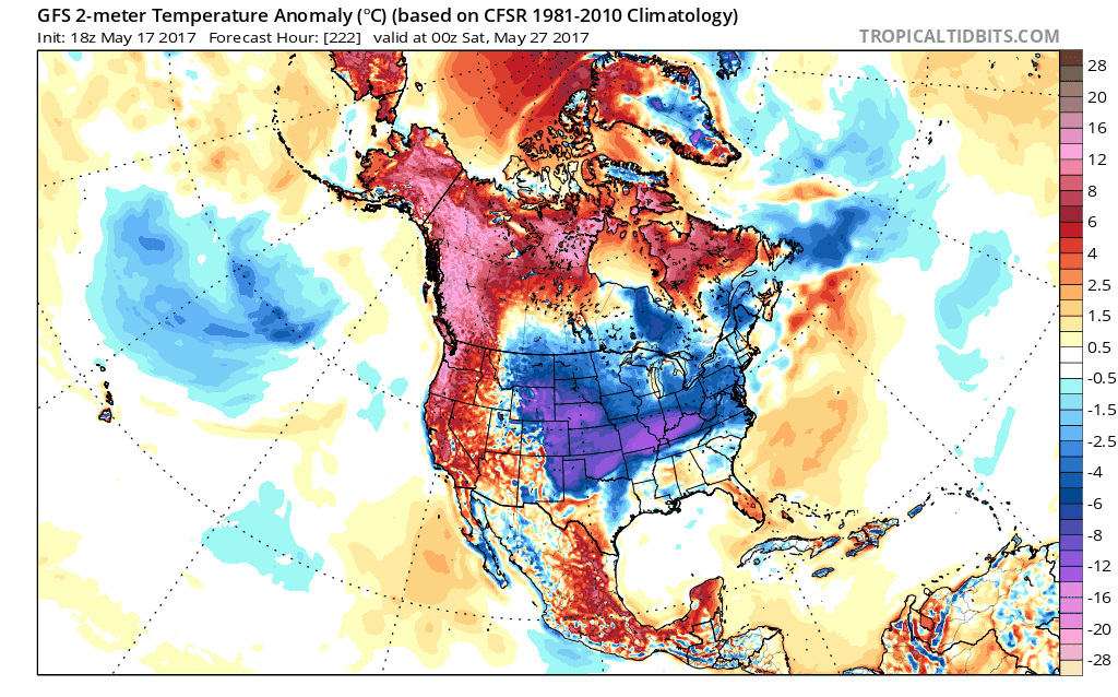
The next more critical question is whether it rains or not. It could be cool and dry but weather models do show the possibility of several weather systems possibly having impact later next week and next weekend with some chances for rain. We will also have to see whether the block forces tracks of storms to our south and east much like what we had last weekend with with cold rain. We will speculate more on this in the coming days.
MANY THANKS TO TROPICAL TIDBITS FOR THE WONDERFUL USE OF THE MAPS

GET JOE A CIGAR IF YOU LIKE!
LANDSCAPE COMPANIES FOR YOUR SPRING SUMMER FALL NEEDS
LONG ISLAND ROCKLAND COUNTY Connecticut

![]()

ROCKLAND COUNTY TRI STATE SNOW REMOVAL JOHNSTOWN PA


FiOS1 News Weather Forecast For Long Island
FiOS1 News Weather Forecast For New Jersey
FiOS1 News Weather Forecast For Hudson Valley
NATIONAL WEATHER SERVICE SNOW FORECASTS
LATEST JOESTRADAMUS ON THE LONG RANGE
Weather App

Don’t be without Meteorologist Joe Cioffi’s weather app. It is really a meteorologist app because you get my forecasts and my analysis and not some automated computer generated forecast based on the GFS model. This is why your app forecast changes every 6 hours. It is model driven with no human input at all. It gives you an icon, a temperature and no insight whatsoever.
It is a complete weather app to suit your forecast needs. All the weather information you need is right on your phone. Android or I-phone, use it to keep track of all the latest weather information and forecasts. This weather app is also free of advertising so you don’t have to worry about security issues with your device. An accurate forecast and no worries that your device is being compromised.
Use it in conjunction with my website and my facebook and twitter and you have complete weather coverage of all the latest weather and the long range outlook. The website has been redone and upgraded. Its easy to use and everything is archived so you can see how well Joe does or doesn’t do when it comes to forecasts and outlooks.
Just click on the google play button or the apple store button on the sidebar for my app which is on My Weather Concierge. Download the app for free. Subscribe to my forecasts on an ad free environment for just 99 cents a month.
Get my forecasts in the palm of your hand for less than the cost of a cup of Joe!
![]()
