DOWNLOAD MY NEW FREE JOESTRADAMUS WEATHER APP FOR ANDROID
THE APP IS ABSOLUTELY FREE TO ALL BUT CONSIDERING SUBSCRIBING TO PATREON FOR A WEATHER EXPERIENCE FREE OF ADS, EXCLUSIVE VIDEOS FOR MEMBERS ONLY AND MUCH MORE…STARTS AT $2 A MONTH..MESSAGE ME AT ANY TIME
Weather Models Absolute Chaos Long Range
I’ve been at this for nearly 40 years. In the last 10 to 15 years we have seen an explosion of models to look at. Once upon a time we lived in a world where when the first 84 hour appeared you stared in wonder over it. Now we have dozens of models going out weeks and months in advance. I have grown to expect model differences over time but I don’t think I’ve ever seen volatility quite like this. Forecasters and enthusiasts are commenting today about the absolute chaos all the models are in. I really believe that the stratospheric warming event we had last year has sent models into a tailspin. Expect volatility in these model runs to continue for another 10 days or so and in the meantime enjoy the roller coaster ride. Just don’t make plans on what you see.
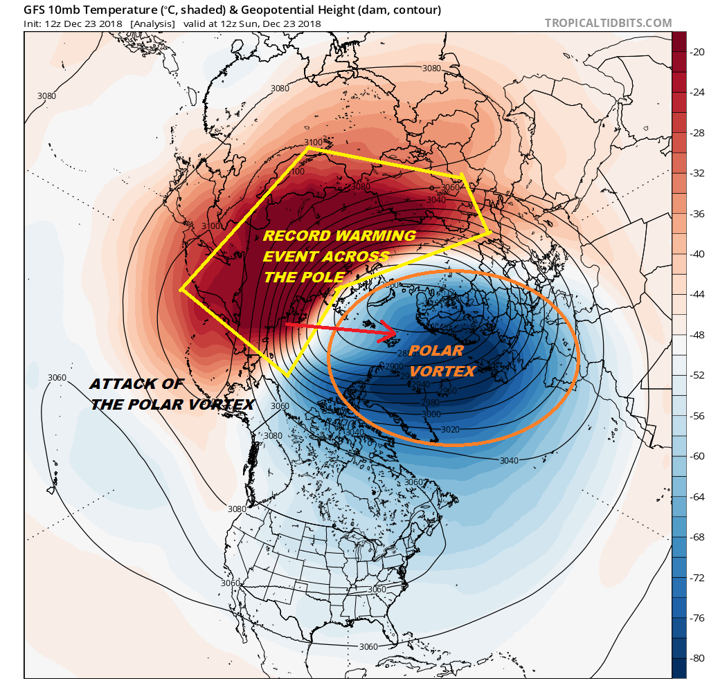
We discussed the stratospheric warming event in our Joestradamus long range post and the impacts. Today’s models are insane in the long range. It seems that the GFS model is having the most difficulty with this. The differences past day 7 are astounding. The GFS has a blowtorch ridge developing between days 7 and 10 in the east which sent snow weenies cascading off a cliff. The GFS has no blocking, a progressive pattern and no cold air.
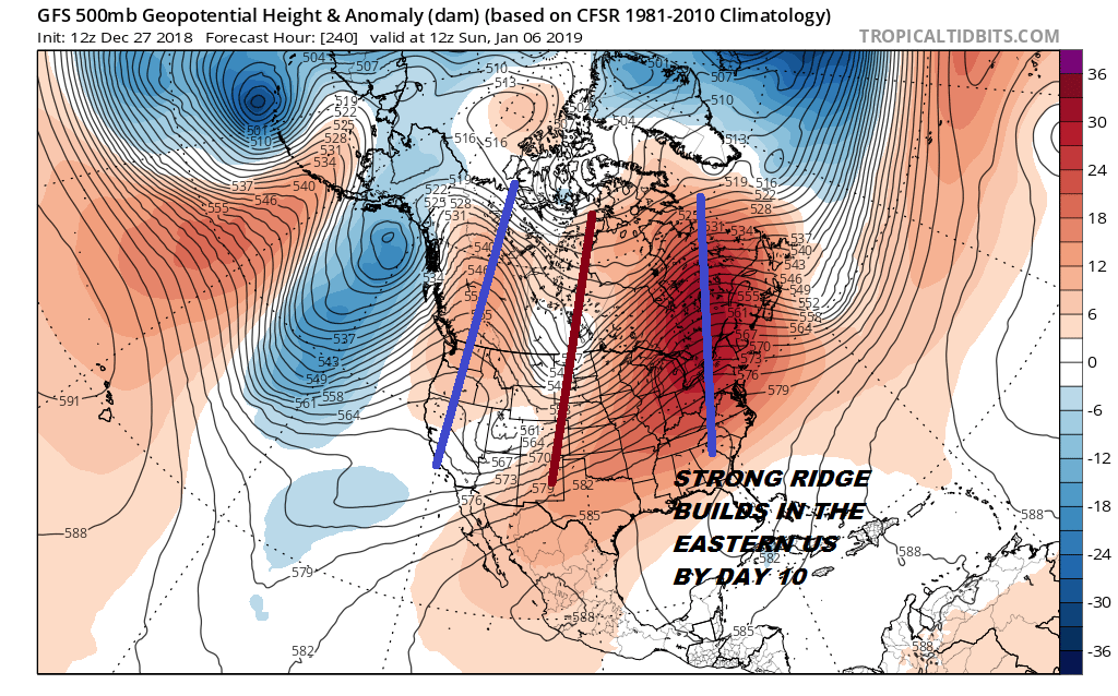
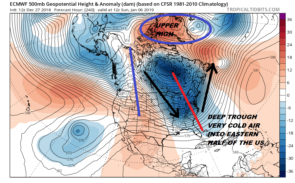
This flies in the face of the European, the Parallel GFS & yes..even the Canadian which all line up with a deep trough in the Eastern US with a couple of significant shots of cold air in the offing!
I think that the best approach to all this is to let the split in the stratosphere play itself out. This is a major event that is occurring according to the experts who watch this sort of stuff. This is another situation where we are seeing the atmosphere pressure patterns being stretched to an extreme and models simply don’t know how to handle all this. It is quite possible that all the models are wrong in where we are headed and it seems a waste in time and energy to get all wrapped up in all this. The same thing happened last mid February when the polar vortex attack split it in two and weather models were chaotic for weeks trying to handle it. Confidence in any long range forecast at this point is very simply very very low!
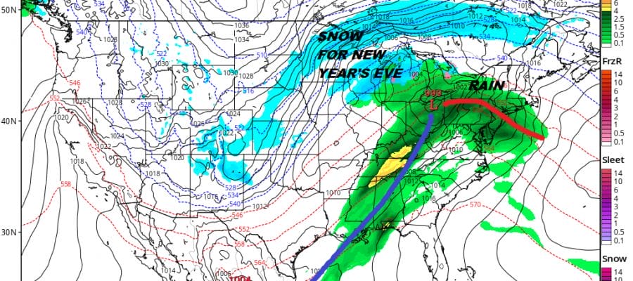
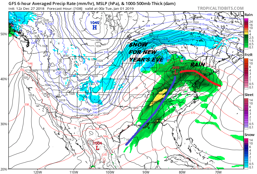
RAIN FRIDAY & AGAIN MONDAY NIGHT INTO TUESDAY
We don’t see much confusion in the short term at least. We have rain coming for Friday and that should be gone by Friday evening. The weekend now looks dry with some sun both Saturday and Sunday. Saturday will be the warmer day. We will be in the 50s on Friday and the the 30s to near 40 on Sunday. The weather system for Sunday is not an issue at all as some models get that completely wrong. We have another low coming out of the Plains for Monday New Year’s Eve making for a rainy arrival for 2019
it should turn colder behind this system after New Year’s Day for the second half of next week. The front with this could stall so we need to watch for a wave developing on it but that is purely speculative at this point. Beyond next Tuesday I’m really not sure about very much as I stated above.
MANY THANKS TO TROPICAL TIDBITS FOR THE USE OF MAPS
Please note that with regards to any tropical storms or hurricanes, should a storm be threatening, please consult your local National Weather Service office or your local government officials about what action you should be taking to protect life and property.