Weather Model Energy Issues

Weather Model Energy Issues
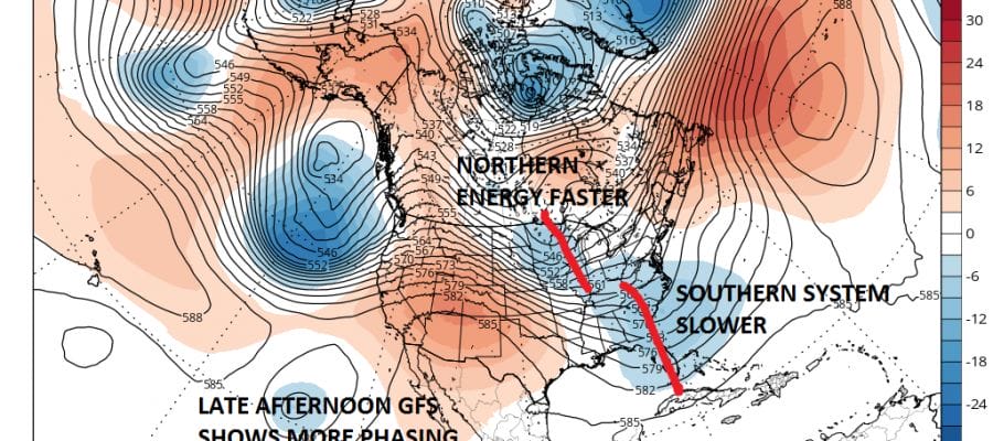
When we watch model run after model run change the profile of the upper atmosphere in the long range it becomes very tough trying to get a gauge what is going to happen. We have seen models shift back and forth from run to run about a possible nor’easter for the middle of next week. The problem is that there is a lot of energy running around so each model run times things out differently. You go from one run looking completely disorganized and “unphased” to something organized and “phased” Phasing refers to 2 waves of energy in 2 separate jet streams phasing together as 1.
WEATHER MODELS GFS LAST 2 RUNS FOR NEXT TUESDAY NIGHT
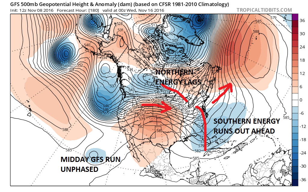

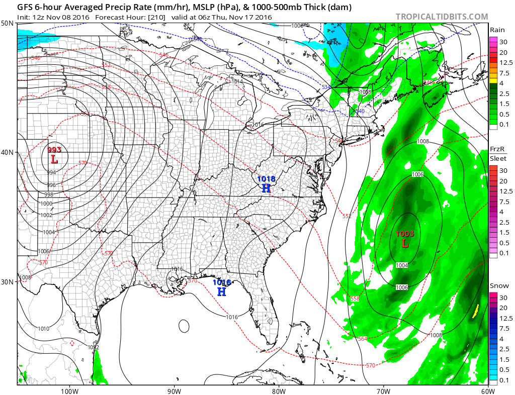
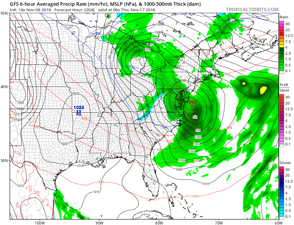
The differences here are very important because an unphased look makes for a non event while a phased look makes for a major rain storm along the east coast. I will take it out 24 hours further and we can look at the resulting surface maps.
WEATHER MODELS GFS SURFACE NEXT WEDNESDAY NIGHT
The European weather model is having similar issues from run to run as well as it tries to decide whether to phase or unphase.
WEATHER MODELS EUROPEAN YESTERDAY’S RUN FOR NEXT THURSDAY MORNING

WEATHER MODELS EUROPEAN TODAY’S RUN FOR NEXT THURSDAY MORNING

It is going to be back and forth, back and forth for the next 3 or 4 days. In the meantime we will continue to just see fast moving weak cold fronts coming through with fast moving shots of cool to cold air as we move through the weekend.
MANY THANKS TO TROPICAL TIDBITS FOR THE WONDERFUL USE OF THE MAPS
SNOW REMOVAL COMPANIES FOR YOUR WINTER NEEDS
LONG ISLAND ROCKLAND COUNTY Connecticut

![]()


WINTER 2016-2017 PART 1 OCEAN WATER TEMPERATURES
WINTER 2016-2017 PART 2 ARCTIC SEA ICE AND SIBERIAN SNOW COVER
FiOS1 News Weather Forecast For Long Island
FiOS1 News Weather Forecast For New Jersey
FiOS1 News Weather Forecast For Hudson Valley
NATIONAL WEATHER SERVICE SNOW FORECASTS
LATEST JOESTRADAMUS ON THE LONG RANGE
Weather App

Don’t be without Meteorologist Joe Cioffi’s weather app. It is really a meteorologist app because you get my forecasts and my analysis and not some automated computer generated forecast based on the GFS model. This is why your app forecast changes every 6 hours. It is model driven with no human input at all. It gives you an icon, a temperature and no insight whatsoever.
It is a complete weather app to suit your forecast needs. All the weather information you need is right on your phone. Android or I-phone, use it to keep track of all the latest weather information and forecasts. This weather app is also free of advertising so you don’t have to worry about security issues with your device. An accurate forecast and no worries that your device is being compromised.
Use it in conjunction with my website and my facebook and twitter and you have complete weather coverage of all the latest weather and the long range outlook. The website has been redone and upgraded. Its easy to use and everything is archived so you can see how well Joe does or doesn’t do when it comes to forecasts and outlooks.
Just click on the google play button or the apple store button on the sidebar for my app which is on My Weather Concierge. Download the app for free. Subscribe to my forecasts on an ad free environment for just 99 cents a month.
Get my forecasts in the palm of your hand for less than the cost of a cup of Joe!
![]()
