Weather Improves Frost Advisories Tonight Temperatures Bounce Sunday
Weather in 5 Saturday October 17, 2020
JOE & JOE WEATHER SHOW FRIDAY OCTOBER 16, 2020
Overnight rains have ended and now weather conditions are set to improve today with some sunshine developing as the day wears on. It will be a bit breezy in spots. Temperatures will be hard pressed to get out of the 50s as a chilly high builds in. The satellite picture shows are cold front well offshore and a developing wave that has moved up into Northern New England and Southeastern Canada. To the west we have clearer skies and that is all headed eastward.
SATELLITE

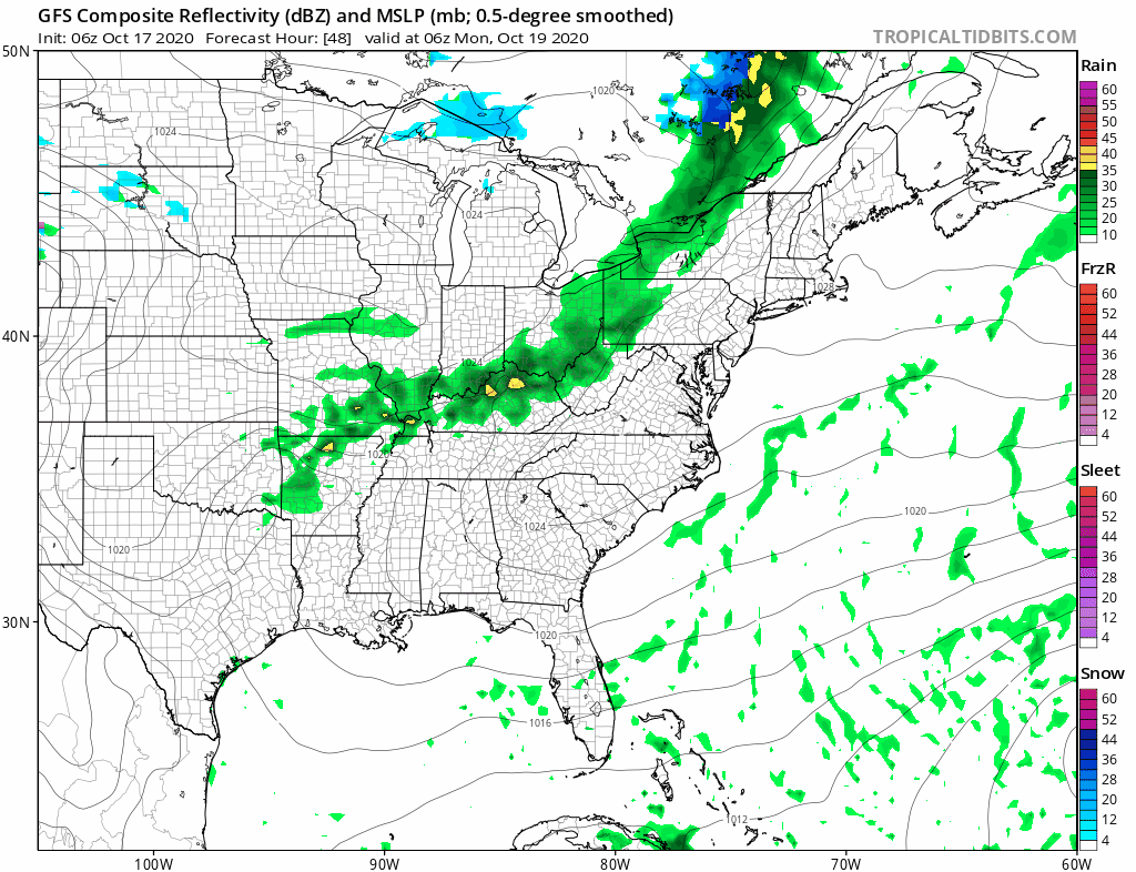
REGIONAL RADAR

Regional radar shows heavy rains in drought plagued New England making some inroads into the extremely dry conditions that exist. However the radars are quiet over us and to our west and south and we are done with them until Monday.
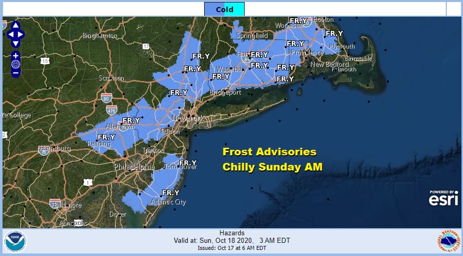
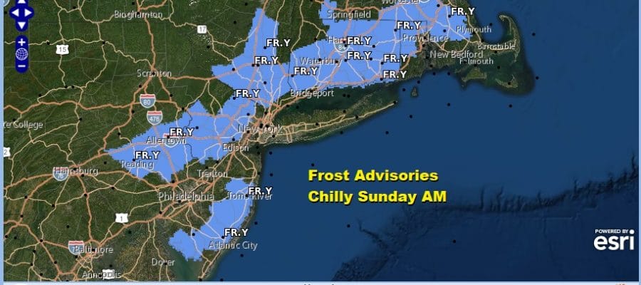
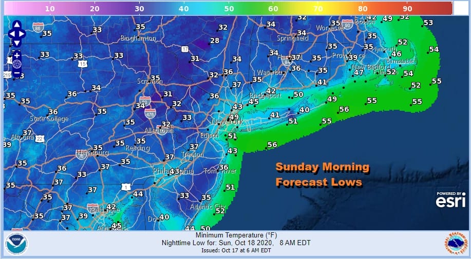
Frost advisories are posted for parts of Northern & Coastal New Jersey to the Hudson Valley as well as much of Connecticut. The first frosts came early to areas north and west of the coast back in September so we are now picking off the remaining counties where the growing season has not ended. Sunday morning lows will be in the low to mid 30s in many inland locations with mainly low 40s coast and warmer urban settings.
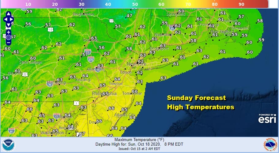
Sunday will be a nice sunny day and as high pressure moves offshore. Temperatures will bounce off those morning lows and reach back into the 60s by afternoon.
The week ahead sees several cold front moving into the Eastern US however thanks to a building upper high in the Atlantic these fronts will weaken considerably and either move through with little fan far or they fall apart all together.
It is likely that every day next week will feature clouds mixed with sun, or sun mixed with clouds depending on which we have more of. We can leave showers out of the forecast through Friday. Highs will be in the 60s to some days near 70. Nights will be in the 40s inland and low to mid 50s coast and warmer urban settings. Longer term we see two tropical systems developing. One forms southeast of Bermuda and the other in the Northwest Caribbean. While models have been showing their usual behavior of storms moving in every direction, we will take the always prudent sit back and wait approach since we are talking about something that is well over a week away.
BE SURE TO DOWNLOAD THE FREE METEOROLOGIST JOE CIOFFI WEATHER APP &
ANGRY BEN’S FREE WEATHER APP “THE ANGRY WEATHERMAN!
MANY THANKS TO TROPICAL TIDBITS FOR THE USE OF MAPS
Please note that with regards to any severe weather, tropical storms, or hurricanes, should a storm be threatening, please consult your local National Weather Service office or your local government officials about what action you should be taking to protect life and property.


