Weather Conditions Improving Dry Thursday Cold Rain Late Friday
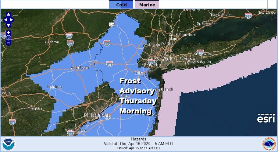
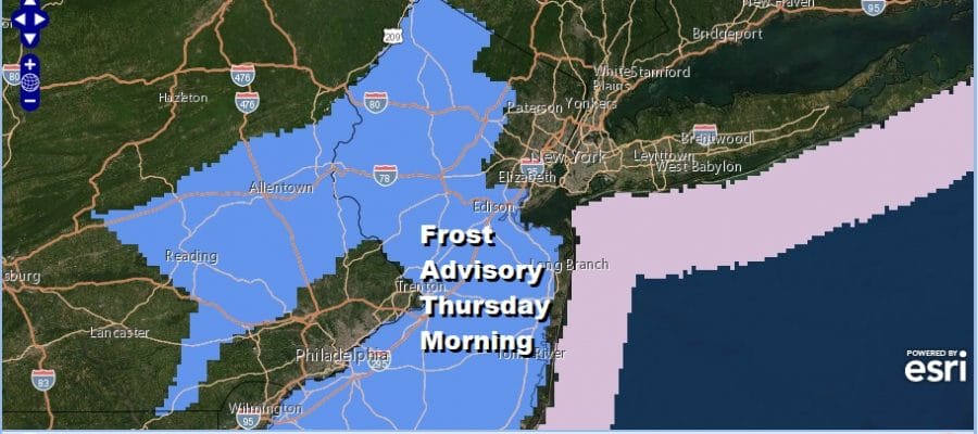
It is spring and we are at the time of year where the growing season has begun for most areas. As a result when the temperatures and wind conditions are such that there could be frost, the National Weather Service will issue frost advisories and we have one up for Thursday morning for Eastern Pennsylvania and much of the state of New Jersey except for areas that are close to the normally warmer urban areas.
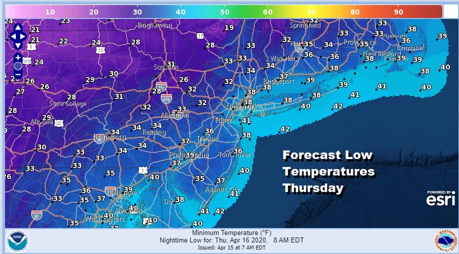
Low pressure has passed to our south overnight and this morning and weather conditions are improving rather nicely this afternoon. Dry air is coming down from the north. We have seen decreasing clouds and increasing sunshine and this trend continues this afternoon. Radars are all but done showing any precipitation. Temperatures this afternoon will be topping out in the low to mid 50s. Then we have a cold night ahead with frost advisories up for Thursday morning with most lows in the 30s.
SATELLITE

REGIONAL RADAR

We don’t see major weather issues coming up over the weekend and long range into next week. The one common theme will be a rather chilly weather pattern for mid April. Temperatures will be averaging 10 or more degrees below normal at times. Thursday however should be a nice day with sunshine. Highs will be in the low to mid 50s.
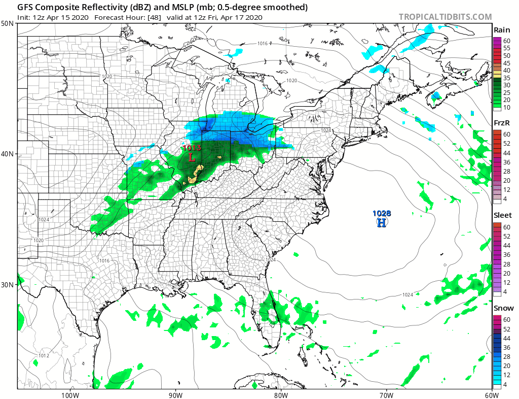
Along with the chilly pattern will be a regular parade of weather systems. The next one arrives Friday with increasing clouds and the likelihood of a chilly rain developing. Highs will be in the upper 40s and lower 50s however if the low tracks just to the north of NYC, areas to the south might get a brief run up in temperatures to the mid and upper 50s. The front passes by early Saturday so showers should end in the morning followed by some improvement Saturday afternoon. Highs will be in the 50s. Sunday looks dry for the daytime with some sunshine and arriving clouds. Highs should reach into the 60s away from the ocean. A cold front brings showers Sunday night into Monday.
BE SURE TO DOWNLOAD THE FREE METEOROLOGIST JOE CIOFFI WEATHER APP &
ANGRY BEN’S FREE WEATHER APP “THE ANGRY WEATHERMAN!
MANY THANKS TO TROPICAL TIDBITS FOR THE USE OF MAPS
Please note that with regards to any severe weather, tropical storms, or hurricanes, should a storm be threatening, please consult your local National Weather Service office or your local government officials about what action you should be taking to protect life and property.


