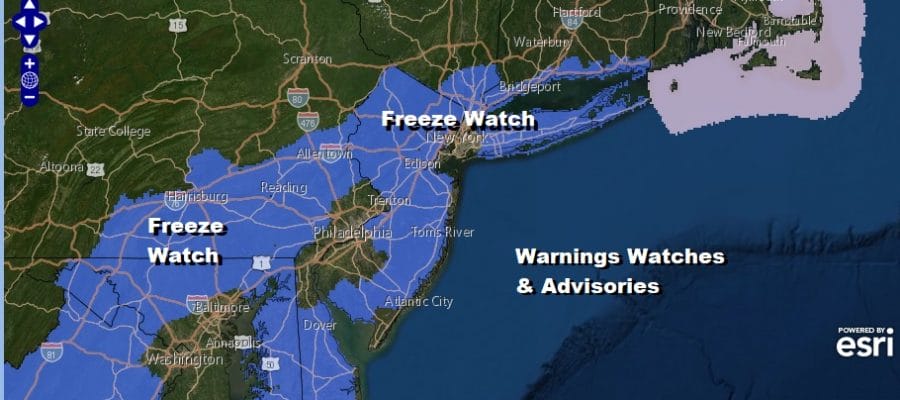
Freeze Watch Overnight into Friday Morning Cold Rain Follows Into Saturday

We are in a very chilly weather pattern for mid April. We are seeing some sunshine this afternoon and that is helping to take the sting of the cold out of the air. We will see highs reaching the 50s but remember that we should be into the 60s on average for this time of year and we continue to run 10 or more degrees below average, certainly when it comes to daytime highs. We are also at the start of the growing season so cold nights have impact. Freeze watches are up for overnight into Friday morning.
SATELLITE

REGIONAL RADAR

There is a bit of an upper trough moving through the Northeast this afternoon and we are picking up on a few scattered rain and snow showers on the regional radar. That precipitation should disappear this evening as skies go mostly clear tonight. Lows will be in the 20s to low 30s in many places except for the warmer urban settings.

Clouds will be increasing Friday as low pressure now coming out of the Central Plains moves straight east to the Middle Atlantic coast by Saturday morning this is going to bring a cold rain to most of the area later Friday into Friday night and early Saturday.

Areas well north and west of the coast, in Northern Pennsylvania and Southern NY east to the Catskills will see some snow out of this. This could produce a coating to a few inches of accumulation well inland.

Weather conditions will improve during Saturday afternoon and evening and we may start out Sunday with some sunshine but clouds will be arriving. We have a cold front that will be approaching and moving through Sunday evening. The front stalls out offshore to the Southeast US and a strong storm will be developing on that frontal boundary.

This low heads to the North Carolina coast Sunday night and then moves northeast from there. It appears that the northern fringe of the rain could reach the coastal areas from Delaware to Southern New England for a short time at least during Monday. The bulk of the rain with this system is likely to stay offshore given that the northern part of the jetstream overwhelms the flow along the East Coast, forcing weather systems moving more to the east than to the north. The busy weather pattern continues next week with another cold front arriving with some showers Tuesday night into Wednesday morning and a stronger storm system for the end of next week.
BE SURE TO DOWNLOAD THE FREE METEOROLOGIST JOE CIOFFI WEATHER APP &
ANGRY BEN’S FREE WEATHER APP “THE ANGRY WEATHERMAN!
MANY THANKS TO TROPICAL TIDBITS FOR THE USE OF MAPS
Please note that with regards to any severe weather, tropical storms, or hurricanes, should a storm be threatening, please consult your local National Weather Service office or your local government officials about what action you should be taking to protect life and property.


