
Weather Conditions Improve Weekend Long Range Cool Maybe More Rain Chances
WEATHER IN 5 WEDNESDAY 9/30/2020 9AM
JOE & JOE WEATHER SHOW TUESDAY 9/29/2020 7PM
Overnight rainfall was in the range of 2 to 3 inches across much of the area from New Jersey into Southern New England and Long Island. The rain was much needed especially in New England where the drought conditions in some areas are severe or even extreme. We could use a few more of these types of systems but for now we will focus on the slowly improving weather conditions for today as our storm system continues to lift northward into Canda.
SATELLITE

REGIONAL RADAR

The clearing line is a sharp one on the satellite pictures and loops this morning and it will reach the coast and move offshore. Some sunshine will break out from west to east. Meanwhile on the radars most of the rain has passed to the northeast and the radars should go quiet this afternoon.
LOCAL RADAR NEW YORK CITY

LOCAL RADAR PHILADELPHIA


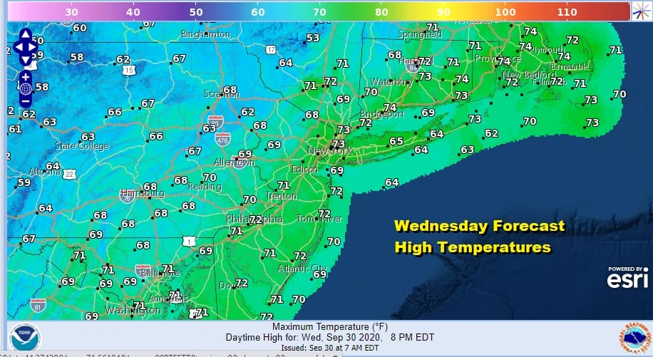
As for high temperatures this afternoon we are seeing cooler air coming in from the west and that should keep temperatures generally in the upper 60s and lower 70s and of course humidity will be dropping.
On to the next weather adventure which involves a second cold front Friday morning. Until then we clear out tonight with lows in the 50s with 40s well inland. Thursday should be sunny for most of the day. Highs will reach 70 to 75 in most areas. The front passes early Friday morning and there could be a few showers with it. Weather conditions will improve later Friday with returning sunshine but it will be cool with highs just in the low to mid 60s.
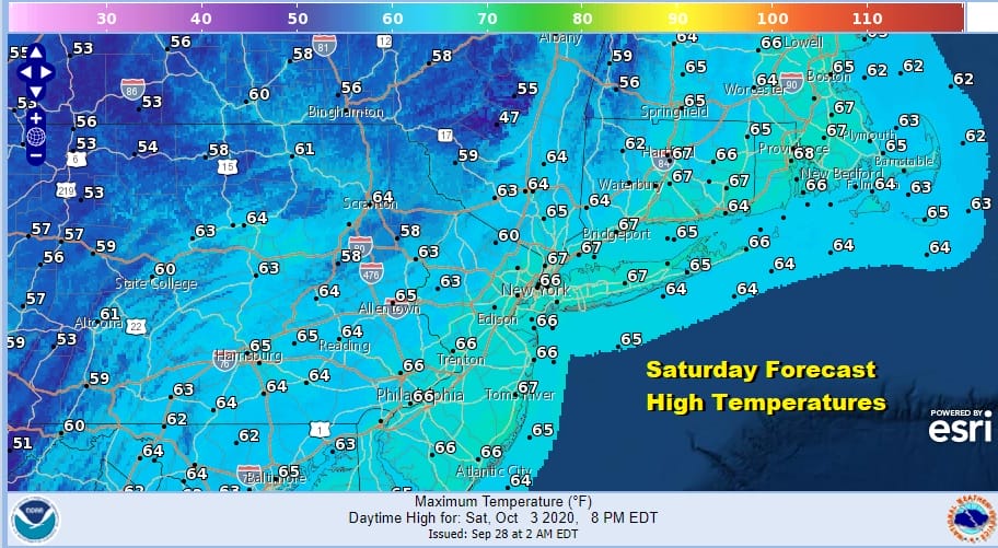
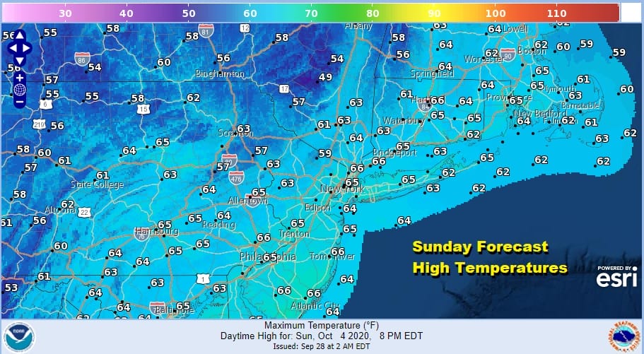
We will have high pressure building across upstate NY and New England this weekend. This brings sunshine and very cool temperatures for both days. Sunday could see some arriving clouds later in the day as the winds turn northeast. Highs both days will be in the low to mid 60s.
Sunday night and Monday we will see another trough dropping southeastward from the Great Lakes into the Ohio Valley. All the models show a vigorous system except for the weaker GFS. This will set us up for clouds and perhaps some rain on Monday along with a raw northeast wind from off the ocean.

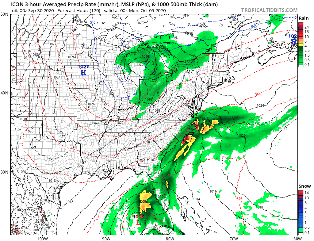
We brought up the Icon model which matches up well with the European regarding rainfall and what the radar might look like if this comes to pass. How vigorous the upper air trough is will determine whether we might see another soaking rain Sunday night and Monday or just a few showers or a little light rain. Below normal temperatures continue into next week regardless.
BE SURE TO DOWNLOAD THE FREE METEOROLOGIST JOE CIOFFI WEATHER APP &
ANGRY BEN’S FREE WEATHER APP “THE ANGRY WEATHERMAN!
MANY THANKS TO TROPICAL TIDBITS FOR THE USE OF MAPS
Please note that with regards to any severe weather, tropical storms, or hurricanes, should a storm be threatening, please consult your local National Weather Service office or your local government officials about what action you should be taking to protect life and property.


