
Weather Conditions Improve Another Rain Storm Possible Halloween
It was a clobbering of rain today with gusty coastal winds and even a few thunderstorms that saw rotation over the coastal waters. Rainfall amounts were in the 1 to 2 inch range with most areas closer to the 2 inch than the one inch. However now the worst of it is over as the rains have shifted to Southeastern New England. A dry slot of clearing has come up from the southwest and skies have actually cleared out in much of New Jersey and Southern Pennsylvania and they are about to do the same in the Hudson Valley, Southern New England and Long Island. Skies should clear out in most areas overnight with most lows in the 40s to lower 50s.
SATELLITE

REGIONAL RADAR

Regional radar as well as the local radars show that the rain area has shifted eastward and there isn’t anything left to worry about to the west and south. This storm is over with and now we look ahead to the next weather threat with a similar set up to this one. This will come on Thursday which is Halloween.
LOCAL RADAR NEW YORK CITY

LOCAL RADAR PHILADELPHIA


We do have 3 days to get through before Thursday and it would seem Monday will be the best of the next 3 days. We should see some sunshine at least to start the day. Monday’s highs will be in the 60s. The pressure pattern behind this storm is a rather weak one. High pressure will develop east of the Canadian Maritime Provinces and build back westward. This will create an onshore flow producing some clouds Monday night and Tuesday. There will also be some patchy light rain around in some areas. Highs will be in the upper 50s and lower 60s.
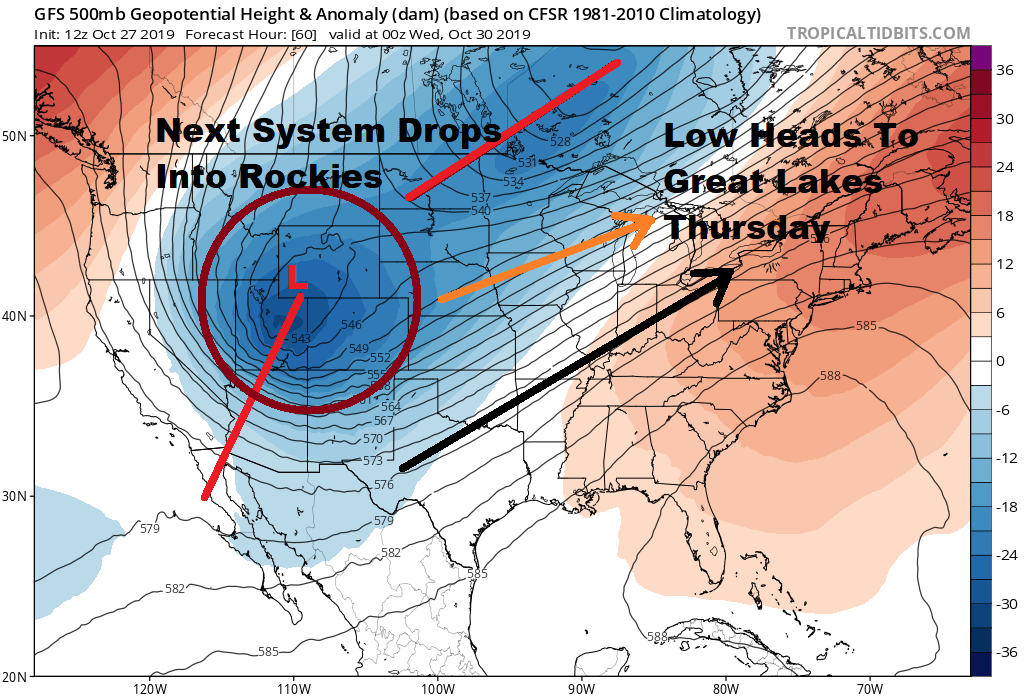
Meanwhile back out in the Rockies are two snow storms in play this week with one overnight into Monday and a second more important storm that drops in on Tuesday and then swings east and northeast toward the Great Lakes by Thursday. This is much like the set up we just went through.

The strong upper air energy lifts up to the Great Lakes. Wednesday will the set up day for a warm front to our south. That means clouds and some breaks of sunshine for a while on Wednesday before clouds thicken up. It appears that some rain will arrive Thursday morning as the warm front nears.
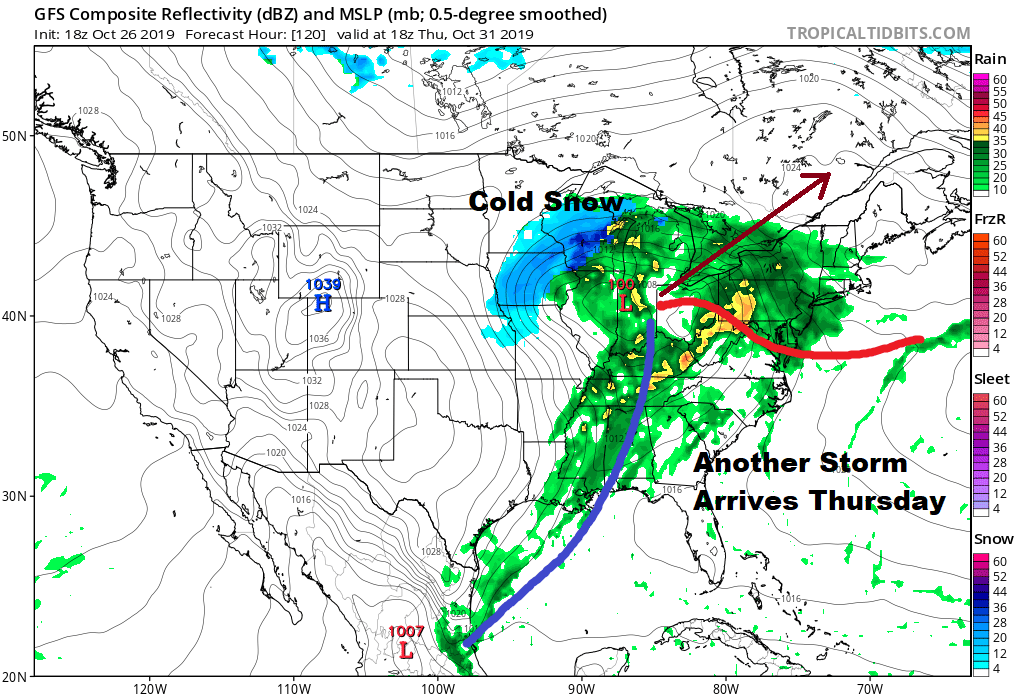
Thursday becomes an issue again of a strong onshore flow from the southeast and a chance for another 1 to 2 inch rain producer here. Halloween highs will be in the 60s. Chilly air from Canada starts to come in on Friday with below average temperatures over next weekend and into the start of the week of November 4th. We could be going into a stretch of relaxation of the active pattern at the point assuming that the next disturbance doesn’t drop into the Eastern US and create issues.
MANY THANKS TO TROPICAL TIDBITS FOR THE USE OF MAPS
Please note that with regards to any severe weather, tropical storms, or hurricanes, should a storm be threatening, please consult your local National Weather Service office or your local government officials about what action you should be taking to protect life and property.


