Weak Weather Systems Moving Eastward Late Thursday & Again Friday Night

Weak Weather Systems Moving Eastward Late Thursday & Again Friday Night
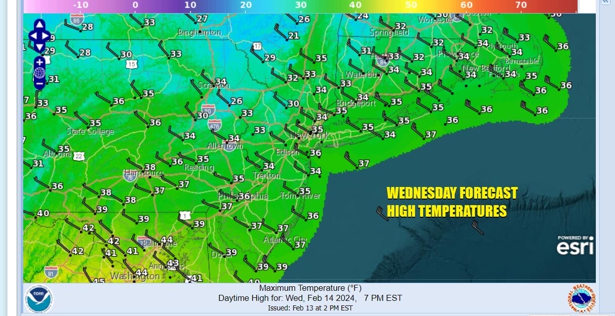
Yesterday’s storm system is of course long gone and we are now in a quiet weather pattern with a nice weathery Wednesday. The sateliite loop shows some patchy clouds streaming southeastward from the Great Lakes and there are some stremers of lake effect snows going on in Upstate NY but overall today will be a nice day with some sunshine and passing clouds. Temperatures will be about where they should be for this time of year. Most highs will be in the mid 30s with some warm pots topping out close to 40 degrees.
SATELLITE WITH LIGHTNING STRIKES

WEATHER RADAR

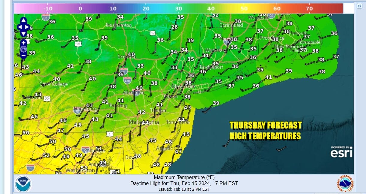
Tonight is going to be a cold night as we set up for clear skies and light winds. Most lows away from warmer urban locations will be in the upper teens and lower 20s while warmer urban centers will be in the mid to upper 20s by Thursday morning. Thursday sees sunshine giving way to some arriving clouds as we do have a cold front approaching. Highs will be in the upper 30s to some middle 40s from north to south.
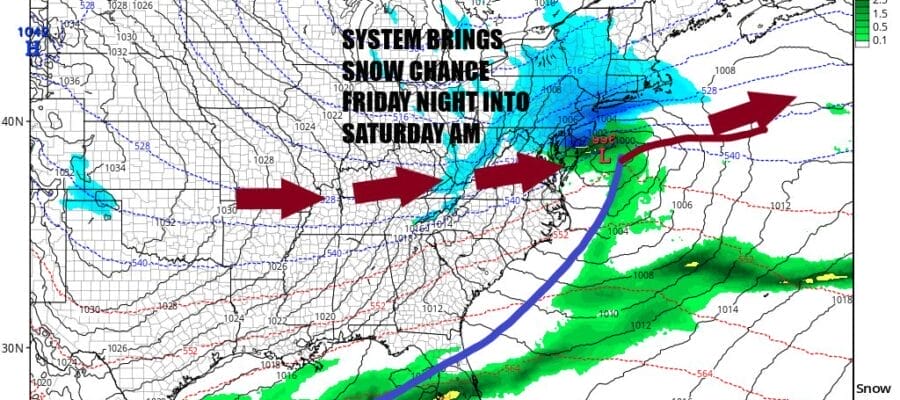
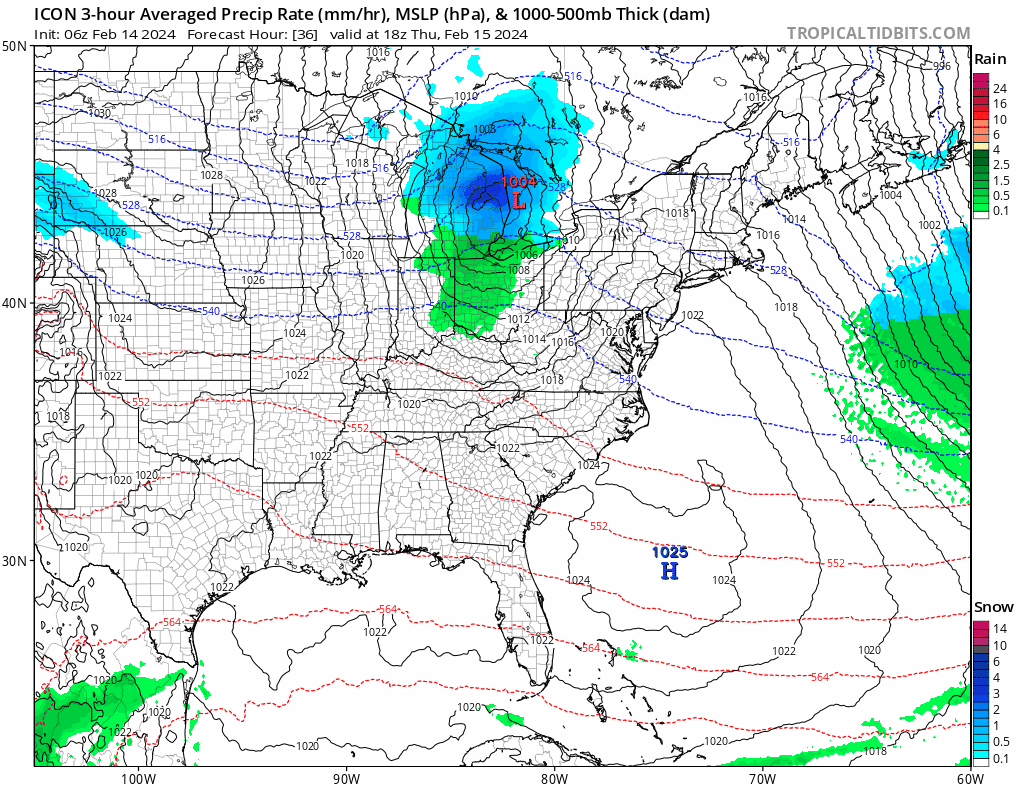
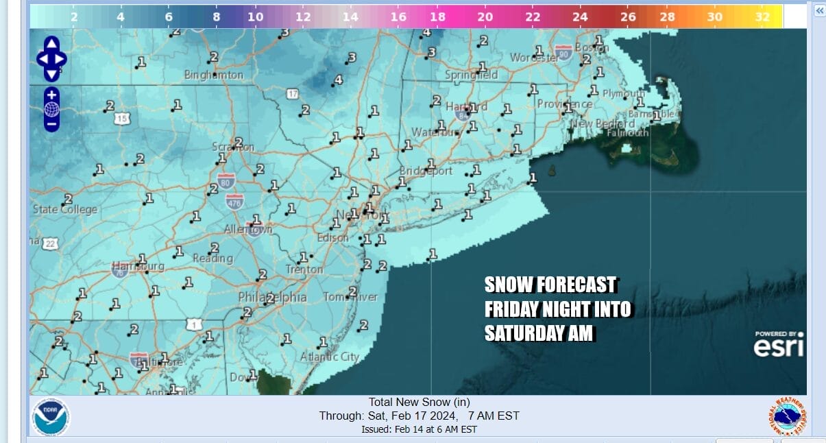
Thursday night we will see the front produce a scattered rain or snow shower or two as it goes by and it should go by relatively quickly. This should lead to some partial clearing of skies with lows in mid 20s to lower 30s by Friday morning. Friday sees some early sunshine giving way to arriving clouds with most highs in the 30s. Low pressure will be moving east from the Plains and track across the Lower Ohio Valley and then off the Delaware coast by early Saturday morning.
At the moment at least, it seems that this weather system is going to have a tough time developing into something important however there is enough here with this low and corresponding upper trough that we will likely see a period of snow Friday night into early Saturday morning. As of this morning, this looks to be a system that has the potential to produce a coating to perhaps a few inches in some places.
We only need to be concerned for something more than what is being forecast for snow accumulations would be a sharper upper trough that swings across the Great Lakes and Northeast so we will be mointoring for that possibility. Otherwise the holiday weekend looks dry and cold especially Saturday into Sunday. Saturday highs may just be in the upper 20s to middle 30s and Sunday we will be into the 30s with sunshine. Nice weather should extend into Presidents’s Day which is Monday.
BE SURE TO DOWNLOAD THE FREE METEOROLOGIST JOE CIOFFI WEATHER APP &
ANGRY BEN’S FREE WEATHER APP “THE ANGRY WEATHERMAN!
MANY THANKS TO TROPICAL TIDBITS FOR THE USE OF MAPS
Please note that with regards to any severe weather, tropical storms, or hurricanes, should a storm be threatening, please consult your local National Weather Service office or your local government officials about what action you should be taking to protect life and property.
(Amazon is an affilate of Meteorologist Joe Cioffi & earns commissions on sales.)


