Light Snow Tonight into Friday North,
Another Snow Friday Night into Saturday South

Light Snow Tonight into Friday North,
Another Snow Friday Night into Saturday South
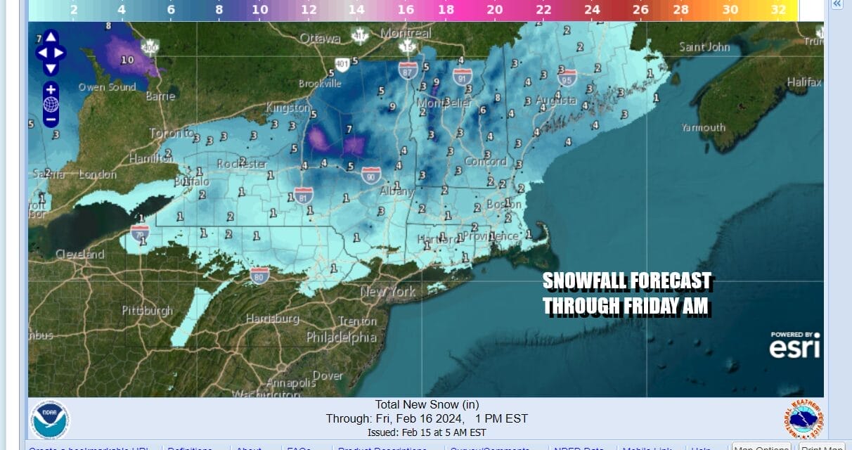
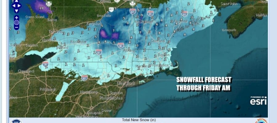
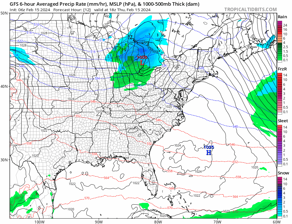
Ahead of us we have two weather systems moving through. The first one will move across Upstate NY and into New England tonight into Friday morning soe most of any accumulation will be from Northeast Pennsylvania and Northwest New Jersey northward. Mainly we are looking for a coating to an inch or so north of Route 84 in New York State and Connecticut.
Low pressure is over the Great Lakes and heading eastward so today will be a day of sunshine giving way to arriving clouds. Temperatures this afternoon will top out in the upper 30s north and northwest of NYC and low to mid 40s south and southeast of Philadelphia. We can see clouds coming in from the west on the satellite loop and the radar is just beginning to pick up on precipitation as it heads east.
SATELLITE WITH LIGHTNING STRIKES

WEATHER RADAR

This evening and the first part of tonight look for snow toi move through from west to east. South of Route 84 there could be a rain or snow shower but it won’t amount to much. Temperatures will settle in the upper 20s and lower 30s by morning once the associated cold front with this low moves offshore. We don’t see any winter weather advisories going up even for inland areas because this is a light event. Northern NY and Vermont have various winter weather advisories and we have winter storm warnings for North Central NY.
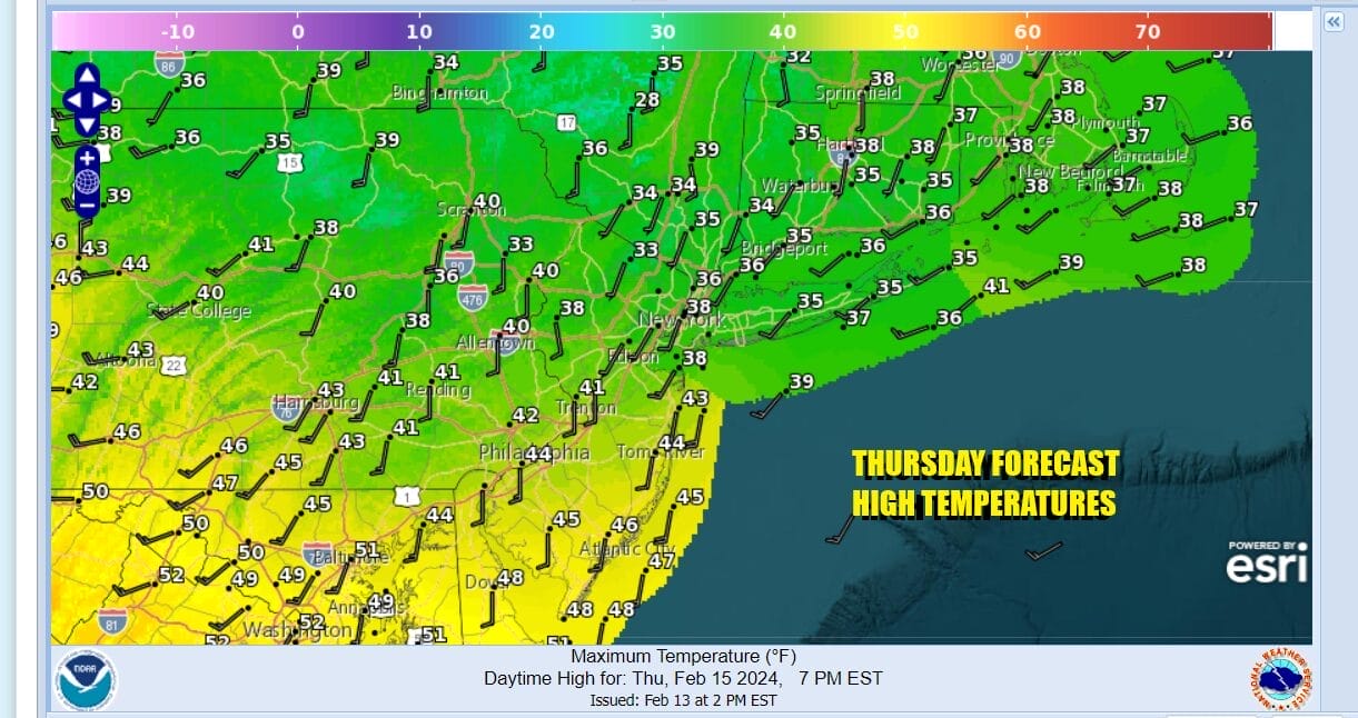
Friday we are looking at some sunshine returning but once again we are looking at clouds arriving later in the day. Low pressure is heading east from Oklahoma to Tennessee and then will make a move off the Virginia coast during Friday night and early Saturday morning. This time around the snow risk will be more to the south of NYC and there is a chance for accumulating snow of up to a couple of inches for Central and South Jersey as well as Southeastern Pennsylvania.
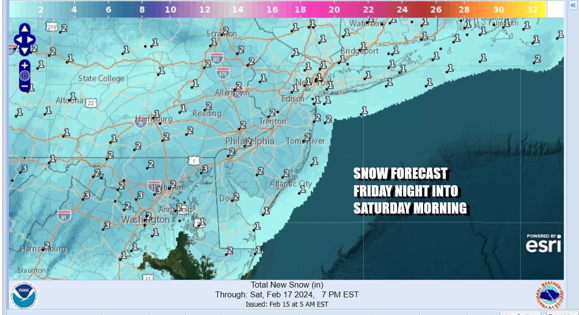
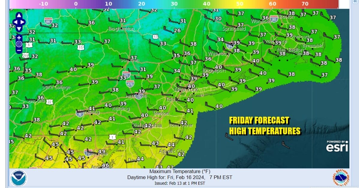
Friday will start with sunshine and then give way to arriving clouds. Highs will be in the mid to upper 30s. Then Friday night, probably after midnight until mid morning Saturday we will see low pressure pass off to the south and east. This is a small system and there is limited upside possible just north of the low track so I think we could see some 2 to 3 inch amounts from Washington DC to Baltimore to Delware and perhaps the southern half of New Jersey (south of Route 195)
After the low goes by, weather conditions will improve Saturday afternoon with developing sunshine and highs in the 30s. We will turn cold Saturday night into Sunday morning. Sunday look for sushine with highs in the 30s. Monday is President’s Day and we will cap off the three day holiday weekend with sunshine and highs in the upper 30s and lower 40s.
BE SURE TO DOWNLOAD THE FREE METEOROLOGIST JOE CIOFFI WEATHER APP &
ANGRY BEN’S FREE WEATHER APP “THE ANGRY WEATHERMAN!
MANY THANKS TO TROPICAL TIDBITS FOR THE USE OF MAPS
Please note that with regards to any severe weather, tropical storms, or hurricanes, should a storm be threatening, please consult your local National Weather Service office or your local government officials about what action you should be taking to protect life and property.
(Amazon is an affilate of Meteorologist Joe Cioffi & earns commissions on sales.)