
Weak Systems Moving Along For Easter Weekend,
Week Ahead Has a Midweek Storm System To Deal With

Weak Systems Moving Along For Easter Weekend,
Week Ahead Has a Midweek Storm System To Deal With
It has taken a long time for yesterday’s storm system to get out of the way. In fact the rain is pulling out of Long Island and Southern New England this morning and it is still raining from Southeastern New England into Maine. Flood Watches continue for Northern New England this storm system is putting the topping of a very wet March across the Northeast and Northern Mid Atlantic states. Many areas finishing up with 10 inches or more of rain for the month with records being set in many places.
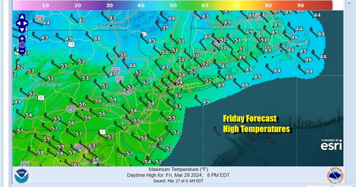
Drier air is slowly but surely making its way on the backside of this developing low which eventually winds up in the Gulf of Maine this afternoon. Northwest winds will pick up nicely as the day wears on. We should also see decreasing clouds and slowly increasing amounts of sunshine from west to east as the drier air takes hold. Temperatures on the backside of this low aren’t especially cold and most highs this afternoon will be in the low to a few middle 50s. That is actually close to where we should be for this time of year.
SATELLITE WITH LIGHTNING STRIKES

WEATHER RADAR

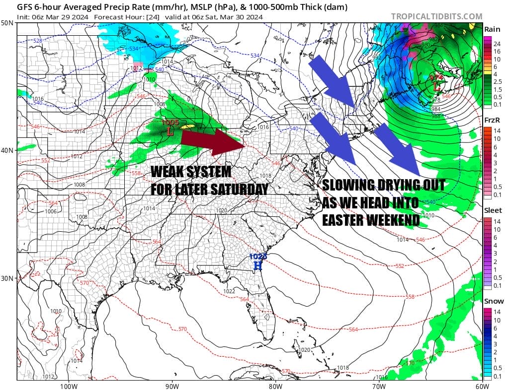
As radars calm down and clouds decrease and clear out tonight, out attention this weekend turns to two systems that will be moving east. There is a lot of energy coming into the Western US with mountain snows and valley & coastal rains from California to the Rockies. Pieces of that energy will break off from a main system along the West Coast and translate eastward.

These systems are weak and really minor inconveniences rather than widespread all day rain events. Saturday will start with sunshine for most but as the first system approaches from the Ohio Valley, a slowly weakening area of clouds and showers will head southeast and this could bring some scattered shower activity later Saturday afternoon and evening. I think the best chances are likely south of NYC and Philadelphia but I can’t rule it completely out for other areas.

Temperatures Saturday will be generally in the 50s and some warm spots could see upper 50s to around 60 mainly in South Jersey, Southern Pennsylvania and points south. Then we should see skies clear out Saturday night. Eastern Sunday should be dry during the day with sunshine giving way to arriving clouds. Highs will be in the mid 50s to around or just over 60.

A second disturbance moving southeast could bring a few scattered showers Sunday night into Monday morning but again more of nuisance and nothing that occurs widespread or in a big way. Monday begins a new month but we seem to be a pattern that winter weather lovers would have loved to see in the winter months and not in early April. A developing Green land block is taking substantial Western US energy and tracking it eastward across the Plains and Ohio Valley. Monday could be a bit tricky given our close proximity of a frontal boundary forming to our south and extending into that developing low to the west.
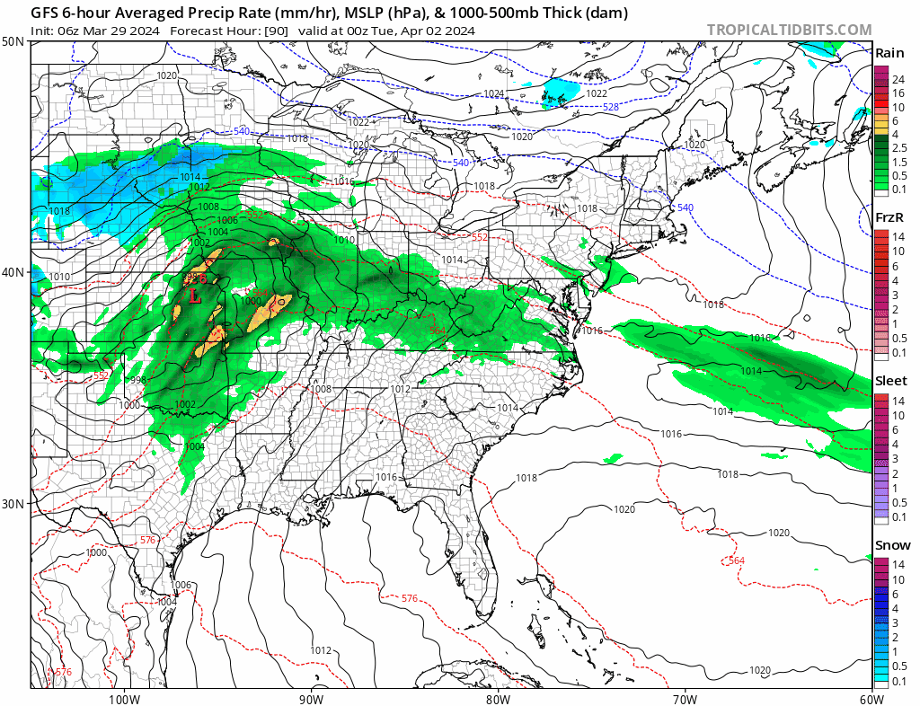
This likely puts us in clouds Monday along with the chance that we could see some rain. Most highs will be just in the upper 40s and lower 50s. This low will bring a cold rain to southern parts of the Northeast and Northern Mid Atlantic Tuesday into Wednesday but it may also bring a substantial snowfall for much of interior New England and possibly Upstate NY ( North of I-90). This system will take center stage after the Easter Holiday weekend.
BE SURE TO DOWNLOAD THE FREE METEOROLOGIST JOE CIOFFI WEATHER APP &
ANGRY BEN’S FREE WEATHER APP “THE ANGRY WEATHERMAN!
MANY THANKS TO TROPICAL TIDBITS FOR THE USE OF MAPS
Please note that with regards to any severe weather, tropical storms, or hurricanes, should a storm be threatening, please consult your local National Weather Service office or your local government officials about what action you should be taking to protect life and property.
(Amazon is an affilate of Meteorologist Joe Cioffi & earns commissions on sales.)


