Rain Continues Today But Ends Tonight, Easter Weekend Outlook

Rain Continues Today But Ends Tonight, Easter Weekend Outlook
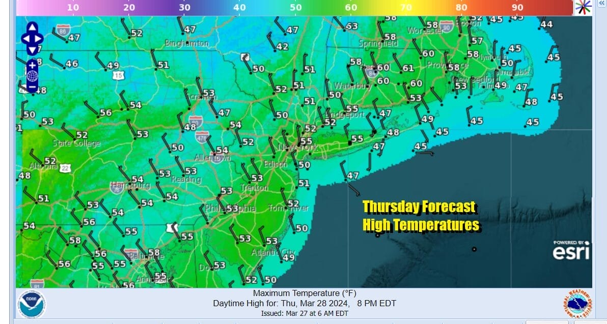
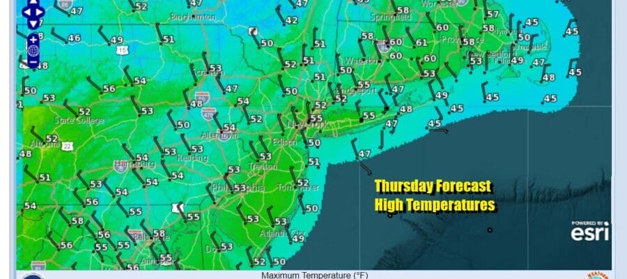
A developing storm off the North Carolina coast this morning is sitting along a frontal boundary. Rain is moving up the coast but the heaviest rain is occurring from Coastal New Jersey to NYC (on the edge), Long Island and Connecticut eastward. The low is going to move east before it turns northward and this will at least keep the rain from getting too out of hand today. No flood watches are posted for our area from Eastern Pennsylvania to Southern New England but we do have them up for Southeastern New England where 2 or more inches of rain total will fall day. The day is a cloudy rainy day for most though west of the NJ Pennsylvania state line rain is late and will start ending from west to east later today and then ending area wide this evening and tonight. Temperatures today will hover in the upper 40s and lower 50s.
SATELLITE WITH LIGHTNING STRIKES

WEATHER RADAR

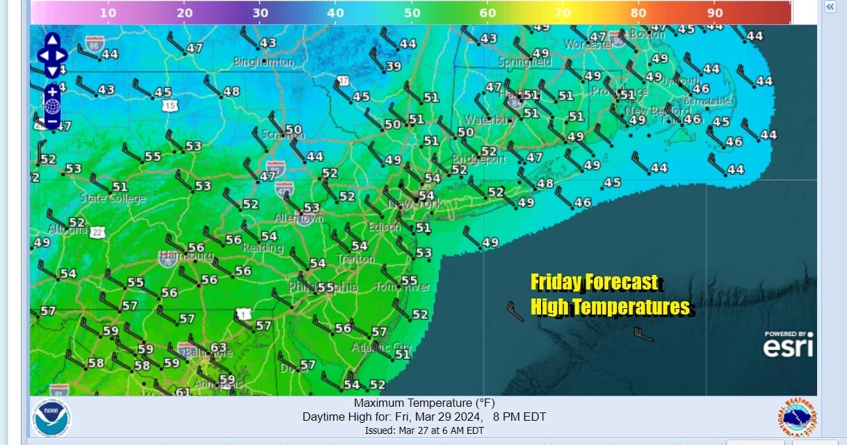
Behind this storm system we will see weather conditions improve later tonight as skies partially clear out. Lows by morning will be in the mid 30s to lower 40s. Friday will be a breezy and chilly day. We will see some sunshine and high temperatures will be in the low and middle 50s from north to south.
While we do not have any major weather systems to deal with this weekend, the northwest flow in the upper atmosphere will be driving weaker upper troughs through the Northeast and Mid Atlantic for the next several days. These systems don’t have much too them other than some clouds and areas of light showers.

One of these weather systems will move from the Upper Ohio Valley southeastward Saturday so we will probably see clouds and there is the chance for some scattered showers around but that would be mainly from Southern Pennsylvania and Southern New Jersey southward. I can’t rule out the chance for a scattered shower or two for areas to the north. Clouds will be around Saturday with limited sunshine. Highs will be into the 50s in most places. South Jersey temperatures could reach 60 or so.


Easter Sunday buys us a short break in between these weak weather systems so we will call it a partly sunny day with no showers around. Temperatures Sunday will be in the mid 50s to lower 60s. Next week energy from a storm in the Plains will be moving eastward. Monday into Tuesday most of the rain will set up to our south across the Mid Atlantic states which should mean an okay Monday but eventually low pressure will move east out of the Plains and spread across the Northeast & Mid Atlantic later Tuesday into Wednesday.
BE SURE TO DOWNLOAD THE FREE METEOROLOGIST JOE CIOFFI WEATHER APP &
ANGRY BEN’S FREE WEATHER APP “THE ANGRY WEATHERMAN!
MANY THANKS TO TROPICAL TIDBITS FOR THE USE OF MAPS
Please note that with regards to any severe weather, tropical storms, or hurricanes, should a storm be threatening, please consult your local National Weather Service office or your local government officials about what action you should be taking to protect life and property.
(Amazon is an affilate of Meteorologist Joe Cioffi & earns commissions on sales.)


