Weak System Rain Snow Showers Today Warmer Wednesday

Weather in 5/Joe & Joe Weather Show Latest Podcast
Weak System Rain Snow Showers Today Warmer Wednesday
We have a weak upper air disturbance moving through the Great Lakes and into the Northeast today. We are already seeing clouds on the satellite overhead and we will likely stay in clouds today though some breaks of sun are possible. Temperatures will be in the upper 30s and lower 40s. The best chance for a rain or snow shower (or two) will be during the afternoon and evening.
SATELLITE

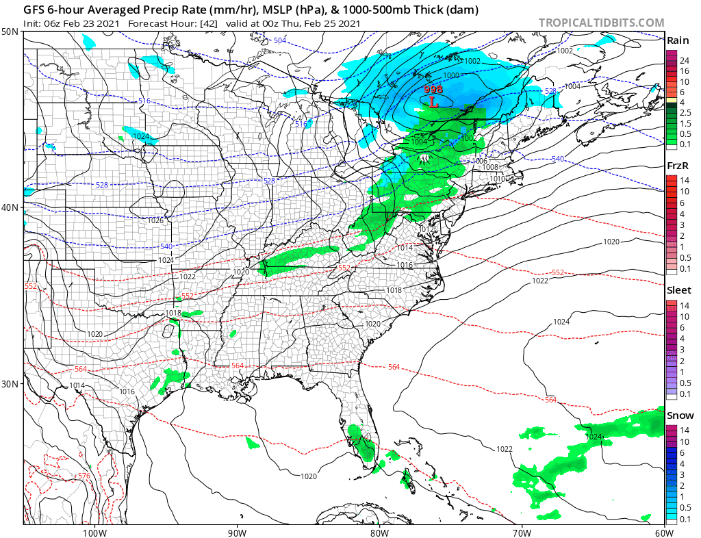
Our regional radars are picking up on the Great Lakes disturbance as it moves eastward. This does not have the kind of dynamics that our system had yesterday. Between that and the warmer surface temperatures there should be no surprises from this.
F5 WEATHER RADARS


Once the disturbance moves by this evening we will be left with leftover clouds but skies should clear out. Lows by morning will be in the upper 20s to mid 30s. Wednesday we will attempt to warm up and some places will be more successful than others.

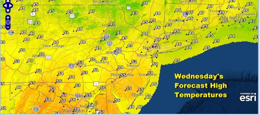
The further north you go from NYC temperatures will likely struggle in the low to mid 40s though there will be sunshine. On the other hand if you are south and west of Philadelphia you might see some upside here with temperatures reaching the mid and upper 50s. We do have a cold front that will pass Wednesday night with just some clouds and the outside chance of a passing shower.
Not much happens Thursday and Friday other than it will be dry and chilly with seasonal temperatures and some sunshine both days. A wave from the south will make a run for us over the weekend but it doesn’t have much with it. Look for clouds and some rain at some point over the weekend. Early next week we will see a strengthening storm in Eastern Canada that could bring a shot of cold air for a day or two. However there is no block so as quick as it comes in will be almost as quick as it pulls out. This means there is almost no chance for any accumulating snow in the short and medium range outlook. March will come in a bit like a lion but it will be manageable.
BE SURE TO DOWNLOAD THE FREE METEOROLOGIST JOE CIOFFI WEATHER APP &
ANGRY BEN’S FREE WEATHER APP “THE ANGRY WEATHERMAN!

MANY THANKS TO TROPICAL TIDBITS & F5 WEATHER FOR THE USE OF MAPS
Please note that with regards to any severe weather, tropical storms, or hurricanes, should a storm be threatening, please consult your local National Weather Service office or your local government officials about what action you should be taking to protect life and property.


