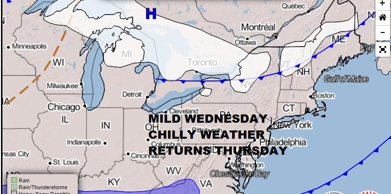
Some Sunshine Melting Snow Chilly Thursday Friday Some Rain Weekend

Weather in 5/Joe & Joe Weather Show Latest Podcast
Some Sunshine Melting Snow Chilly Thursday Friday Some Rain Weekend
It seems to me that we could see a bit of upside in the temperature department today provided we get enough sunshine. I think there is a rather good chance that we can finish 5 degrees or so higher from forecast highs so I’m thinking middle to upper 50s in many locations and areas to the south might see highs close to or even slightly above 60. There are some high clouds to the west that will be streaming up but they don’t appear all that extensive. Also the launching pad seems to be set with lows this morning that were in the mid 30s to near 40. Wherever we wind up it will be a hint of spring coming soon enough.
SATELLITE

Not much is on the radar to worry about today. We do have a cold front that will pass through tonight and with that we could see a passing brief shower. Most lows Thursday morning will be in the 30s.
F5 WEATHER RADARS


A chilly high builds in for Thursday and Friday but it will mean sunshine both days. It won’t particularly cold with seasonal temperatures around. Highs will be in the low to mid 40s both days with nighttime lows in the 20s.
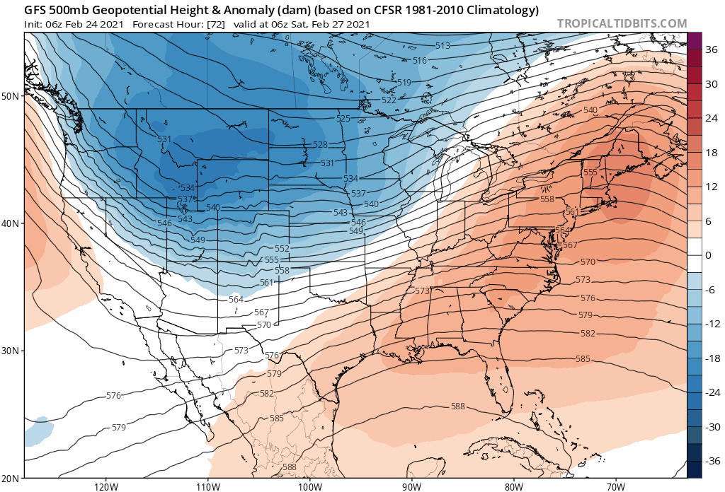
The upper air pattern change is complete now and it has left us in a west to east flow. It also involves a bit of a northern component that will flex its muscle every couple of days or so. For the weekend we have a a couple of weak systems in the flow that will get together and bring up some rain.
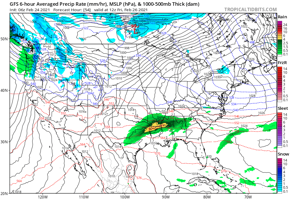
It will probably be on the raw side on Saturday with temperatures in the 40s. Sunday we could see highs reach the upper 40s to middle 50s. It doesn’t rain straight through the weekend. There should be some dry stretches in there. You will notice on the upper air loop a strong trough driving southeastward from Canada that, if it verifies, will bring a quick shot of cold air early next week. However there is some disagreement regarding that trough and the strength of it. One possibility is a weaker lead system and perhaps a stronger one behind it for later next week. Which ever way it plays it brings into March which is notorious for strong storms and lots of wind as the atmosphere on one end is trying to warm while cold air from Canada still remains a factor. It should lead to interesting times ahead.
BE SURE TO DOWNLOAD THE FREE METEOROLOGIST JOE CIOFFI WEATHER APP &
ANGRY BEN’S FREE WEATHER APP “THE ANGRY WEATHERMAN!

MANY THANKS TO TROPICAL TIDBITS & F5 WEATHER FOR THE USE OF MAPS
Please note that with regards to any severe weather, tropical storms, or hurricanes, should a storm be threatening, please consult your local National Weather Service office or your local government officials about what action you should be taking to protect life and property.


