Weak Spinning Low Offshore Overnight Turns More Humid Through the Weekend

Weather in 5/Joe & Joe Weather Show Latest Podcast
Weak Spinning Low Offshore Overnight Turns More Humid Through the Weekend
Another beautiful day of blue sky, sunshine, and low humidity comes to a close. Off to the southeast we have an odd development. High pressure is to the northeast creating an onshore flow. Under that high and on the old frontal boundary from Tuesday, a weak low is forming off the Virginia coast. The satellite is showing a bulging of the clouds to the northwest. Those clouds will back northwestward into the coast tonight.
SATELLITE

Radars are picking up on some showers that are developing offshore. They are moving north northwestward and Long Island could see a few scattered showers overnight. It is possible we could even see a thunderstorm in the mix but this weak system will gradually get weaker early Friday morning and the low itself will be gone by day break. High pressure to the northeast will build back westward as a strong upper high starts to build into the Eastern US. Temperatures tonight will probably hold in the upper 50s and lower 60s.
WEATHER RADAR


The onshore flow will continue on Friday but we should see skies go partly sunny during the morning. Afternoon highs will be in the mid 70s to near 80 inland while along the shore temperatures will probably be in the 60s to near 70. Humidity levels will be increasing from east to west as the day wears on. It should still be moderately comfortable though you will notice the difference compared to the last 2 days.

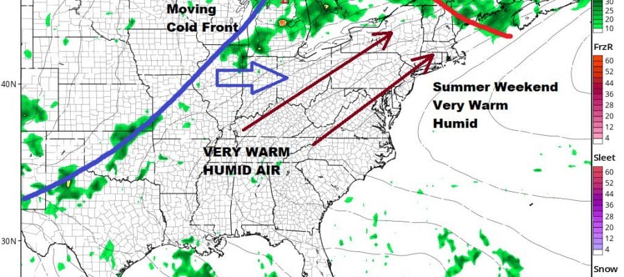
The weekend is straight forward from a forecast stand point. It will be very warm and humid both days. We should see no worse than partly sunny skies. I’m going to mention the odd chance for an isolated shower or a thunderstorm but there is a very good chance you won’t see a thing all weekend. Saturday’s highs will reach 80 to 85 inland and 80s at the beaches and over the East End. Sunday highs will be in the mid to upper 80s inland and near 80 shore and east.

The southwest flow thanks to the high offshore going nowhere and a strong ridge aloft building into the east looks to keep much if not all of next week under very warm to hot conditions with partly sunny skies and the very small chance for a pop up shower or thunderstorm. We may have to wait for the end of next week before any cold front gets close.
BE SURE TO DOWNLOAD THE FREE METEOROLOGIST JOE CIOFFI WEATHER APP &
ANGRY BEN’S FREE WEATHER APP “THE ANGRY WEATHERMAN!

MANY THANKS TO TROPICAL TIDBITS & F5 WEATHER FOR THE USE OF MAPS
Please note that with regards to any severe weather, tropical storms, or hurricanes, should a storm be threatening, please consult your local National Weather Service office or your local government officials about what action you should be taking to protect life and property.