
USE COUPON CODE JOEANDJOEWEATHERSHOW GET 10% OFF
Warming Up With No Rain All Week Long
Next Chance for Showers Over the Weekend

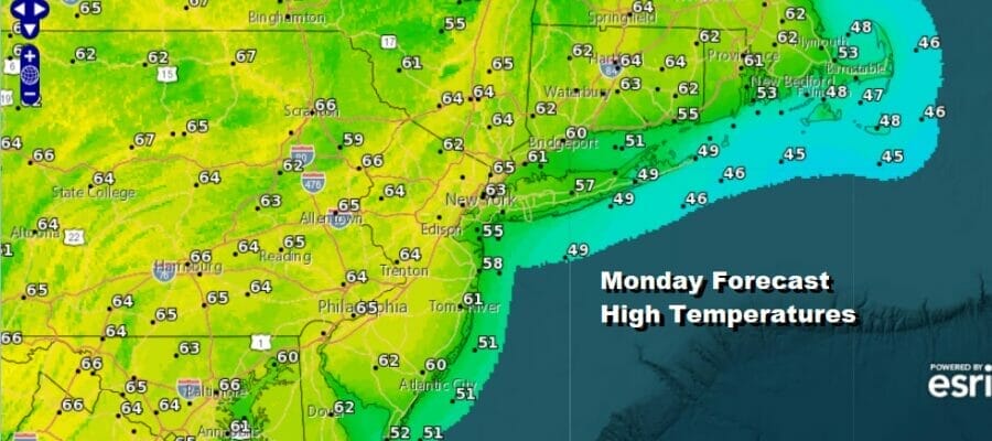
The Easter holidays are done but we are still under the control of a very dry pattern across the Northeast and Mid Atlantic states. That is going to last all week long and it will also come with a gradual uptrend in temperatures. We are looking at vitually cloud free conditions up and down the Eastern Seaboard today and with lots of sunhsine, temperatures this afternoon will be able to rebound back into the low and middle 60s. Radars are nice and quiet and will likely remain so all through the work week.
SATELLITE

WEATHER RADAR

High pressure is going to settle along the Mid and South Atlantic coast while we have low pressure to the northeast between Nova Scotia and Newfoundland. This creates more of a west to northwest flow and that is going to be a warming wind in this set up. It is also going to be a dry wind so we are going to see temperatures rise with no real rise in humidity levels.
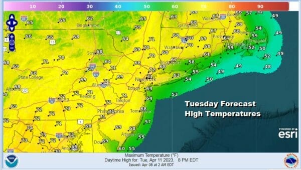
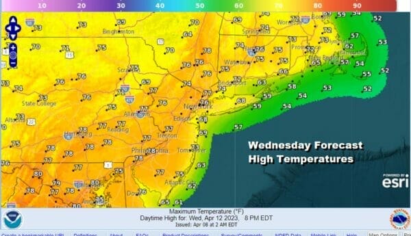
Tuesday we will see a good deal of sunshine all day long as high temperatures take a step up into the low and middle 70s. A cold front will clip the Northeast Tuesday night but all that does really is re-enforce the dry air in the Northeast and that allows the warm up to continue Wednesday. We will have a nice sunny day Wednesday with highs in the mid to upper 70s. Some warm spots could approach 80 degrees.
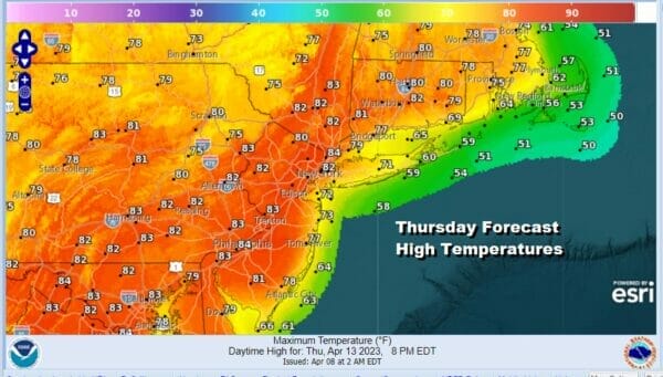
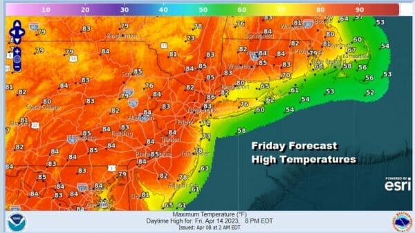
Thursday and Friday will be the two warmest days of the week. It will be interesting to see whether we wind up with some upside on these temperatures since they are already pushing 20 degrees or more above average for the forecast highs. This time of year 90 degrees is possible given the right set up and we have that to an extend Thursday and Friday. We should see sunshine both days and highs will be at least in the low to mid 80s but I would not all be surprised if somebody pushes it up toward 90 degrees.
The ridge in the Eastern US will begin to break down over this coming weekend and that will allow the next weather front to come in from the west. It may not be until late Sunday or Sunday night when we could see showers so we will for now emphasize that much of the weekend will be dry. A less favorable wind and more clouds will probably keep temperatures in the 70s to near 80 or so rather than in the 80s.
BE SURE TO DOWNLOAD THE FREE METEOROLOGIST JOE CIOFFI WEATHER APP &
ANGRY BEN’S FREE WEATHER APP “THE ANGRY WEATHERMAN!
MANY THANKS TO TROPICAL TIDBITS & F5 WEATHER FOR THE USE OF MAPS
Please note that with regards to any severe weather, tropical storms, or hurricanes, should a storm be threatening, please consult your local National Weather Service office or your local government officials about what action you should be taking to protect life and property.


