Warming Up Into the Weekend Storm System Brings Rain & Snow Next Week

Warming Up Into the Weekend Storm System Brings Rain & Snow Next Week
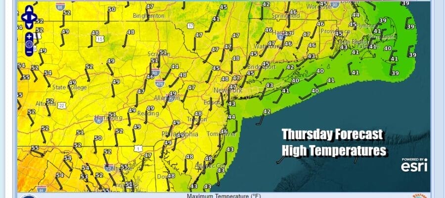
Today is the sixth day in a row of sunshine and nice weather which is the longest streak of sunny days since forever! At least it seems that way especially after 10 days in a row of gloom and doom. Now we have high pressure which has been pinned along the coast moving to the east and this is going to bring warmer temperatures this afternoon. Highs will reach into the 50s today in many locations and we are at the time of year where a slowly strengthening sun can work wonders on temperatures so we are going to go a little higher than the digital numbers from the National Weather Service and model guidance which wants to keep temperatures in the 40s to around 50. Radars are nice and quiet and remain a non issue from Eastern Pennsylvania to Southern New England.
SATELLITE WITH LIGHTNING STRIKES

WEATHER RADAR

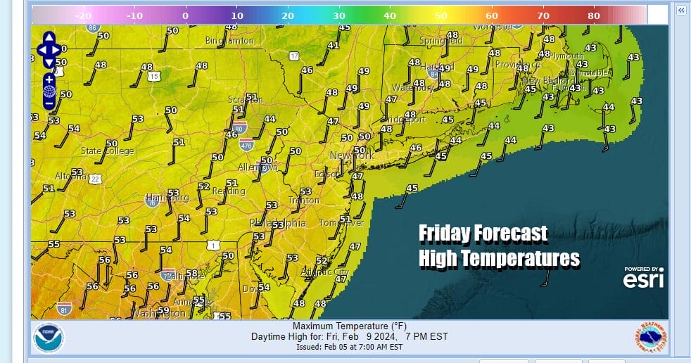
The trend to warmer temperatures will contiinue tonight with nothing more than some passing clouds in an otherwise clear night. Lows will be in the 30s to around 40. This sets us up for warmer temperatures Friday with sunshine and some passing clouds. Highs will be in the 50s area wide.
Saturday sees the approach of the first cold front in over a week. Ahead of it we will warm up even further especially if we have any kind of sunshine during the day Saturday,. The front is from low pressure moving across Southern Canada and has very little moisture with it. Highs will reach the upper 50s and lower 60s and some places could see some record high temperatures being set Saturday afternoon.

The front will pass Saturday night and other than a passing scattered shower it will be dry. Sunday begins a slow stair step decline in temperatures as the front moves southward and stalls across the Mid Atlantic states and westward through the lower Ohio and Tennessee Valley. Eventually we will see low pressure develop in the Southern Plains Sunday and that low heads east northeast to the Mid Atlantic coast by Monday night early Tuesday.
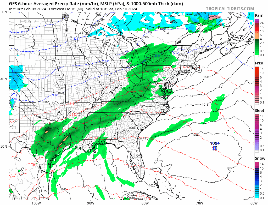
Sunday will likely be a day of clouds with some breaks of sunshine developing and highs mostly in the 40s. Monday we will likely start with some sunshine but clouds will be in on the increase with highs reaching the upper 30s and lower 40s. Overnight GFS model runs have a colder look to them with low pressure tracking further south and margainl cold air reaching into coastal as well as inland areas. However we see all the other global models showing a track further north, tucked in along the coast, and mostly rain along the coast. Snow would be be mainly from Route 84 northward from Pennsylvania to New England. Right now we continue to lean in this direction and away from the offshore, colder, and further south track of the GFS. It would seem that even if that were correct, snow accumulations will favor elevated areas as there isn’t much cold air to speak of. We will have more on this storm system in posts later today and tonight on the Joe & Joe Weather Show on youtube.
BE SURE TO DOWNLOAD THE FREE METEOROLOGIST JOE CIOFFI WEATHER APP &
ANGRY BEN’S FREE WEATHER APP “THE ANGRY WEATHERMAN!
MANY THANKS TO TROPICAL TIDBITS FOR THE USE OF MAPS
Please note that with regards to any severe weather, tropical storms, or hurricanes, should a storm be threatening, please consult your local National Weather Service office or your local government officials about what action you should be taking to protect life and property.
(Amazon is an affilate of Meteorologist Joe Cioffi & earns commissions on sales.)


