Beautiful Weather Continues Before Pattern Changes Next Week

Beautiful Weather Continues Before Pattern Changes Next Week

Today is the 5th day in a row of beautiful weather conditions. The omega block that has put us in this sweet spot continues to very slowly break down but we are still under high pressure from Maine to the Southeast US Coast. This should hold in place for another day or so before weather systems really start to move along again. This will be another day of lots of sunshine with just a few passing clouds from time to time. Temperatures will top out once again in the low to middle 40s this afternoon and the radars across the Northeast and Mid Atlantic states remain nice and quiet.
SATELLITE WITH LIGHTNING STRIKES

WEATHER RADAR

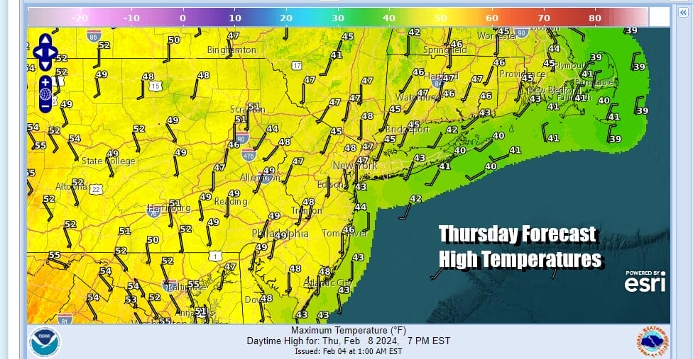
As the high moves out to the east tonight and Thursday we will start to see temperatures edge higher in the coming days. Tonight will be another night of clear skies with most lows in the mid 20s to lower 30s. Thursday we will see temperatures bounce a little higher with sunshine for much of the day. Highs Thursday afternoon will reach the mid to upper 40s. A few warm spots might make a run for 50 degrees or so.
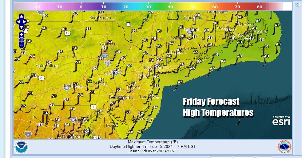
Friday we will warm up a bit more as high pressure lies just offshore and winds turn southwest. This should keep temperatures up Thursday night into Friday morning with most lows in the 30s. Friday will finish the work week with some sunshine and we will see warmer temperatures as highs will be in the 50s area wide.
The big California storm is slowly making its way through the Rockies and that low in a much weaker state takes a track to the Northern Plains and into Canada. There will be a trailing cold front with this system which is likely to pass through Saturday night and that might bring the first risk of some passing showers. However I think they will be scattered in nature as the Gulf of Mexico and the Atlantic remain closed as a moisture source.

Ahead of that front, Saturday will give us a taste of late March weather with clouds and some sunshine. Highs Saturday will reach the mid and upper 50s. Areas from Southern New Jersey to Southern Pennsylvania southward could see highs reach into the 60s. No rain is forecast for the daytime Saturday.

The cold front passes and stalls across the Tennesse Valley and the South and Pacific energy will be moving across the Deep South. At the same time we have a flow of colder air that will be setting up from Northern Canada to the Great Lakes and Northeast. Temperatures will drop in stair step fashion as we will see some sunshine Sunday with highs back in the 40s. Monday look for sunshine and arriving clouds with highs mostly in the 30s.

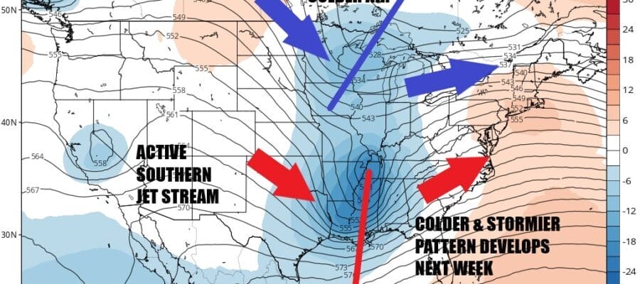
Weather models are growing more bullish on the idea of low pressure coming out of the Middle Mississippi Valley and moving east northeast and strengthening as it moves along. The GFS model above shows a well developed storm system tracking off the New Jersey coast and moving east northeast as colder air to the north gets wrapped into its circulation. This run lines up a near perfect scenario of the northern jet stream phasing with the south to create a major storm

When models show perfect storm scenarios 5 or 6 days out, it usually winds up evolving into something different or weaker. Before we start thinking about what this means storm wise for next week, we need to see some consistency from run to run as to how this storm will play out. For now we will start thinking about the chance for rain or snow, or rain changing to snow for Monday night and Tuesday of next week and leaving it at that for the time being. Longer range after this system, it seems we will be in a colder pattern overall for at least a week to 10 days if not longer as we make our way through the second half of February.
BE SURE TO DOWNLOAD THE FREE METEOROLOGIST JOE CIOFFI WEATHER APP &
ANGRY BEN’S FREE WEATHER APP “THE ANGRY WEATHERMAN!
MANY THANKS TO TROPICAL TIDBITS FOR THE USE OF MAPS
Please note that with regards to any severe weather, tropical storms, or hurricanes, should a storm be threatening, please consult your local National Weather Service office or your local government officials about what action you should be taking to protect life and property.
(Amazon is an affilate of Meteorologist Joe Cioffi & earns commissions on sales.)


