
Warmest Day of the Week As Cold Front Passes Colder Wednesday

Warmest Day of the Week As Cold Front Passes Colder Wednesday

Today is going to be the warmest day of the week for Eastern Pennsylvania to Southern New England as a cold front passes through. Northwest winds and developing sunshine will take temperatures to the mid 60s some some lower 70s. Some areas saw showers overnight but those are mostly now to the east and they are a non issues for the rest of the day. Low pressure continues to move along to the east in Southeastern Canada and there will be colder air that comes in behind it tonight and Wednesday as we are in this fast moving weather pattern. Weather systems will continue to move from west to east for the rest of the week.
SATELLITE WITH LIGHTNING STRIKES

WEATHER RADAR

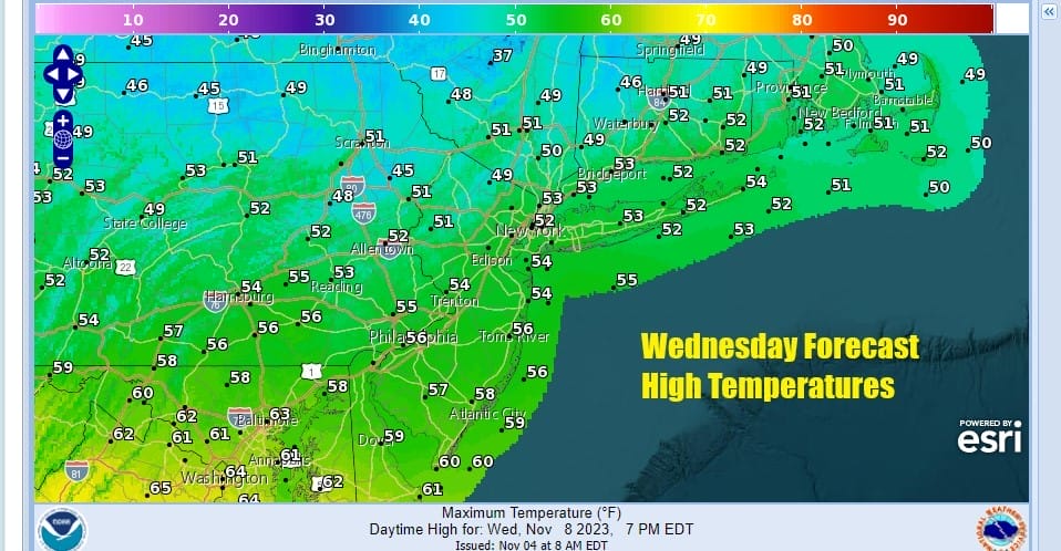
Skies will clear out tonight with most lows in the upper 30s to lower 40s. Wednesday is looking like a nice day but a northerly wind and high pressure in Southeastern Canada will knock temperatures down by 10 degrees or more. Highs Wednesday afternoon will range from the upper 40s to near 50 north and northeast of NYC to mid and upper 50s south and southeast of Philadelphia.
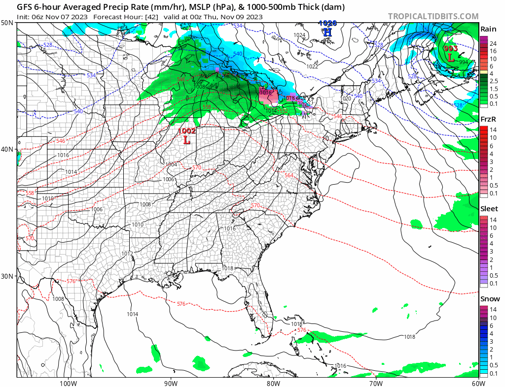
We may start to see high clouds ahead of the next warm front/cold front combination start to arrive Wednesday afternoon and Wednesday night into Thursday morning this warm front will go by. It appears low pressure will be heading to the west and north up the Saint Lawrence Valley. Most of the showers with this system will be to our north but there will be cloud issues and i will throw in the chance there could be an overnight scattered shower or two.
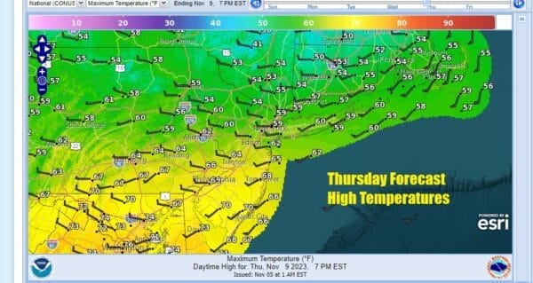
There will be a wide range in temperatures Thursday because of where the warm front sets up. The spread is likely to be 20 to 25 degrees from north to south. Highs in the HudsoN Valley to Connecticut will be in the mid to upper 50s as well as in Northwest New Jersey while to the south in Southeastern Pennsylvania to Southern New Jersey we are looking at upper 60s and lower 70s.
 Sky conditions will range from cloudy in northern areas where temperatures will struggle to partly sunny in areas to the south where temperatures could break 70. Once again we have colder air coming in behind the cold front that passes. We don’t expect any complications from the front stalling so Friday look for sunshine but highs just in the 50s. The weekend will be on the chilly side with highs in the upper 40s to mid 50s Saturday and highs only in the mid 40s to lower 50s Sunday. Both days will feature sunshine as another high builds southward from Southeastern Canada. We still don’t see much happening storm wise into next week as the pattern remains relatively benign.
BE SURE TO DOWNLOAD THE FREE METEOROLOGIST JOE CIOFFI WEATHER APP &
ANGRY BEN’S FREE WEATHER APP “THE ANGRY WEATHERMAN!
MANY THANKS TO TROPICAL TIDBITS FOR THE USE OF MAPS
Please note that with regards to any severe weather, tropical storms, or hurricanes, should a storm be threatening, please consult your local National Weather Service office or your local government officials about what action you should be taking to protect life and property.
(Amazon is an affilate of Meteorologist Joe Cioffi & earns commissions on sales.)


