
Chilly Wednesday Warm Front Cold Front Thursday
Leads to Chilly Friday Weekend

Chilly Wednesday Warm Front Cold Front Thursday
Leads to Chilly Friday Weekend
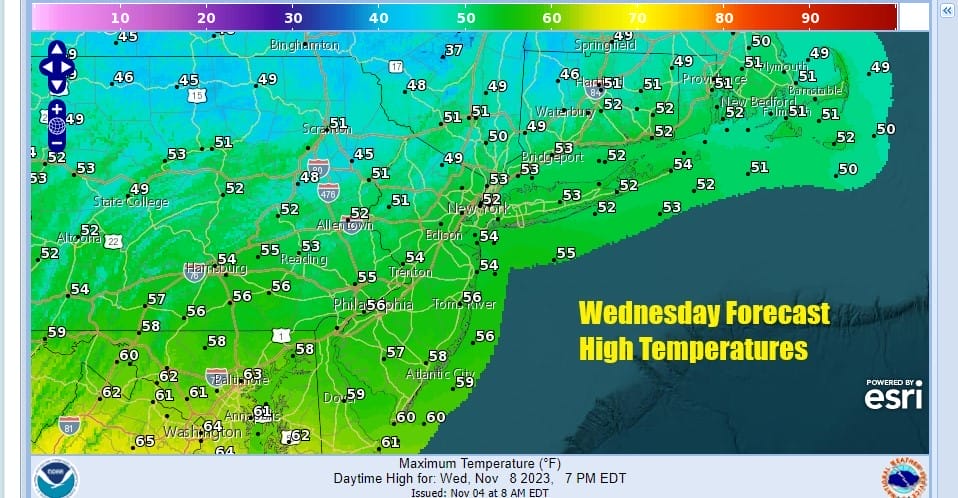
Today we are on the other side of a cold front and we are going to see sunshine at least for awhile today. Clouds to the west in the Great Lakes are moving eastward and they will probably start to arrive from west to east this afternoon. Temperatures today will be on the chilly side with most highs in the low to middle 50s. Radars are nice and quiet for now and we have no issues with any rain through this evening.
Low pressure is heading east across the Great Lakes and into New England. We have the Atlantic Ocean and the Gulf of Mexico basically cut off from supplying any moisture so these systems are relatively moisture starved and not going to be big precipitation producers. Rain will be streaming eastward tonight but the bulk of that rain will pass to our north. We see only a few showers overnight for Northeast Pennsylvania, the Hudson Valley, and Connecticut while areas to the south will see little or nothing in the way of rain.
SATELLITE WITH LIGHTNING STRIKES

WEATHER RADAR

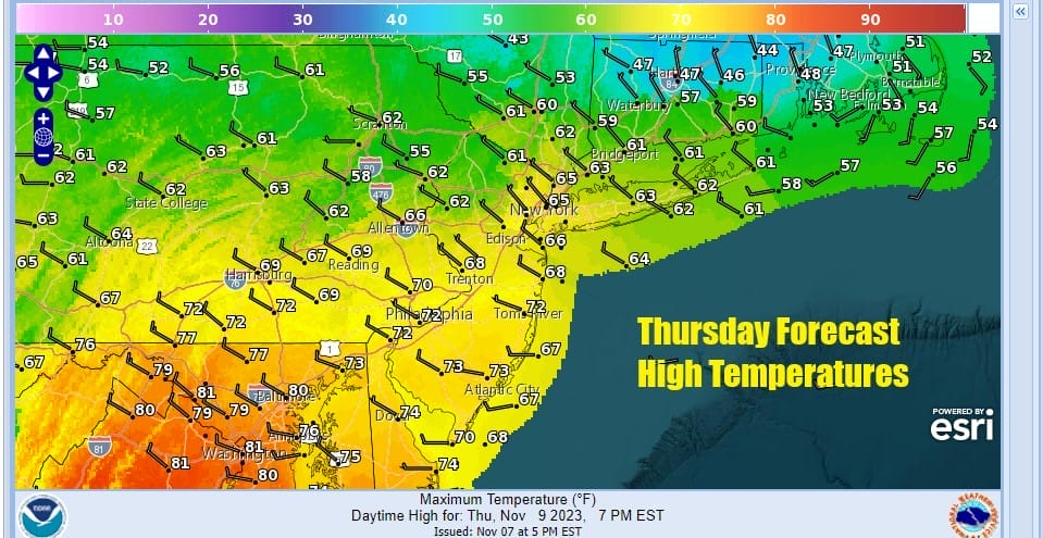
Moving on to Thursday it is a bit of a tricky day as the warm front will basically struggle to move northward so this will create a wide range in temperatures. For areas north and northeast of NYC clouds into the afternoon will hold temperatures down as highs will reach the upper 50s and lower 60s. However further south where we will see mostly cloudy skies go partly sunny, highs will reach into the 70s in areas like Southern New Jersey and points southward.
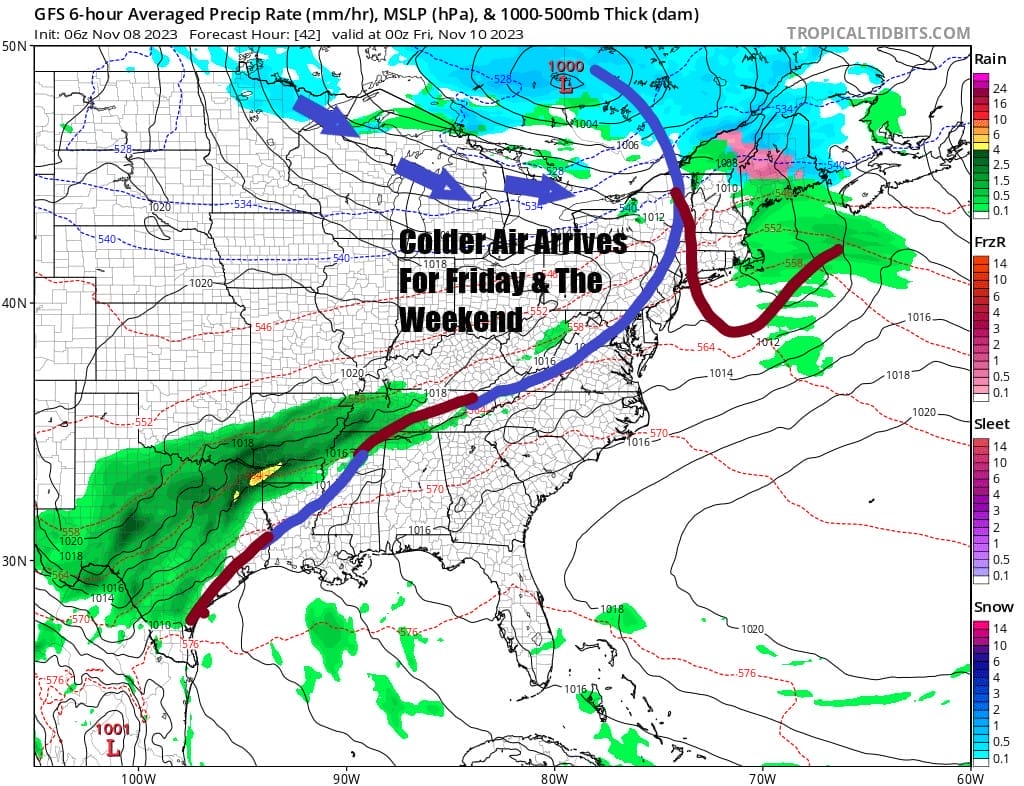
The cold front will pass and temporarily stall across the Middle Atlantic states southward into the Southeast US and a weak wave will develop on the front for Friday. It appears that the front and wave will produce some clouds for Friday but we think any rain or showers stay south and east. In the meantime Friday brings a northerly wind and that will mean for a much colder day. Highs will only be in the low to middle 50s.

The weekend will be dry and chilly as high pressure builds southward from Eastern Canada and hold in through the weekend and into next week. Saturday will be a day of no worse than partly sunny skies with highs reaching the low and middle 50s. Sunday will likely be the coldest weekend day with sunshine but most areas will see temperatures not get out of the 40s.
BE SURE TO DOWNLOAD THE FREE METEOROLOGIST JOE CIOFFI WEATHER APP &
ANGRY BEN’S FREE WEATHER APP “THE ANGRY WEATHERMAN!
MANY THANKS TO TROPICAL TIDBITS FOR THE USE OF MAPS
Please note that with regards to any severe weather, tropical storms, or hurricanes, should a storm be threatening, please consult your local National Weather Service office or your local government officials about what action you should be taking to protect life and property.
(Amazon is an affilate of Meteorologist Joe Cioffi & earns commissions on sales.)


