Warmer Sunday Monday Arctic Front Arrives Chance Snow Tuesday
Warmer air is arriving aloft and you saw it today with some high clouds and you will see it overnight with more clouds which are to the west on the satellite picture this evening. Once those clouds reach us it will place a blanket overhead and keep temperatures from falling very much. We may just settle in the 30s tonight however at least until it clouds up, look for areas away from warmer urban centers to lose a little heat tonight and temperatures there will be dropping into the 20s. While we transition over to warmer air we will be doing it without any showers of either rain or snow as the quiet regional radar can attest to.
SATELLITE

REGIONAL RADAR

There are no changes in the outlook for Sunday as we will have sunshine and temperatures bouncing into the upper 40s and lower 50s with higher numbers possible Southern New Jersey and Southeastern Pennsylvania. The bounce continues on Monday as we set up for the next arctic boundary and an even colder air mass to come in beginning Tuesday and lasting into Thursday.
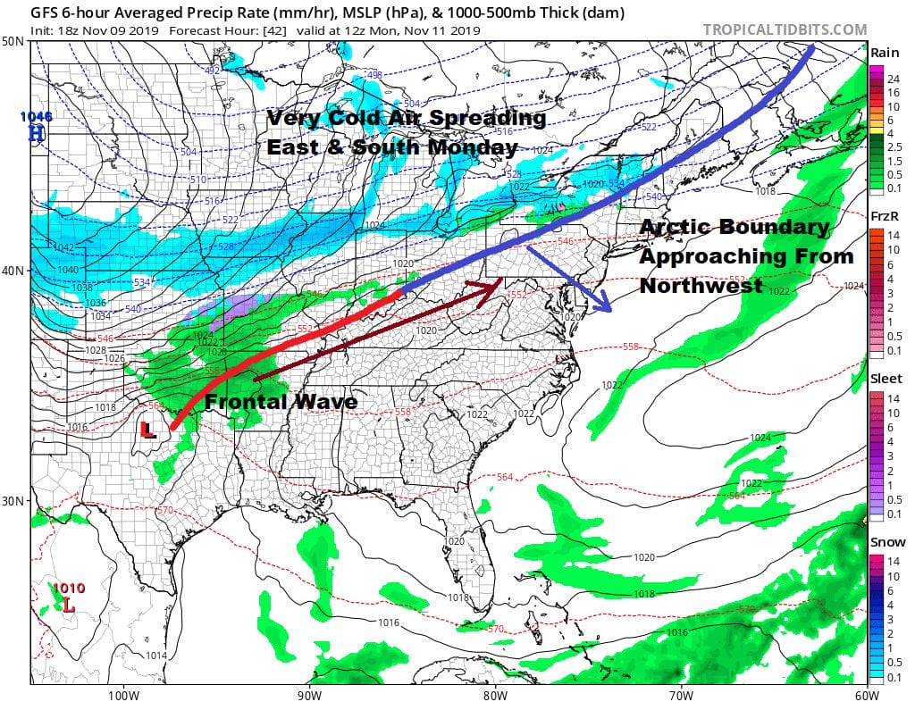
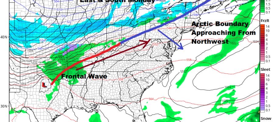
Setups that bring in very cold air can involve major storms but they can also involve flat looking systems like this one which is basically a cold front with a little wave on it. The wave ripples rapidly along and swings the frontal boundary eastward. Monday actually looks like a dry day here with some sunshine and arriving afternoon clouds especially as you go north and west of NYC. Highs will be in the mid to upper 50s which is about where we are supposed to be for November 11th. I don’t see any rain issues Monday for Veterans. Day.

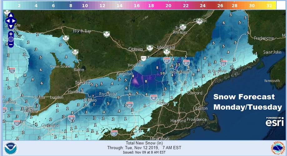
Everything swings into action later Monday night into Tuesday morning as the Nam Model shows above. Cold air of this nature can be aggressive and arrive faster than models can handle sometimes. This is from 1pm Monday to 7pm Tuesday. In Northwest Pennsylvania and upstate NY into Western New England it is a no brainer here. Snow develops rather quickly Monday afternoon and evening. Tuesday morning the boundary shifts to the coast and offshore and it is race between the cold air and the precipitation shutting off. Clearly the NAM says it gets here in time while other models are less bullish but still show the possibility. In the end this is a minor event if it plays out. We are talking about a handful of hours of some snow and not really a lot of precipitation involved here. Most areas are under a quarter of an inch of melted liquid and some even under a tenth. None the less the chance is there and it could perhaps leave areas that see the change with a quick snowfall and maybe even a cheap thrill accumulation.
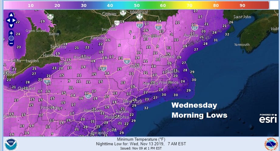
After that is done it is all about the cold and when you wake up Wednesday morning it is going to be very cold here in the Northeast and Middle Atlantic States with lows in the teens to low 20s in many areas. Wind will also be an issue Tuesday night into Wednesday morning so knock off another 10 degrees with that. Wednesday’s highs will be just into the 30s with many areas north and west of the coast not out of the upper 20s to near 30 which for this time of year is unusually cold indeed.
BE SURE TO DOWNLOAD THE FREE METEOROLOGIST JOE CIOFFI WEATHER APP &
ANGRY BEN’S FREE WEATHER APP “THE ANGRY WEATHERMAN!
MANY THANKS TO TROPICAL TIDBITS FOR THE USE OF MAPS
Please note that with regards to any severe weather, tropical storms, or hurricanes, should a storm be threatening, please consult your local National Weather Service office or your local government officials about what action you should be taking to protect life and property.


