Warmer More Humid Weekend Outlook Long Range Summer Heat Close By Next Week
We managed a day of sunshine with moderate levels of humidity but what helped today was an ocean component to the wind and that help to keep temperatures from getting much above the low to mid 80s inland and kept it mostly in the 70s along the shore. We have a fair amount of sunshine with some patchy clouds from time to time. Overall it is a good solid mid July day.
SATELLITE

REGIONAL RADAR

There are not issues tonight on the radar. Yesterday evening we had some leftover pop up isolated thunderstorms that come through between 6 and 8pm east of NYC but they were gone and skies cleared out in time for viewing Comet Neowise. Tonight should be okay with clear skies mixed with a few odd clouds here and there. You should be able to see it in the north northwest sky beginning around 9:30pm. Try to be away from city lights as that will obscure your viewing.

The next two days will be prepping up for some weekend heat. Thursday we are looking at clouds and sun with highs ,much like today in the low and middle 80s with 70s along the ashore. Once again there will be a bit of an ocean component to the wind which will hold temps down. Friday we have a weak weather front moving thought that might set off a late day thunderstorms in one or two spots. It isn’t much of a front really as the air behind it is actually warmer than the air ahead of it. Highs Friday will be in the 80s.

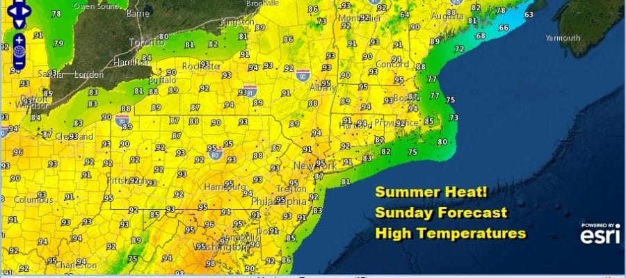
Saturday begins a hot stretch of weather lasting through Monday and we will likely hit 90 or better each day. Saturday’s highs will reach 90 to 95 with some sea breeze relief at the shore. Sunday will likely reach the low and middle 90s and it will be the hottest day of the month and of the summer so far for some areas.
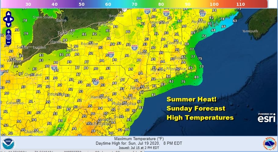
Though Sunday we will see highs in the 90s reaching up into Maine, this time around we have a more normalized atmosphere. The hottest temperatures in the mid to upper 90s will be in the Mid Atlantic States where it will reach mid to upper 90s. This is different from back in June when mid to upper 90s were occurring in Northern New England and it was actually much cooler further south. We called it the upside down atmosphere. This time around things are right side up!
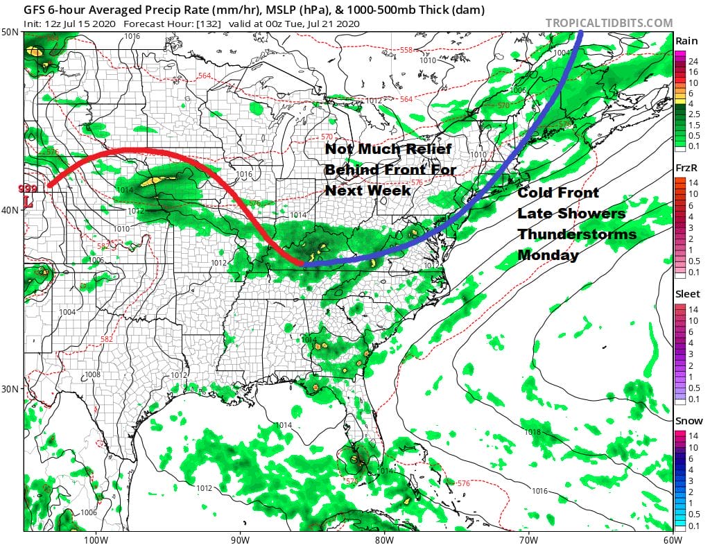
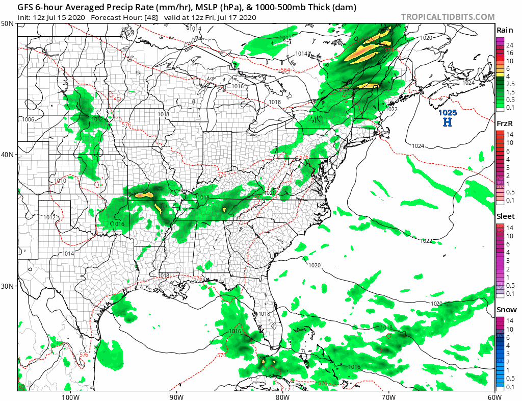
Next Monday brings a third day of 90 plus with a chance for thunderstorms late in the day. Another weak weather front goes by and there isn’t hope for much relief behind it. The hot humid weather likely takes us through much of next week and other than the isolated pop up shower or thunderstorm, it is quite likely that the entire stretch over the next 7 days or longer wiil see little if any rain.
BE SURE TO DOWNLOAD THE FREE METEOROLOGIST JOE CIOFFI WEATHER APP &
ANGRY BEN’S FREE WEATHER APP “THE ANGRY WEATHERMAN!
MANY THANKS TO TROPICAL TIDBITS FOR THE USE OF MAPS
Please note that with regards to any severe weather, tropical storms, or hurricanes, should a storm be threatening, please consult your local National Weather Service office or your local government officials about what action you should be taking to protect life and property.


