
Warmer Air Arriving & Rain Monday And Again Tuesday Night Wednesday
Colder Air Late Week

Warmer Air Arriving & Rain Monday And Again Tuesday Night Wednesday
Colder Air Late Week
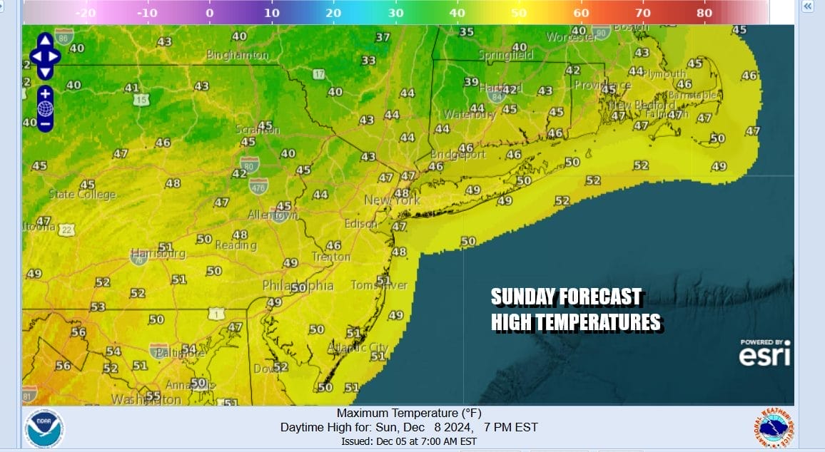
The overnight disturbance that brought snow showers from the Hudson Valley & Northernmost New Jersey to Long Island and Connecticut is making its exit to the east and that means improving weather conditions this Sunday. Decreasing clouds and increasing sunshine is what is in store for today. Also we are seeing warmer temperatures coming into the Eastern US and that will take highs to the upper 40s and lower 50s. Radars are showing all precipitation out to the east and we are done with it for the rest of the day.
SATELLITE WITH LIGHTNING STRIKES

WEATHER RADAR

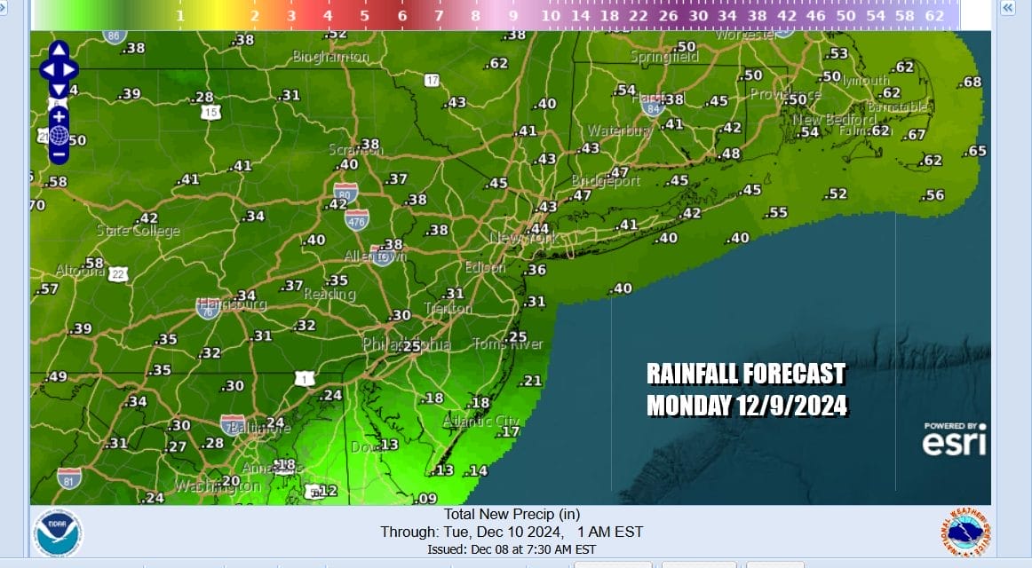
Most lows tonight will be in the 30s with cold spots well inland in the 20s. Clear skies will give way to arriving clouds late tonight as the next weather system heads our way. Low pressure is going to be moving eastward across the Great Lakes and Northeast Monday coupling with some gulf moisture. Basically this is going to be a warm front that will be pushing the rain northward and we will see rain come in Wednesday morning and it should be mostly done by Wednesday evening.

Until the warm front passes, temperatures will be relatively contained especially while it is raining. Monday highs will be in the upper 40s and lower 50s. The rain should end during the mid and late afternoon from west to east and rainfall amounts will be on the order of 1/3 to 1/3 inch across Eastern Pennsylvania to Southern New England.
Once the warm front passes it leaves us drying out for Monday into Tuesday and temperature will be rather warm Tuesday. Highs will reach the mid 50s to lower 60s. We might have some sun early in the day but clouds will be rolling in ahead of an arctic cold front that is going to sweep heavy rains up and down the coastal plain from New England to Florida.
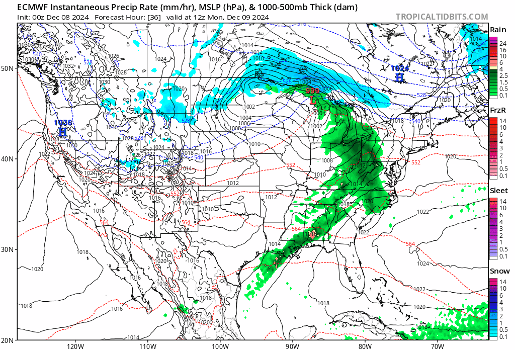
Rain will develop Tuesday night into Wednesday morning. Plenty of Gulf of Mexico and Atlantic moisture is available and a second wave develops as the front slows down bringing more rain Wednesday. 1.5 to 2.5 inches of rain is likely from west to east and there might even be a thunderstorm in the mix. Wednesday highs will be in the mid 50s to lower 60s before the front passes. Then we turn sharply colder Thursday along with strong gusty northwest winds. Thursday and Friday highs will not get out of the 30s. Any change to snow before precipitation ends will be confined to areas in Upstate NY and Central and Northern New England.
BE SURE TO DOWNLOAD THE FREE METEOROLOGIST JOE CIOFFI WEATHER APP &
ANGRY BEN’S FREE WEATHER APP “THE ANGRY WEATHERMAN!
MANY THANKS TO TROPICAL TIDBITS FOR THE USE OF MAPS
Please note that with regards to any severe weather, tropical storms, or hurricanes, should a storm be threatening, please consult your local National Weather Service office or your local government officials about what action you should be taking to protect life and property.


