Chance for Snow Showers Tonight NYC North & East
Warmer Weather Sunday into Next Week

Chance for Snow Showers Tonight NYC North & East
Warmer Weather Sunday into Next Week
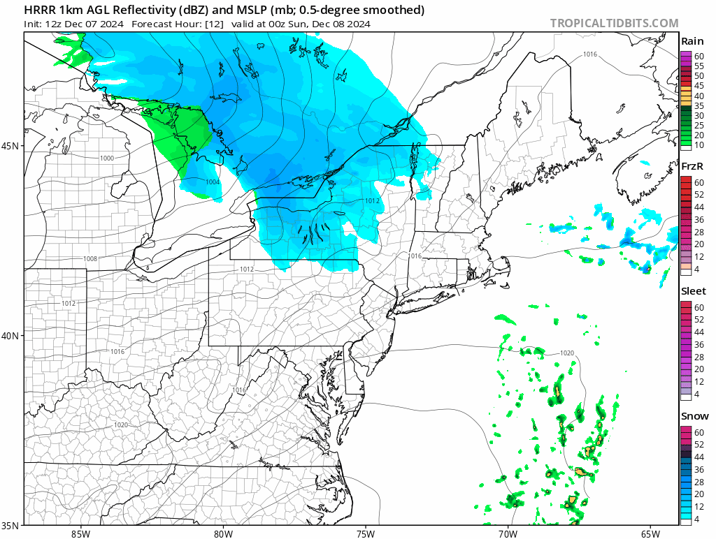
After the cold start this morning we have warmer air on the way. Another clipper system is going to be passing to our north with a warm front extending south. Ahead of that warm front we may see some snow showers mainly Northern New Jersey and NYC north and east. These snow showers will be moving through between 9pm and 1am from west to east and they could whiten up the ground in some places. A few tenths of an inch might accumulate until the front passes by.
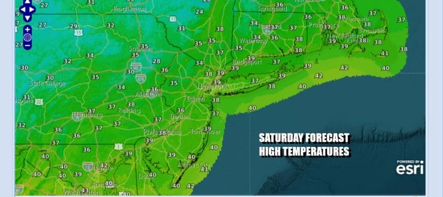
Meanwhile today it is a cold Saturday with sunshine giving way to arriving clouds. Highs this afternoon will be in the 30s to around 40 degrees. The clouds tonight will keep temperatures from falling and overnight temperatures will likely settle in the low to mid 30s.
SATELLITE WITH LIGHTNING STRIKES

WEATHER RADAR

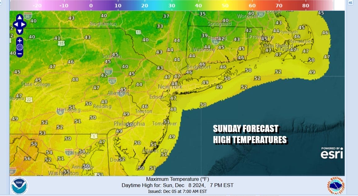
Sunday begins a mostly warmer pattern that will be the primary pattern for the next 10 days or soures. For Sunday you can look for decreasing clouds and eventually skies will become mostly sunny. West winds will help temperatures to rise and highs Sunday afternoon will be in the warm upper 40s and lower 50s.
The warm up continues Monday and Tuesday. We do have a weak low pressure area coming out of the Gulf States and that will bring a round of rain Monday afternoon into Monday night. Rainfall amounts will average around a quarter to a third of an inch. That low goes by Monday night leading to even warmer temperatures Tuesday.

Tuesday will be dry but then a second stronger low will head northeast on a cold front that will be pushing eastward through the Ohio Valley Wednesday and then offshore Thursday. We could see a more significant rainfall from this system as it goes by. In the meantime Monday temperatures will be in upper 40s and lower 50s thanks to clouds and the arriving rain.

Tuesday will be warmer with a south wind but there will be a lot of clouds around. Temperatures Tuesday will reach the mid 50s to lower 60s. Then we will see more rain developing later Tuesday night and it will likely rain for much of the day Wednesday. Highs will be in the mid 50s to lower 60s before the front passes. Colder air comes in behind a developing wave on the front and it is possible that some areas well inland could see a brief change to snow before it ends. A quick shot of colder dry air for Thursday and Friday as temperatures head back to average for this time of year followed by another warm up next weekend.
BE SURE TO DOWNLOAD THE FREE METEOROLOGIST JOE CIOFFI WEATHER APP &
ANGRY BEN’S FREE WEATHER APP “THE ANGRY WEATHERMAN!
MANY THANKS TO TROPICAL TIDBITS FOR THE USE OF MAPS
Please note that with regards to any severe weather, tropical storms, or hurricanes, should a storm be threatening, please consult your local National Weather Service office or your local government officials about what action you should be taking to protect life and property.


