Rain Today & Tuesday Night Wednesday Will Bring 2 to 3 Inches
Ahead of Arctic Cold Air Late Week

Rain Today & Tuesday Night Wednesday Will Bring 2 to 3 Inches
Ahead of Arctic Cold Air Late Week

We have rain on the way for later today into tonight. This is the first of 2 weather systems bringing much needed rainfall to Eastern Pennsylvania to Southern New England. Rain will develop from west to east around midday and it will come to an end sometime later this evening. Temperatures today will be mostly in the upper 40s and lower 50s though it might be a little warmer in Southern New Jersey and points south.

Satellite and radar loops show the area of rain advancing steadily eastward. Most of the rain is on the light to moderate side and we don’t expect this system to strengthen. it will just hold its own as it heads northeastward. Rainfall amounts will be on the order of a quarter to a half inch or so with lesser amounts in South Jersey, Southeastern Pennsylvania and Delaware.
SATELLITE WITH LIGHTNING STRIKES

WEATHER RADAR

Once the first weather system is done, an arctic cold front will be swinging eastward across the Ohio Valley and Great Lakes extending into the Deep South. This is going to bring up Atlantic Ocean and Gulf of Mexico moisture up the East Coast. This sets up for another round of rain and this is going to be more substantial due to the strong upper air dynamics.

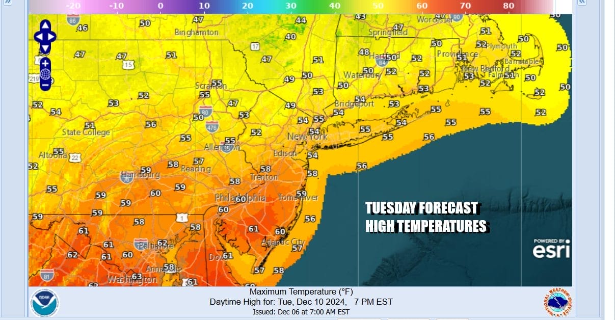
The dayside Tuesday will be mostly dry but there will be lots of clouds and temperatures will be warm. Highs will be in the upper 50s to lower 60s as warm moist air moves up the East Coast. Rain will develop overhead during Tuesday night plus or minus a could of hours of midnight and continue into Wednesday morning.
During Wednesday the front swings eastward into the Appalachians and slows down. A wave develops on the front and moves northward and we will see rain become heavy at times Wednesday afternoon and evening. We may even see some thunderstorms get into the mix going into Wednesday night. Temperatures Wednesday will be in the mid 50s to lower 60s.
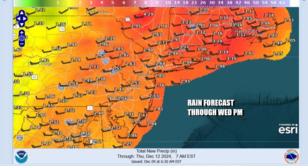
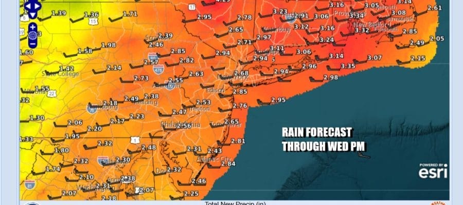
The rain will end Wednesday evening from west to east and when it is all said and done 2 to 2 1/2 inches of rain will fall from the second system. This will make the 3 day total from both storms 2.5 to 3 inches and in some cases it will be even higher especially over Southern and Southeastern New England. Colder air comes in on gusty northwest winds for Thursday and Friday. Both days will see some returning sunshine but daytime highs both days will not get out of the 30s.
BE SURE TO DOWNLOAD THE FREE METEOROLOGIST JOE CIOFFI WEATHER APP &
ANGRY BEN’S FREE WEATHER APP “THE ANGRY WEATHERMAN!
MANY THANKS TO TROPICAL TIDBITS FOR THE USE OF MAPS
Please note that with regards to any severe weather, tropical storms, or hurricanes, should a storm be threatening, please consult your local National Weather Service office or your local government officials about what action you should be taking to protect life and property.


