Powerful Cold Front Brings Strong Winds Heavy Rains Severe Weather
& Heavy Lake Effect Snow Wednesday

Powerful Cold Front Brings Strong Winds Heavy Rains Severe Weather
& Heavy Lake Effect Snow Wednesday
The atmosphere is gearing up for a rough weather event for later tonight and especially during the day Wednesday into Wednesday evening. A powerful cold front is moving east and we have a situation where we have strong dynamics in the upper atmosphere coupled with a wide open Atlantic Ocean and Gulf of Mexico providing tons of moisture. This cold front and waves moving northward on the frontal boundary will set off everything from very heavy rain, severe thunderstorms, strong winds especially along the coast, and heavy lake effect snow in Western NY and NW Pennsylvania. The snow part comes Wednesday night into Thursday.
SATELLITE WITH LIGHTNING STRIKES

WEATHER RADAR

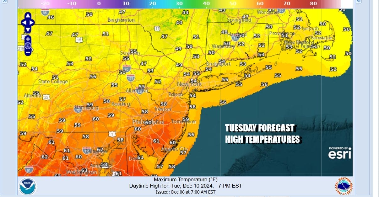
Today we see no major issues other than some dense fog that is around now that the warmer air has arrived. All of this will be under cloudy skies today. Temperatures across Eastern Pennsylvania to Southern New England will likley shoot up to the mid 50s to some lower 60s for daytime highs. No rain is forecast during the dayside but we will start to see showery rains arrive during Tuesday night.
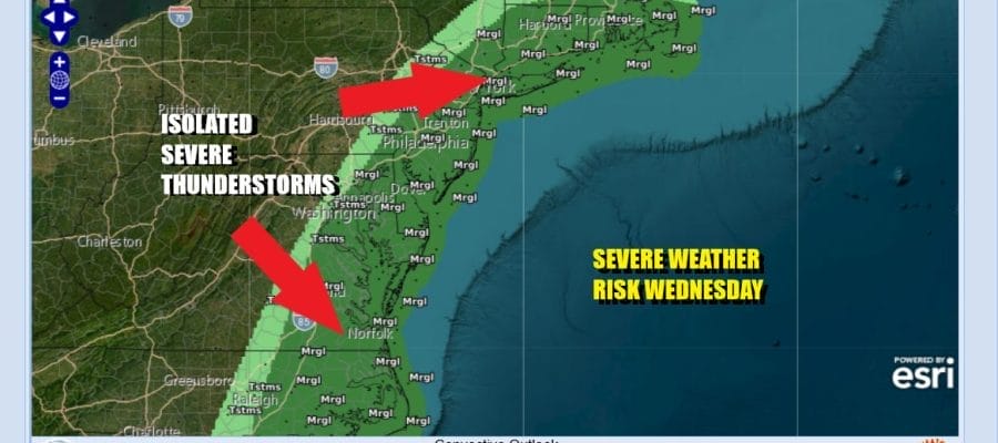
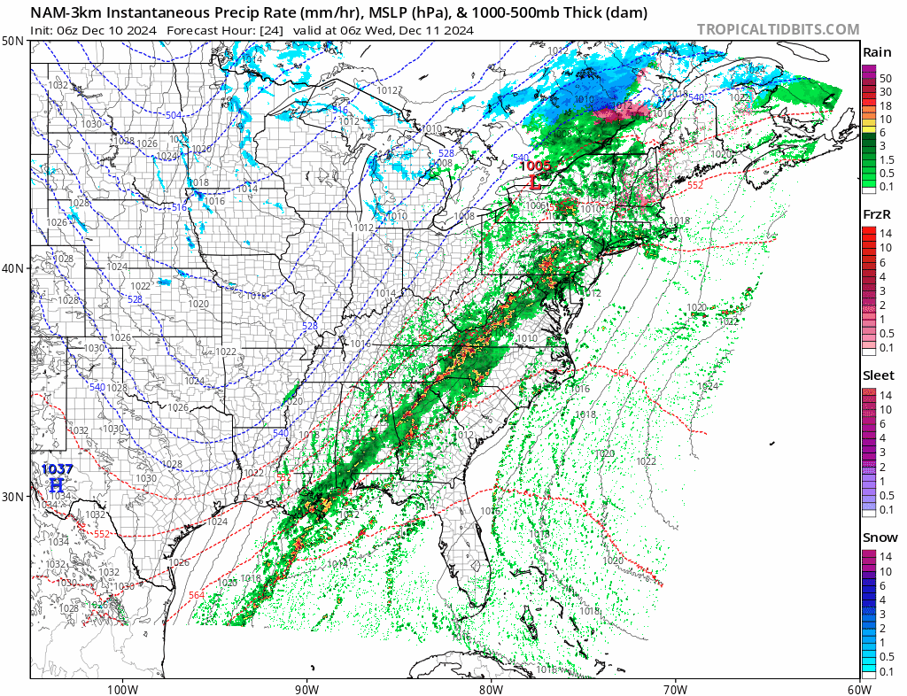
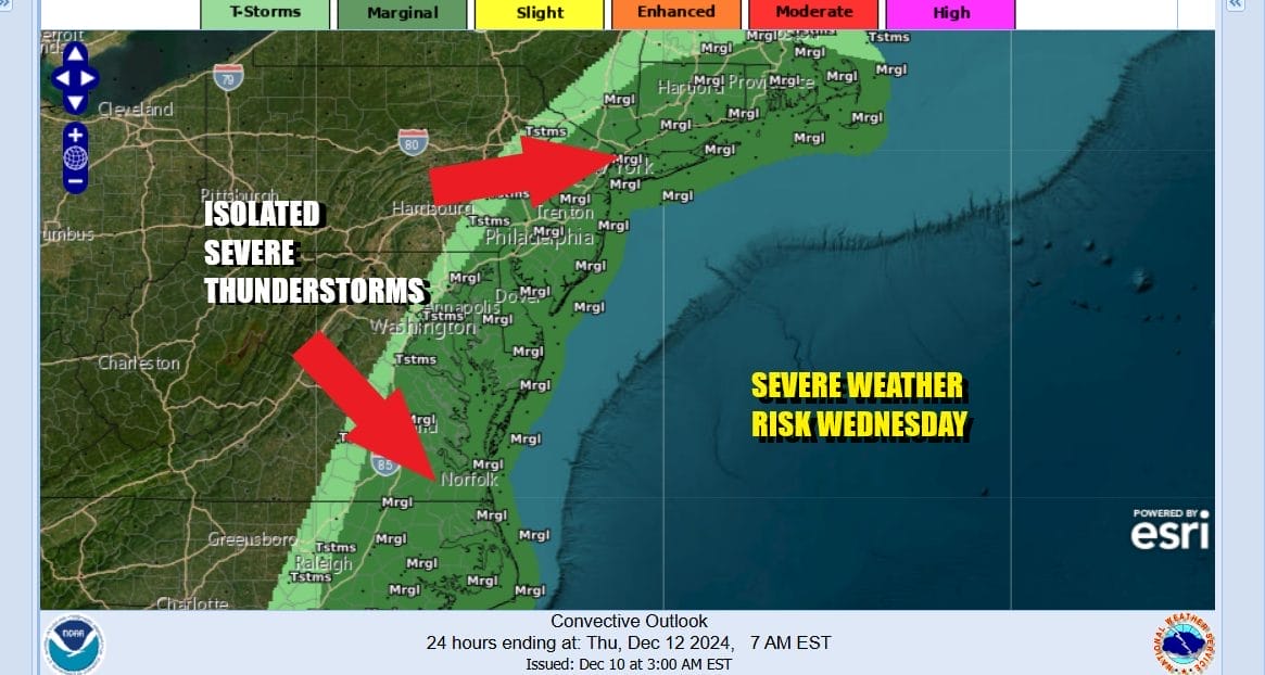
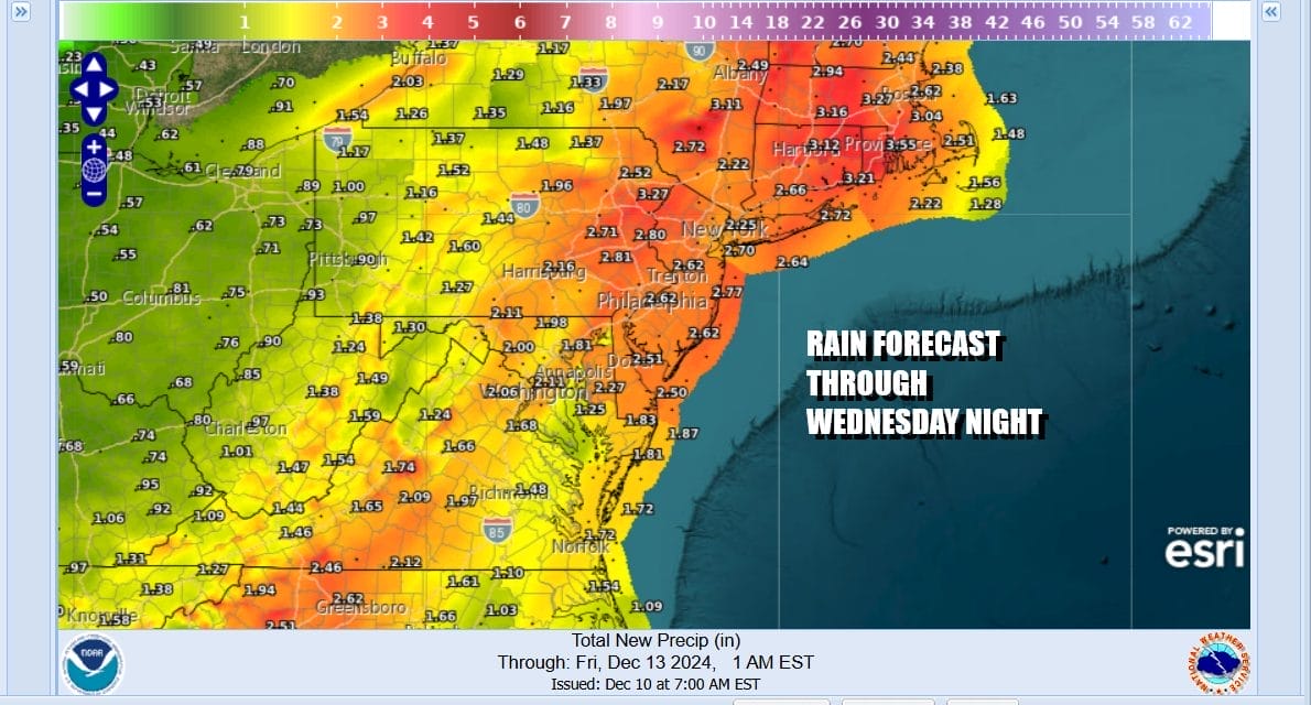
Showery rains Tuesday night into Wednesday morning will become more continuous as we move through the day Wednesday and into Wednesday evening. Thunderstorms will develop and we will likely see a squall line of strong to severe thunderstorms develop ahead of the cold front Wednesday afternoon and evening. The Storm Prediction Center has much of the the Eastern Seaboard at a marginal risk for isolated severe thunderstorms. The risk zone runs from Southeast Massachusetts southwest to Connecticut, the Hudson Valley of NYC, all of New Jersey and south to Eastern Virginia and North Carolina.
The worst of this will occur between noon and 8pm Wednesday when we will see waves of heavy downpours as well as strong gusty winds. We expect winds inland to gust to 30 to 40 mph at times while along the coast we will see winds gusting to over 50 mph. High Wind Watches are up from Eastern Long Island to Southeastern New England. As for total rainfall from this system, we will likely see 2 to 2.5 inches of rainfall and it would not be surprising to see some 3 inch rain amounts especially from NYC east and northeast into New England.
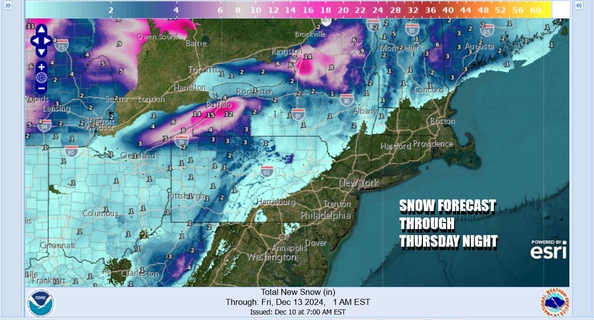
Temperatures will be very warm and some record highs will be sit Wednesday. Highs will reach the upper 50s and lower 60s across the area. Wednesday night into Thursday much colder air comes in behind the front and that triggers yet another round of lake effect snows from Northeast Ohio to Northwest Pennsylvania, Western NY and North Central NY. Strong west winds coming off Lake Erie and Lake Ontario will drive waves of snow inland and up to 2 feet is likely in some places.
Weather conditions in Eastern Pennsylvania will improve Thursday and Friday as some sunshine returns but it will remain windy through Thursday with gusts of 30 to 40 mph at times from the northwest. Temperatures both Thursday and Friday will likely not get out of the 30s. Some moderation in temperature will occur over the weekend and at the moment it seems that we should be free of rain or snow issues through Sunday.
BE SURE TO DOWNLOAD THE FREE METEOROLOGIST JOE CIOFFI WEATHER APP &
ANGRY BEN’S FREE WEATHER APP “THE ANGRY WEATHERMAN!
MANY THANKS TO TROPICAL TIDBITS FOR THE USE OF MAPS
Please note that with regards to any severe weather, tropical storms, or hurricanes, should a storm be threatening, please consult your local National Weather Service office or your local government officials about what action you should be taking to protect life and property.