High Wind Warnings Wind Advisories Across Much of the Northeast,
Heavy Rain & Severe Weather Late Today

High Wind Warnings Wind Advisories Across Much of the Northeast,
Heavy Rain & Severe Weather Late Today
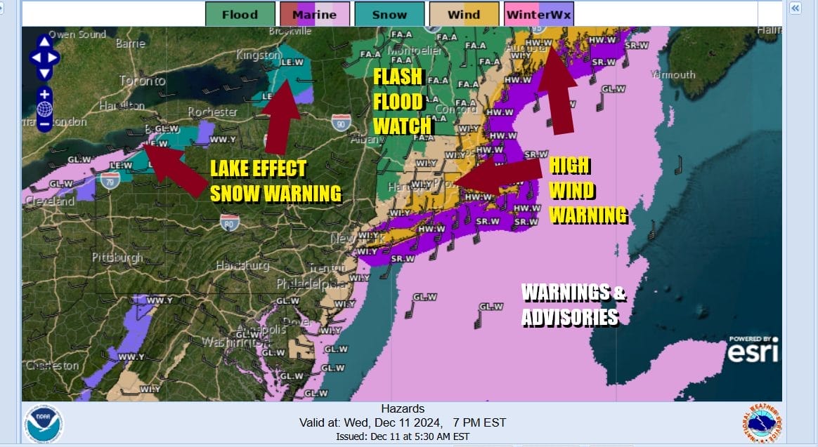
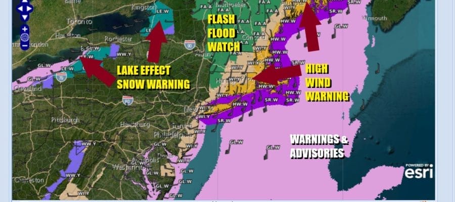
It is a stormy day from the Carolinas to Maine today. A cold front is approaching and it is a strong one. Very cold air lies behind it. Very warm air is ahead of it. Tropical moisture is surging up the East Coast. The result will be strong winds and heavy rains. High Wind Warnings are in effect from Long Island and Southern New England east and Storm Warnings are up for the coastal waters. Winds will gust over 50 mph this afternoon. Wind Advisories are up for the New Jersey coastal counties from south to north for gusts over 40 mph and that includes New York City, the Lower Hudson Valley and Southwest Connecticut.
SATELLITE WITH LIGHTNING STRIKES

WEATHER RADAR

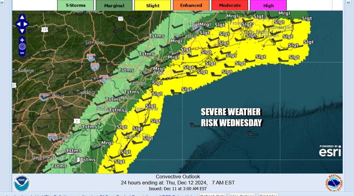
Waves of rain will continue all day long and this afternoon (12noon until 6PM will be the worst of it with heavy downpours, the risk for thunderstorms and severe weather. The Storm Prediction Center has raised the risk for severe thunderstorms to a “slight” risk (15%) as a squall line of thunderstorms is likely to develop ahead of this strong cold front. Isolated gusts to 60 mph are possible in some of these storms.
An additional 1,75 to 2,25 inches of rain are forecast today and that is on top of the rain that has fallen overnight. This will bring storm totals to as much as 3 inches and localized urban flooding is likely especially in areas of poor drainage. Thunderstorms could produce some localized higher amounts before this is all said and done this evening.

The HRRR model along with other models all show a squall line of thunderstorms developing around noontime in Eastern Pennsylvania and then reaching the coast around 4 or 5pm This will be the worst of it. Rain will end from west to east this evening as the front passes and then colder air will follow. Winds will shift from strong southerly to strong northwesterly. Temperatures today will be very warm with highs in the 60s in most locations and that could produce some record highs for the date.

Colder air comes in tonight and Thursday will be a windy cold day with ineffective sunshine and some clouds. Thursday morning lows will be in the 30s and temperatures will go absolutely nowhere Thursday and hold in the 30s. We will be down in the teens and low 20s Friday morning. Friday will be a sunny day with less wind but highs won’t be out of the 30s. The weekend will see temperatures moderate as the cold air moves out. The weekend will be dry with sunshine Saturday and at least some sun for Sunday. Highs Saturday will be in the upper 30s and lower 40s. Sunday highs will be in the 40s.
BE SURE TO DOWNLOAD THE FREE METEOROLOGIST JOE CIOFFI WEATHER APP &
ANGRY BEN’S FREE WEATHER APP “THE ANGRY WEATHERMAN!
MANY THANKS TO TROPICAL TIDBITS FOR THE USE OF MAPS
Please note that with regards to any severe weather, tropical storms, or hurricanes, should a storm be threatening, please consult your local National Weather Service office or your local government officials about what action you should be taking to protect life and property.


