Cold Thursday & Friday But Temperatures Moderate Over the Weekend

Cold Thursday & Friday But Temperatures Moderate Over the Weekend
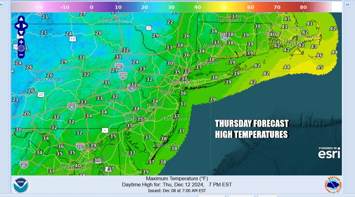
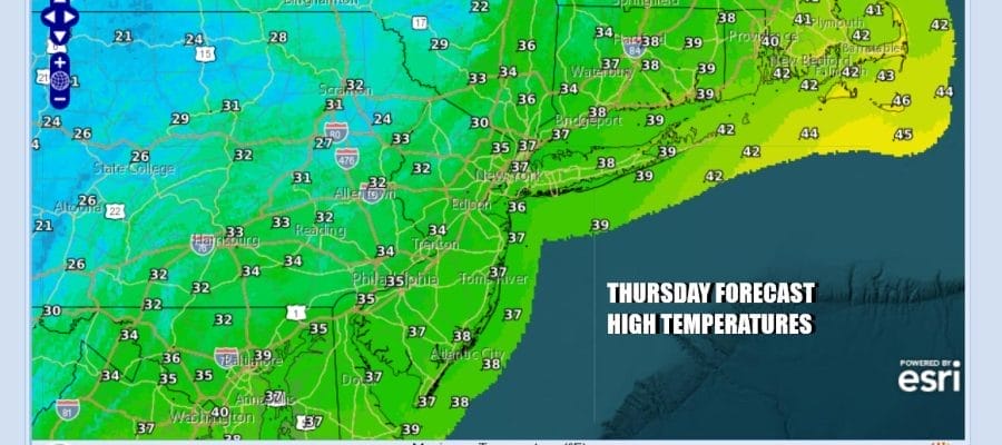
Yesterday’s storm system produced significant rains across Eastern Pennsylvania to Southern New England. 1.75 to 2.25 inches of rain was meaasured in most locations and this shrinks the rainfall deficit further. This should alleviate the drought conditions even further. Now it is on to cold air today on gusty northwest winds to 30 mph and ineffective sunshine. Most temperatures today will struggle in the low to mid 30s all day long. Lake effect snow continues today in Northwest Pennsylvania as well as Western and Northern Central NY. Sometimes a patchy area or two of snow showers makes the trip over the mountains so we will throw in the chance there could be a passing scattered snow shower inland.
SATELLITE WITH LIGHTNING STRIKES

WEATHER RADAR

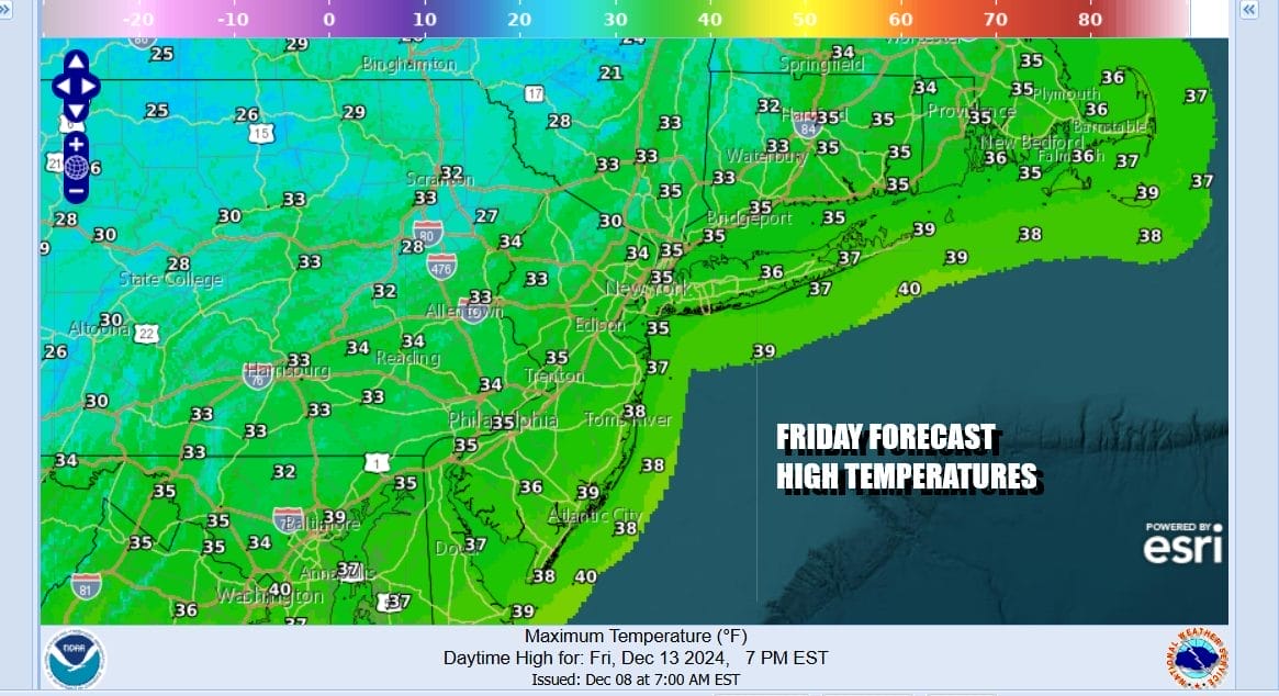
High pressure will be building into the Northeast tonight and winds will ease as skies go mostly clear. It will be a cold night indeed and Friday morning lows will be in the upper teens and lower 20s. Friday looks to be a sunny day with less wind but it will still be cold with highs again not getting out of the 30s.
We do not see any big issues for the weekend. High pressure wedges down the East Coast from New England and Atlantic Canada. There is a weak weather system that will be coming out of the Plains and heading east into the Ohio Valley Sunday. There will be an area of rain showers with this but we see this system moving along and not strengthening much. Rain stays out of the picture through the daytime Sunday.

Moisture from the first system brings some light rain late Sunday night or early Monday morning. It could be in the form of some light snow inland though it doesn’t amount to anything. Then a second stronger front brings showers later Monday into early Tuesday. There could be another system coming later next week.
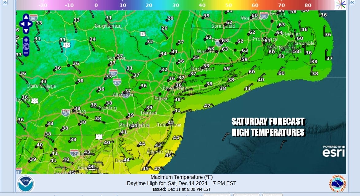
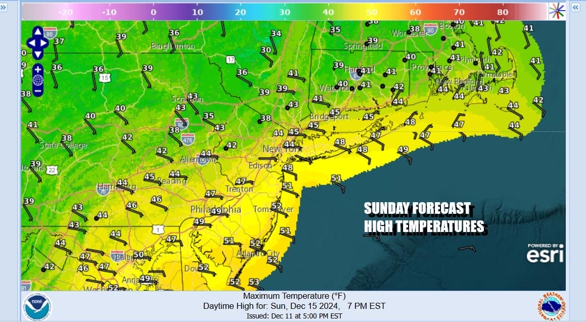
As far as the weekend goes, Saturday is probably the better day when it comes to sunshine, while Sunday looks to be the better day when it comes to temperatures. Saturday highs will still be struggling though it should reach the upper 30s and lower 40s. Sunday we will see sunshine giving way to arriving clouds and most highs Sunday will be in the 40s.
Weather systems continue to move along in west to east fashion next week so that means some cold shots are possible in between weather fronts. We also will continue to make progress in reducing the rainfall deficit we built up from September to mid November. That dry pattern is long gone. Now the question becomes when will the pattern turn to support chances for snow down the road?
BE SURE TO DOWNLOAD THE FREE METEOROLOGIST JOE CIOFFI WEATHER APP &
ANGRY BEN’S FREE WEATHER APP “THE ANGRY WEATHERMAN!
MANY THANKS TO TROPICAL TIDBITS FOR THE USE OF MAPS
Please note that with regards to any severe weather, tropical storms, or hurricanes, should a storm be threatening, please consult your local National Weather Service office or your local government officials about what action you should be taking to protect life and property.


