Cold Friday & Saturday But Moderating Sunday. More Rain on the Way Next Week

Cold Friday & Saturday But Moderating Sunday. More Rain on the Way Next Week
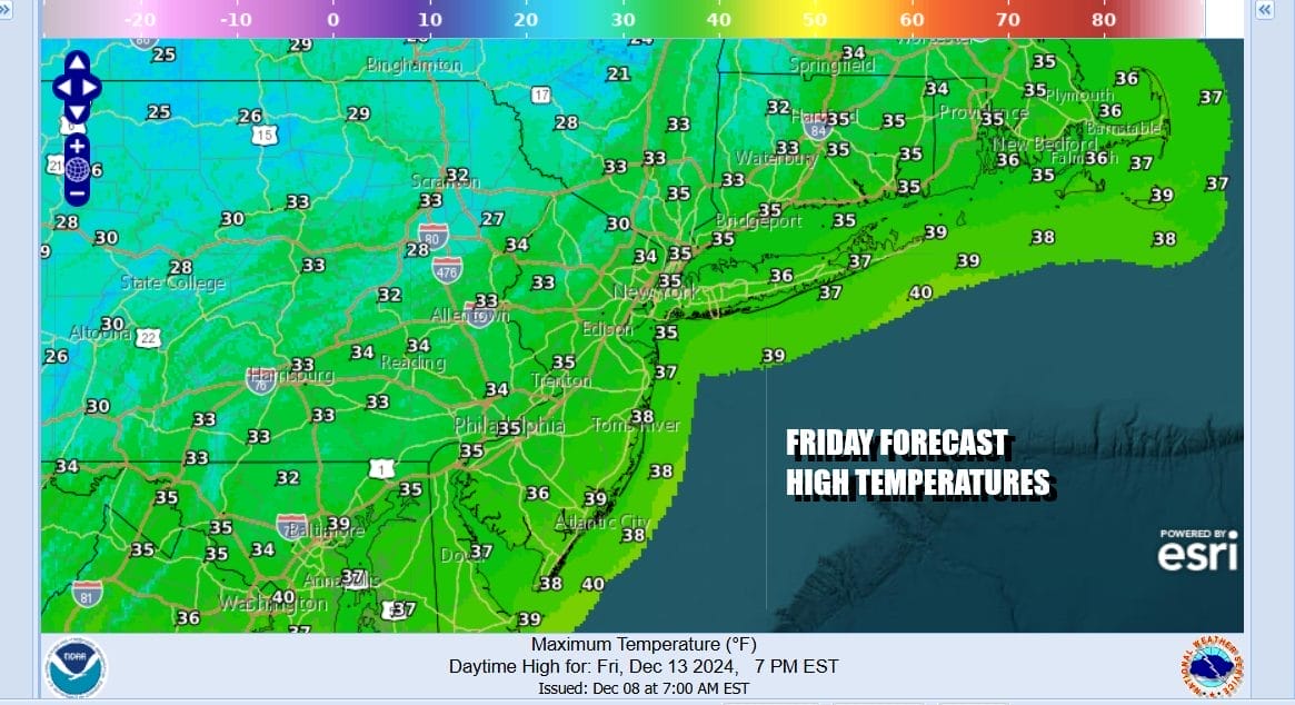
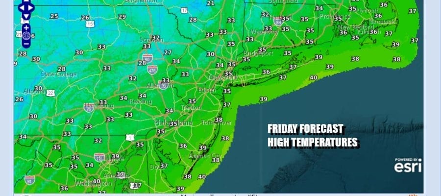
It is a cold day across the Northeast and Mid Atlantic states. Strong high pressure is building in upstate NY keeping us in a mostly northerly flow of cold air. We should see plenty Of sunshine today with winds lower than yesterday as the high settles in overhead. Other than a few patchy clouds it will be a nice weather day. Temperatures this afternoon will not get out of the 30s. We are still seeing Lake Effect Snow Warnings in Western and North Central NY but that should start to diminish as the day wears on. Local radars are on the quiet side.
SATELLITE WITH LIGHTNING STRIKES

WEATHER RADAR

High pressure will be slowly moving east and offshore over the weekend but it is moving slower than initially modeled. This will keep it a little colder for a little longer but temperatures should start to moderate Sunday and more so Monday. The weekend will be dry across Eastern Pennsylvania to Southern New England but we do have two weather systems approaching for the start of the new work week.
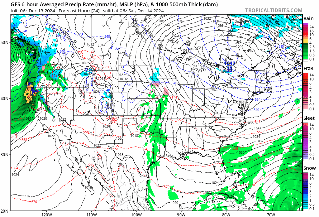
The first wave of moisture will move in late Sunday night and then move out Monday morning with some light rain. This is a warm front that will be going by. The second system that follows will bring a steadier round of rain or showers later Monday into Monday night or early Tuesday morning. Neither system will produce a big rain, generally a quarter or a third of an inch combined.
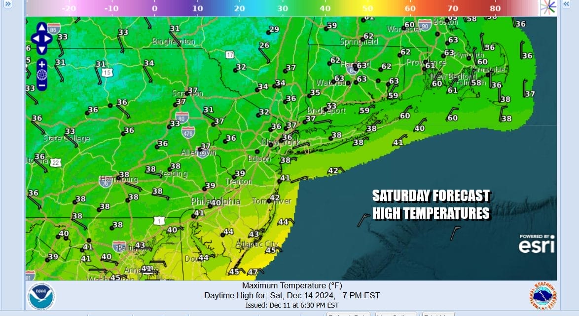
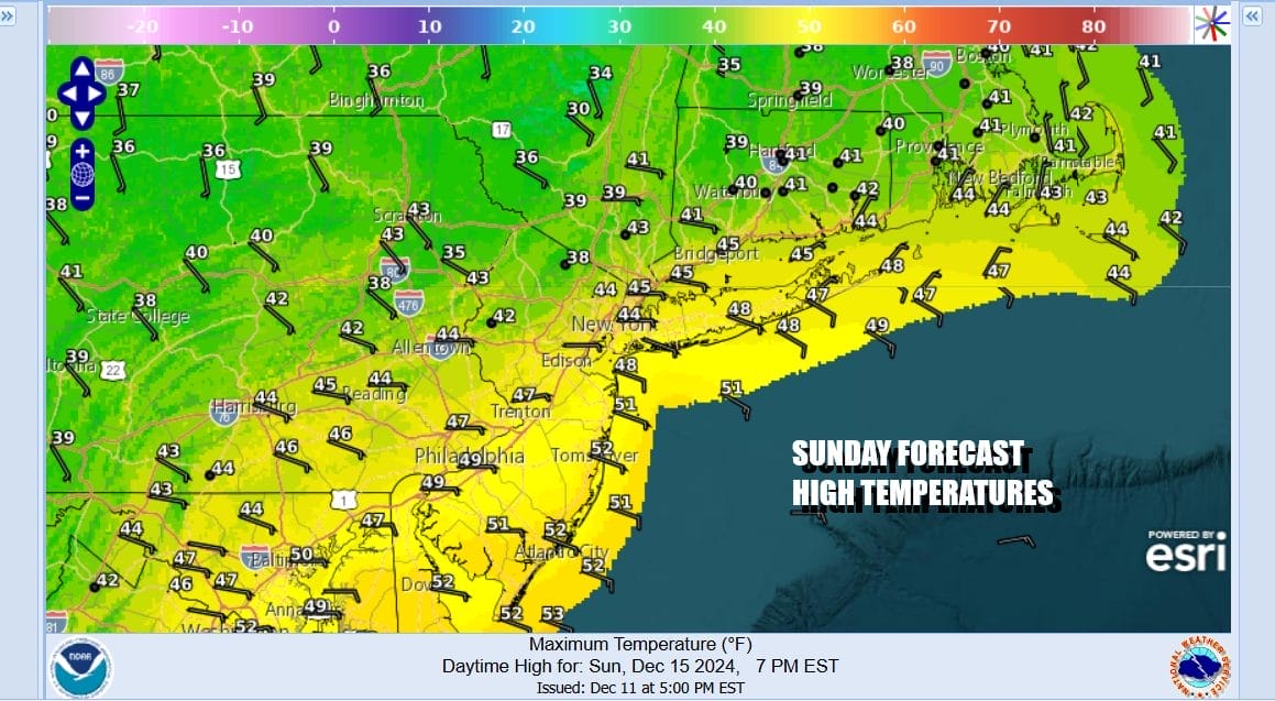
Saturday will be the better of the two weekend days in terms of sunshine. Highs will be mostly in the mid 30s to around 40 degrees or so. Sunday will be the sightly warmer day though we will have an east wind and clouds will be on the increase. Highs will reach the upper 30s to lower 40s from north to south.
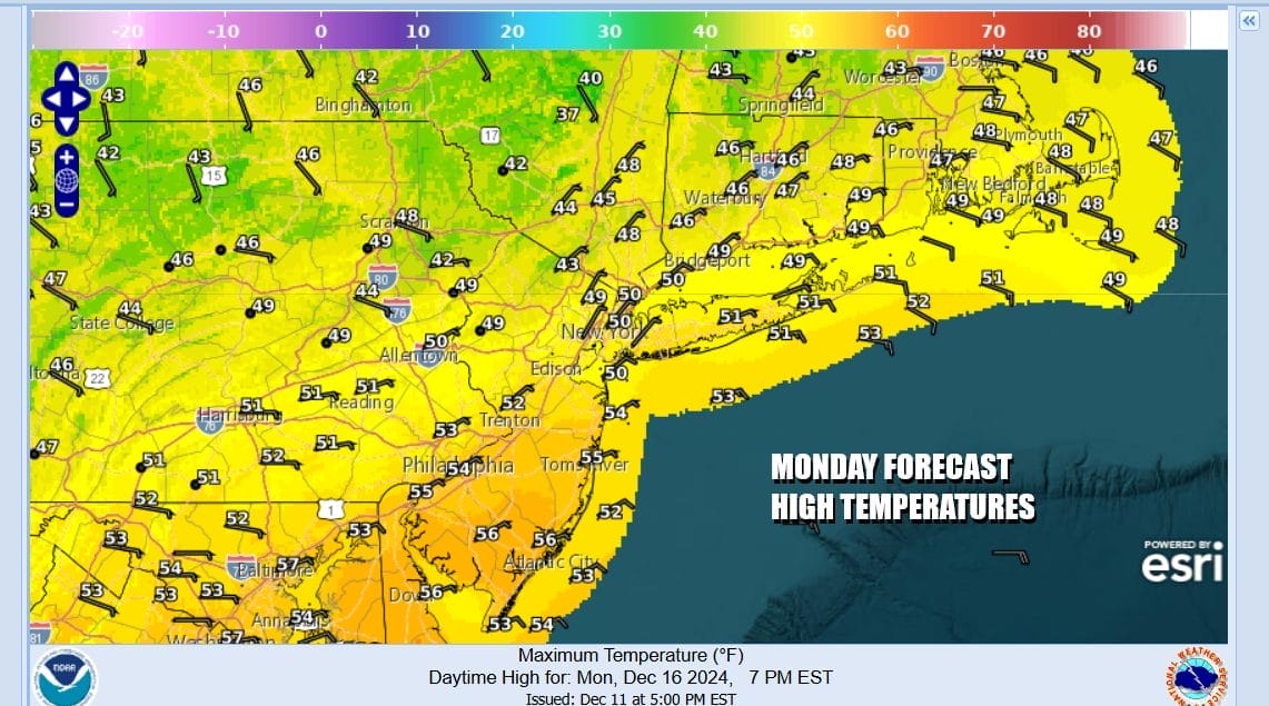
Sunday night into Monday morning we will get into some light rain that comes in and goes out quick. The warm front should go by Monday and temperatures will likely push up into the upper 40s and lower 50s once the front goes by but it may take some time to play through. Then a second round of rain comes in the day Monday or more than likely Monday night.
Tuesday morning the front passes and showers move offshore. Weather conditions will improve and the air behind the front is not cold at all so it will be warmer behind the cold front than ahead of it. Some sunshine develops and temperatures Tuesday will reach the upper 50s and lower 60s. Wednesday will be a little cooler with highs in the 40s as a stronger storm system sets us up for rain Wednesday night into early Thursday. That cold front will have colder air behind it for the end of next week.
BE SURE TO DOWNLOAD THE FREE METEOROLOGIST JOE CIOFFI WEATHER APP &
ANGRY BEN’S FREE WEATHER APP “THE ANGRY WEATHERMAN!
MANY THANKS TO TROPICAL TIDBITS FOR THE USE OF MAPS
Please note that with regards to any severe weather, tropical storms, or hurricanes, should a storm be threatening, please consult your local National Weather Service office or your local government officials about what action you should be taking to protect life and property.


