Warm Weather & Sunshine Today & Wednesday, Showers Thunderstorms Thursday,
Memorial Day Weekend Outlook

Warm Weather & Sunshine Today & Wednesday, Showers Thunderstorms Thursday,
Memorial Day Weekend Outlook

We are in a sweet spot today and Wednesday as a ridge is parked along th East Coast and a powerful storm in the Plains heads north northeast to the Northwestern Great Lakes. In the Midwest US today we see a widespread severe weather outbreak but in the Eastern US, it is a different story. Very warm mid to late spring weather is over us for today and Wednesday and it extends the dry weather streak to 3 days. Look for plenty of sunshine today. There will be a light south to southeast wind and that will hold temperatures down somewhat at the coast. Inland highs today should reach the 70s along the coast and low to middle 80s inland. Radars are nice and quiet with no rain or thunderstorms to worry about.
SATELLITE WITH LIGHTNING STRIKES

WEATHER RADAR

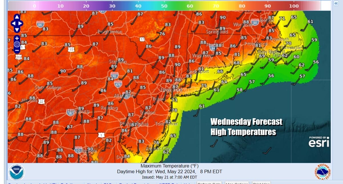
Most lows tonight will be in the upper 50s and lower 60s. Wednesday we will see winds turn more southwest and that will allow temperatures to warm up even more. We should have plenty of sunshine from start to finish and no rain or thunderstorms to worry about. This time of year warm ups can exceed model forecasts and we see highs reaching the mid to upper 80s in many locations. Some warm spots around urban settings could see high temperatures touching the 90 degree mark. It will be in the 70s at the coast.
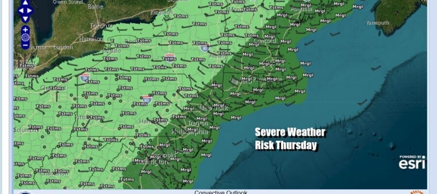
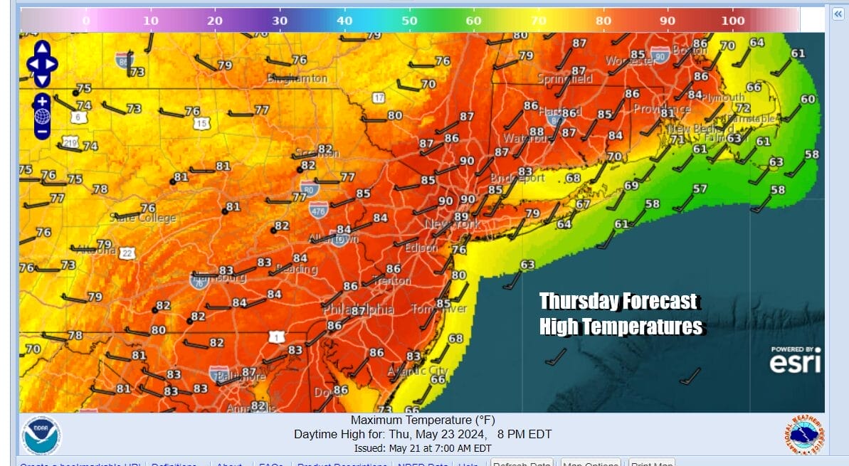
Thursday brings us one more very warm day and while the day starts off dry, we do see a cold front approaching from the west. This is part of the same system that is bringing a widespread severe weather outbreak today in the Midwest but this front will be less powerful as it reaches the east. We will have some severe weather risk and the Storm Prediction Center has a marginal risk for severe weather.

Marginal risk for severe weather means look for the possibility of thunderstorms with some isolated severe thunderstorms in the mix. Thursday will be a very warm to hot day ahead of any showers and thunderstorms as highs are forecast once again to reach the mid 80s to around 90 degrees.
Friday should see some improvement with leftover clouds and some sunshine. Highs will be in the upper 70s and lower 80s. The Memorial Day holiday weekend remains in flux as there will be weak weather systems moving through and some shower chances though the timing of such showers is in question. It seems much of the time it won’t be raining but we still need to work out the timing of these systems going through. It will be cooler over the weekend with highs in the mid to upper 70s Saturday and lower 70s Sunday and Monday with 60s near the coast. We will speak more on the weekend later today and over the next couple of days.
BE SURE TO DOWNLOAD THE FREE METEOROLOGIST JOE CIOFFI WEATHER APP &
ANGRY BEN’S FREE WEATHER APP “THE ANGRY WEATHERMAN!
MANY THANKS TO TROPICAL TIDBITS FOR THE USE OF MAPS
Please note that with regards to any severe weather, tropical storms, or hurricanes, should a storm be threatening, please consult your local National Weather Service office or your local government officials about what action you should be taking to protect life and property.


