Warm Weather Continues Cooler Coast Friday Weekend Outlook

Weather in 5/Joe & Joe Weather Show Latest Podcast
Warm Weather Continues Cooler Coast Friday Weekend Outlook
A nearly stationary upper ridge in the Eastern US doesn’t allow for much to change in the forecast for the next several days. There are some subtle changes today with regard to the wind direction. High pressure is reforming in the Gulf of Maine and we will have more of an east wind today verses a northwest wind of yesterday.
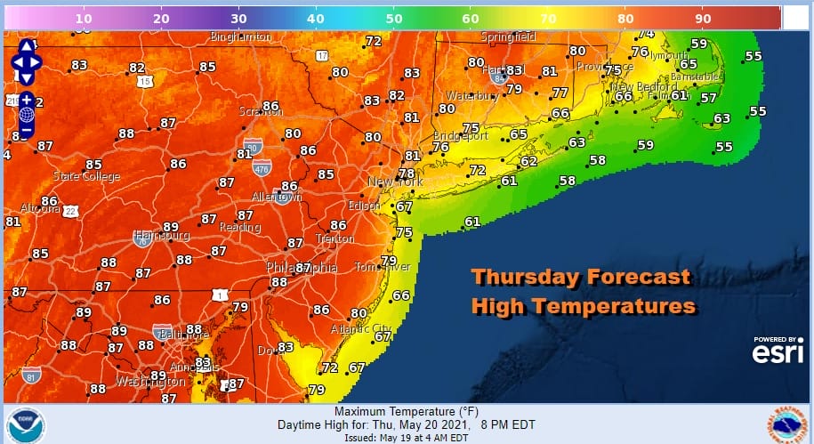
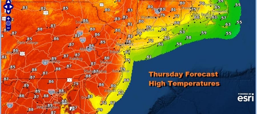
Wednesday’s highs in the region were in a range of 85 to 90. Inland areas today will be a couple of degrees lower but with sunshine highs will still be in the 80s. Along the immediate coast however the east wind will have an impact and temperatures along the New Jersey shore, Long island and South Coastal New England will be in the 70s except for 60s in Southeast New England. No rain is forecast today in the area and the radars are quiet.
SATELLITE

Friday will essentially be a repeat of Thursday with the same idea. High pressure to the northeast keeps the winds along the immediate coast from the east. Highs again for New Jersey Shore, Long Island and South Coastal New England will be in the 70s Inland areas once again will be in the 80s.
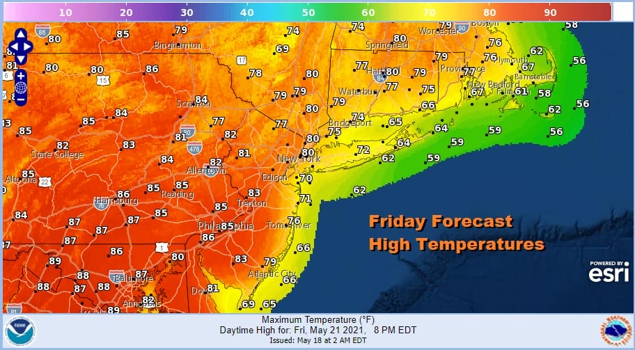
Friday evening some showers or a thunderstorm will move across Northern New England but those showers will stay to our north. A shower or thunderstorm might sneak in early Saturday morning. Otherwise Saturday should be partly sunny with highs again 70s coast and 80s inland. There could be a shower or thunderstorm Saturday night as a weak trough passes.
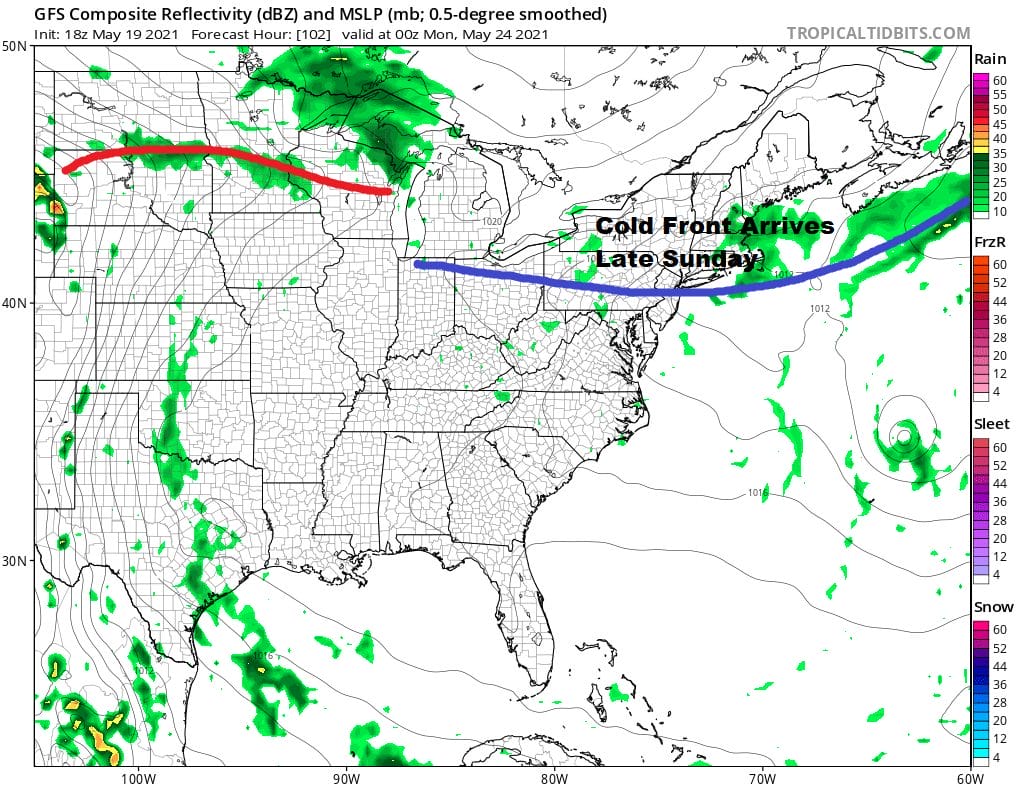
Sunday the upper ridge will be moving to the Middle Mississippi Valley and that will allow a cold front dropping southward from Eastern Canada to move through in the evening. Sunday will be partly sunny and warm with highs in the 80s and the chance for a scattered late day shower or thunderstorm. It is a rather straight forward look at the weather through the weekend.
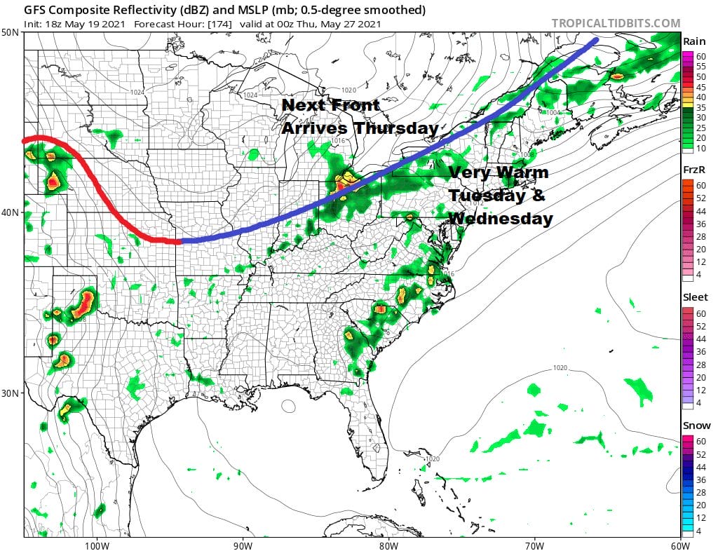
Next week starts out a little cooler with some sunshine Monday and highs in the 70s. Winds go west and southwest for Tuesday and Wednesday and that means it warms up again. We are looking for highs in the mid 70s to near 80 Tuesday and mid to upper 80s Wednesday ahead of the next cold front.

BE SURE TO DOWNLOAD THE FREE METEOROLOGIST JOE CIOFFI WEATHER APP &
ANGRY BEN’S FREE WEATHER APP “THE ANGRY WEATHERMAN!
MANY THANKS TO TROPICAL TIDBITS FOR THE USE OF MAPS
Please note that with regards to any severe weather, tropical storms, or hurricanes, should a storm be threatening, please consult your local National Weather Service office or your local government officials about what action you should be taking to protect life and property.


