
Warm Up Begins Thursday & Lasts Through the Weekend No Rain in Sight

Warm Up Begins Thursday & Lasts Through the Weekend No Rain in Sight
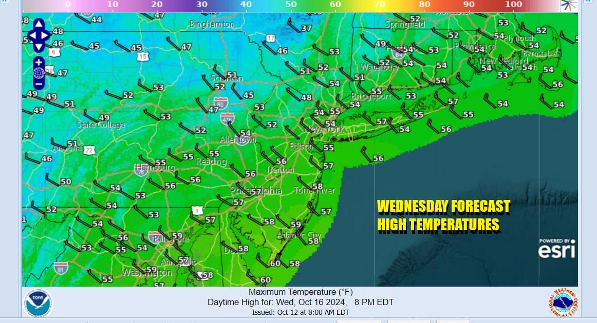
We had just enough of a west wind overnight to prevent widespread frosts and freezes inland. Today we have a weak upper trough moving southeast from New England and Eastern Canada. This is the final act of the cold air mass that covers the Eastern US. Look for sunshine and some passing clouds today. Highs will probably not get much higher than the middle to upper 50s.
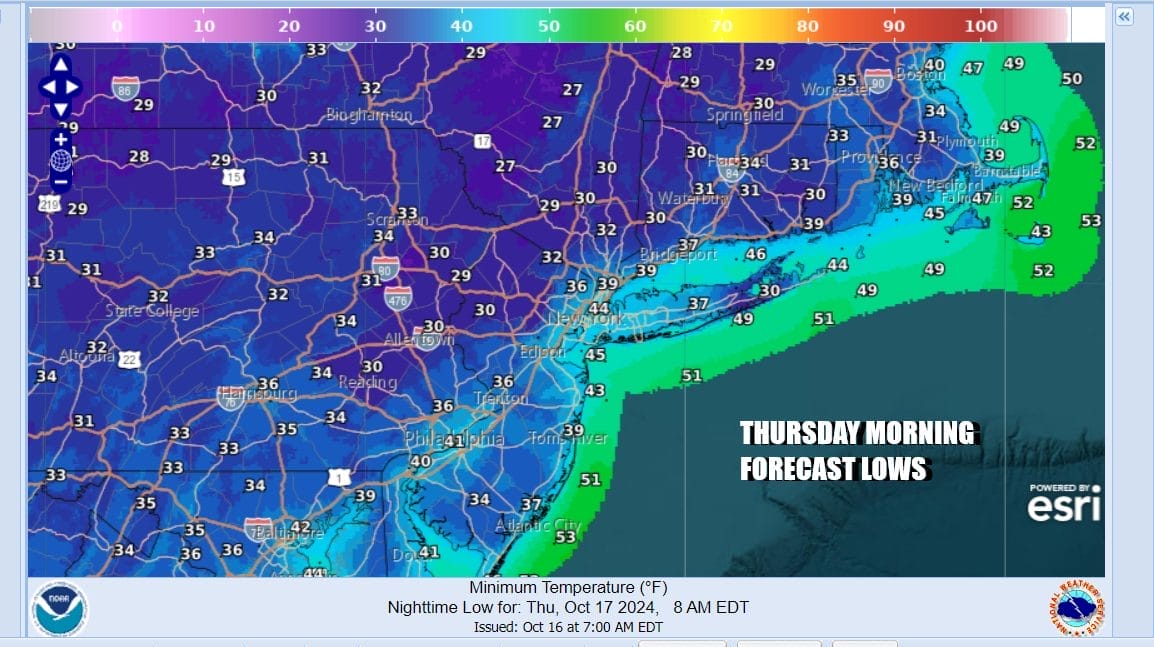
Tonight will be the coldest night of this stretch of below average temperatures. High pressure should be right overhead and that sets up for a night of clear skies, light winds, and radiational cooling conditions. Urban areas will bottom in the lower 40s but many areas including the coast will see lows in the 30s. Inland areas will be down in the low 30s and even some upper 20s are possible in some areas.
SATELLITE WITH LIGHTNING STRIKES

WEATHER RADAR

Thursday begins the bounce higher in temperatures. High pressure is going to hang around the East Coast right through the weekend. The core of the cold air will be offshore and we will have a mostly sunny Thursday. High temperatures will bounce to the upper 50s to around or just over 60 in some places.

The move higher in temperatures will continue Friday under mostly sunny skies. Highs will be in the low to middle 60s. The weekend will be an “Indian Summer” type weekend with sunny skies forecast for both Saturday and Sunday. Temperatures Saturday will reach into the lower 70s and Sunday we could see highs in the low to mid 70s. No rain is forecast for the weekend. In fact we may not see any rain until perhaps late next week. High pressure holds in the Eastern US for the most part and no cold front can reach the coast until perhaps next Friday.
BE SURE TO DOWNLOAD THE FREE METEOROLOGIST JOE CIOFFI WEATHER APP &
ANGRY BEN’S FREE WEATHER APP “THE ANGRY WEATHERMAN!
MANY THANKS TO TROPICAL TIDBITS FOR THE USE OF MAPS
Please note that with regards to any severe weather, tropical storms, or hurricanes, should a storm be threatening, please consult your local National Weather Service office or your local government officials about what action you should be taking to protect life and property.


