Sunshine Today Through the Weekend As Temperatures Rise
Dry Weather Streak Continues With No Rain

Sunshine Today Through the Weekend As Temperatures Rise
Dry Weather Streak Continues With No Rain

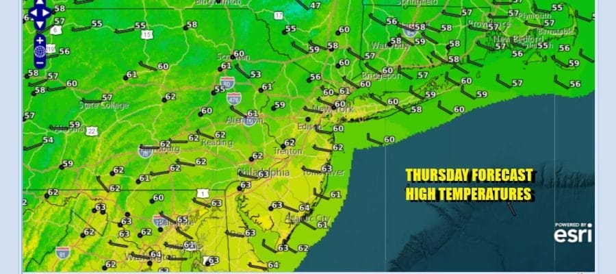
It is like a bit of a broken record here but we see nothing but sunshine over the next 5 days at least. The core of the current cold air mass is now beginning to move away to the east. It is following a coastal storm that is developing east of North Carolina and moving out to the east northeast so it is not a factor in our weather or for anyone along the East Coast except for coastal North Carolina. This leaves the East in sunshine. Temperatures hit their coldest lows of the season this morning and we should bounce back to the mid 50s to around 60 degrees this afternoon.
SATELLITE WITH LIGHTNING STRIKES

WEATHER RADAR

For many areas in Eastern Pennsylvania to Southern New England, there hasn’t been a drop of rain for the entire month. Coupled with the very dry September and we are seeing developing drought conditions across much of the area. In fact this dry pattern has impacted a large portion of the US. 75 percent of the US at least abnormally dry with just under 5 percent in extreme drought or exceptional drought.

None of this changes any time soon with high pressure both at the surface and aloft covering much of the East. The only rain or snow is in the Northwest US as a deep trough moves into that region. None of this breaks down until late next week when a weak weather front approaches and even that doesn’t have much with it. While we wait for all this to change we will see clear skies tonight with most lows in the 30s to near 40 except for 40s in urban areas.
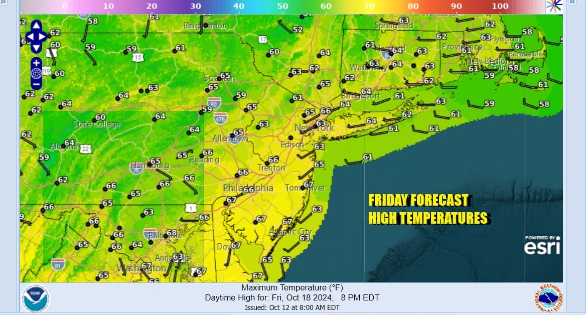
Friday will be a mostly sunny day with highs reaching the low and middle 60s. The weekend will feature sunny days and mainly clear nights though as the high stagnates we will probably see low clouds and fog develop in some areas at night and into the early morning hours. Once the sun gets high enough in the sky it should burn off to sunshine.

Since many areas had their first frosts and freezes, the weekend will be what was once referred to as “Indian Summer” which basically describes a bounce in temperatures after a cold air mass tied to the first frosts. Sunshine Saturday will take temperatures back into the 70s. Sunday look for sunshine to take highs into the low and middle 70s.

We see more of the same for next week with sunshine or at least some sunshine Monday through Wednesday with above average temperatures. If we do not get any rain from a week front Thursday, then it is possible that we may have to wait until the very end of the month to see any significant precipitation.
BE SURE TO DOWNLOAD THE FREE METEOROLOGIST JOE CIOFFI WEATHER APP &
ANGRY BEN’S FREE WEATHER APP “THE ANGRY WEATHERMAN!
MANY THANKS TO TROPICAL TIDBITS FOR THE USE OF MAPS
Please note that with regards to any severe weather, tropical storms, or hurricanes, should a storm be threatening, please consult your local National Weather Service office or your local government officials about what action you should be taking to protect life and property.


