Sunshine Warmer Temperatures And Little or No Rain for the Next 7 Days

Sunshine Warmer Temperatures And Little or No Rain for the Next 7 Days
It isn’t often that weather people get to put their feet up and relax. This is about as dry a weather pattern that we have seen in the Eastern US in many years. We can say that there will be little or no rain to worry about over the next 7 days at least and it is conceivable that we can go the rest of the month with no measurable precipitation. We are on course for one of the driest months if not the driest month on record for many areas in Eastern Pennsylvania, New Jersey, Southeastern NY, Connecticut, and Long Island.
SATELLITE WITH LIGHTNING STRIKES

WEATHER RADAR

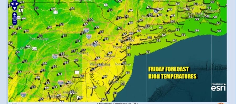
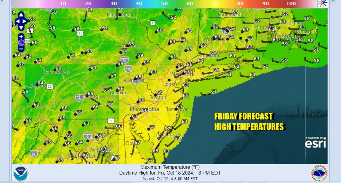
Skies are clear on the satellite loop from the East Coast to the Mississippi River and a little bit beyond that. Radars are nice and quiet and will remain so for days. Today it will be a mostly sunny day. Temperatures are now headed up as the core of the cold air has moved out to the east. Highs today will be in the middle to upper 60s in most places.

Temperatures will be above average going forward through much of next week since we don’t have any cold front moving through until perhaps next Thursday. Even that front is weak and all the rain associated with it dries out as it heads east. Other than that we have no other weather systems that pose a threat for rain.

Sunday is going to be a sunny day and warm with highs mostly in the mid to upper 70s There will probably be local sea breezes that will keep the shore a little cooler. The one thing we will start to see going forward will be at night. Some areas are likely to see low clouds and fog develop during the overnight and early morning hours but that will burn off once the sun gets high enough in the sky.

Little will change Monday and Tuesday and probably Wednesday. Sunshine or at least no worse than partly sunny skies will be on the agenda all three days with most highs each day in the mid to upper 70s. A weather front will bring clouds and perhaps a brief shower (if it happens at all) for Thursday. Temperatures may start to ease a bit toward the end of the week. Enjoy your weekend.
BE SURE TO DOWNLOAD THE FREE METEOROLOGIST JOE CIOFFI WEATHER APP &
ANGRY BEN’S FREE WEATHER APP “THE ANGRY WEATHERMAN!
MANY THANKS TO TROPICAL TIDBITS FOR THE USE OF MAPS
Please note that with regards to any severe weather, tropical storms, or hurricanes, should a storm be threatening, please consult your local National Weather Service office or your local government officials about what action you should be taking to protect life and property.


