
Chilly Days & Nights Through Thursday
No Rain Is Forecast Through the Weekend As Temps Rise

Chilly Days & Nights Through Thursday
No Rain Is Forecast Through the Weekend As Temps Rise
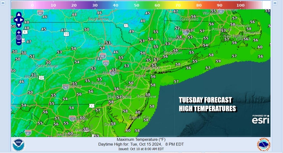
The first cold night has taken lows down to the 30s inland and low to mid 40s coast and urban areas. Large hgh pressure moving southeast from Canada and the Great Lakes will be the primary driver of the weather over the next 5 days. Today will be a breezy and chilly day with ineffective sunshine and some developing clouds. The upper trough over the Eastern US will be slowly moving east keeping the cold air flow intact. Temperatures today will generally top out in the low to mid 50s.
SATELLITE WITH LIGHTNING STRIKES

WEATHER RADAR

Tonight we will see skies clear out and the winds drop off somewhat. That will probably cause some frosts and freezes to occur across some inland areas north and west of the coast as well as in some valley areas. Most inland lows will be in the low to mid 30s while coastal and urban areas will be in the upper 30s to lower 40s.

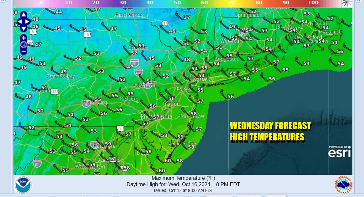
The upper trough will move offshore Wednesday allowing more of the high to the west to build in. That should lead to a mostly sunny day with highs again only reaching the low and mid 50s. Wednesday night into Thursday morning will likely be the coldest night of this stretch with frosts and freezes possible once again.
The strong high will settle over the Eastern US Thursday and Friday but instead of moving out it will build back westward. This not only keeps things dry but it will eventually allow temperatures to warm up some as we head into the weekend. Low pressure developing offshore Wednesday moves out to the east and is no issue here. The overall pattern means no rain at all through the weekend and we may be dry for much of next week as high pressure holds in the east and cold fronts are delayed from following the normal west to east movement.

Thursday morning starts cold with morning lows in the 30s except for warmer urban areas which will be in the lower 40s and sheltered areas inland which might break under 30 degrees in spots. We will have plenty of sunshine and highs will reach the mid to upper 50s Thursday afternoon.

The uptrend in temperatures late week gains some steam Friday as sunshine takes highs into the low and middle 60s. The weekend right now looks to be nice, sunny and even warmer. Saturday highs will be in the upper 60s and lower 70s. Sunday highs with sunshine will be in the low to mid 70s. No major or even minor storms are in sight over the next 7 days and the tropics are mostly on the quiet side with no issue for the East Coast, the Gulf States and Florida.
BE SURE TO DOWNLOAD THE FREE METEOROLOGIST JOE CIOFFI WEATHER APP &
ANGRY BEN’S FREE WEATHER APP “THE ANGRY WEATHERMAN!
MANY THANKS TO TROPICAL TIDBITS FOR THE USE OF MAPS
Please note that with regards to any severe weather, tropical storms, or hurricanes, should a storm be threatening, please consult your local National Weather Service office or your local government officials about what action you should be taking to protect life and property.
(Amazon is an affilate of Meteorologist Joe Cioffi & earns commissions on sales.)


