Coldest Air of the Season So Far Arrives & Lasts Through Thursday
Little to No Rain Forecast All Week

Coldest Air of the Season So Far Arrives & Lasts Through Thursday
Little to No Rain Forecast All Week
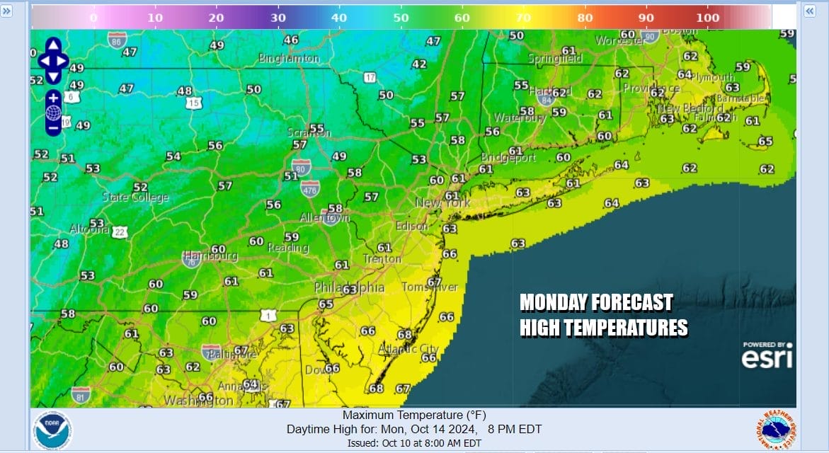
Low pressure developing in New England and a cold front passing offshore will begin the process of spreading cold air across the Eastern & Southern US over the next couple of days. We don’t see much in the way of showers around today but we will see increasing northwest winds as the low strengthens to the north. We also see leftover clouds (and the odd isolated shower) give way to breaks of developing sun in the afternoon. Temperatures this Monday will be in the mid to upper 60s for highs which occurs early in the day but inland areas north of NYC and Philadelphia will feel the colder air coming in faster and temperatures will be in the upper 50s and lower 60s
SATELLITE WITH LIGHTNING STRIKES

WEATHER RADAR

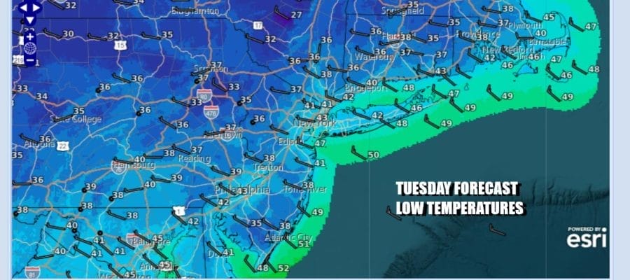
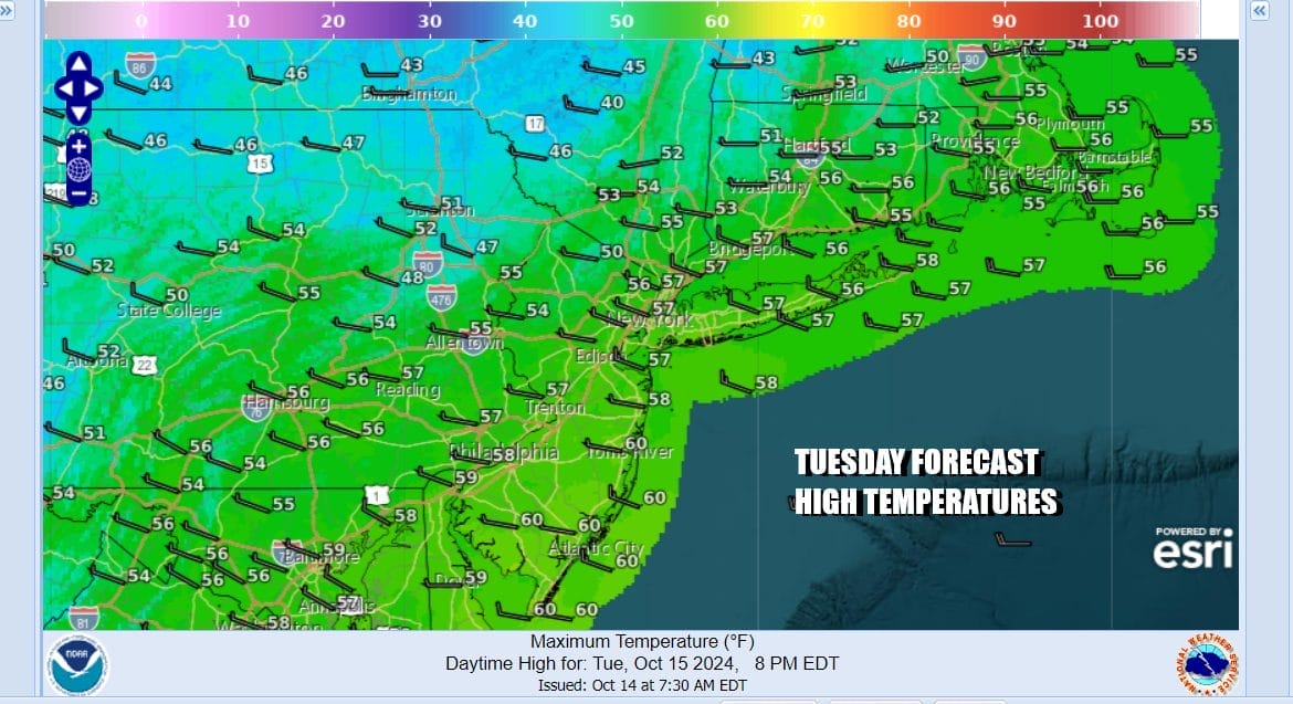
Chilly nights lie ahead. Skies should at least partially clear tonight. It will be breezy and it will be cold with lows in the upper 30s to lower 40s. Tuesday will be a day of some self destruct sunshine and a gusty northwest wind and that will keep temperatures in check. Most highs Tuesday will be in the low and middle 50s. It will really feel like Autumn with the gusty winds and in and out sunshine.
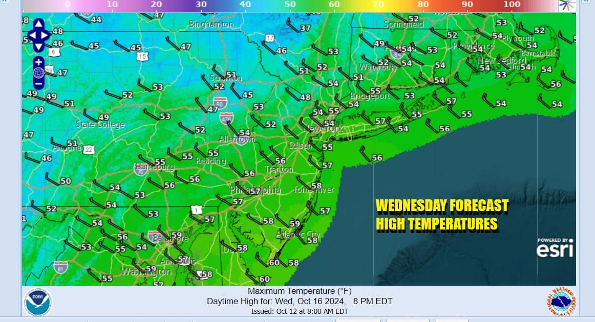
Cold high pressure moves overhead Tuesday night and Wednesday and that means another cold night with Wednesday morning lows in the upper 30s and lower 40s but some areas inland will likely be down in the low and middle 30s so some frosts and freezes are possible depending on the wind. Wednesday will be another sunny chilly day with highs again only in the 50s.
Another chilly night is forecast for Wednesday night into Thursday morning and again there is the chance for some frosts and freezes inland. Thursday we will start to see temperatures begin to moderate some with mainly sunny skies and highs back to the upper 50s to around 60. Friday will be a sunny finish to the week with highs reaching the low and middle 60s. Temperatures will continue to rise some with a sunny dry weekend in the forecast. Saturday and Sunday highs will be in the upper 60s and lower 70s. No rain is forecast for at least the next 7 or 8 days as weather fronts will be blocked from moving east and the tropics for the most part remain quiet..
BE SURE TO DOWNLOAD THE FREE METEOROLOGIST JOE CIOFFI WEATHER APP &
ANGRY BEN’S FREE WEATHER APP “THE ANGRY WEATHERMAN!
MANY THANKS TO TROPICAL TIDBITS FOR THE USE OF MAPS
Please note that with regards to any severe weather, tropical storms, or hurricanes, should a storm be threatening, please consult your local National Weather Service office or your local government officials about what action you should be taking to protect life and property.
(Amazon is an affilate of Meteorologist Joe Cioffi & earns commissions on sales.)


