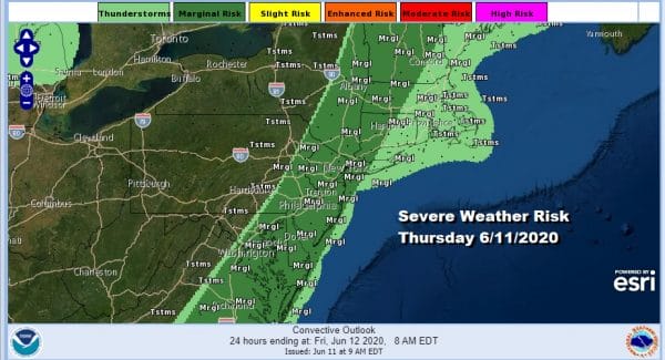
Warm Humid Showers Thunderstorms Marginal Risk Severe Weather
It is a warm very humid day and some areas of seen downpours while others have not. A cold front is nearing the coast and the Storm Prediction Center remains with a marginal risk for severe weather into this afternoon until the front passes far enough offshore. We see a band of clouds from New England to the Middle Atlantic states with some breaks in that cloud cover once you get into Central Pennsylvania.
SATELLITE
REGIONAL RADAR
Much of the shower and thunderstorm activity has been north of NYC into Upstate NY, mostly in the Hudson Valley and edging into Connecticut and Massachusetts. We are also seeing a narrow line firing up from Delaware south and there are some widely scattered downpours in between. Everything is moving to the northeast as the front nears the coast.
LOCAL RADAR NEW YORK CITY
LOCAL RADAR PHILADELPHIA

Gradually all the activity will swing offshore. Weather conditions will start to improve from west to east later this afternoon and tonight. Temperatures will be in the sticky upper 70s and lower 80s. Tonight we should see skies partially clear and the humidity should come down a bit. Most lows will be in the upper 50s to mid 60s.
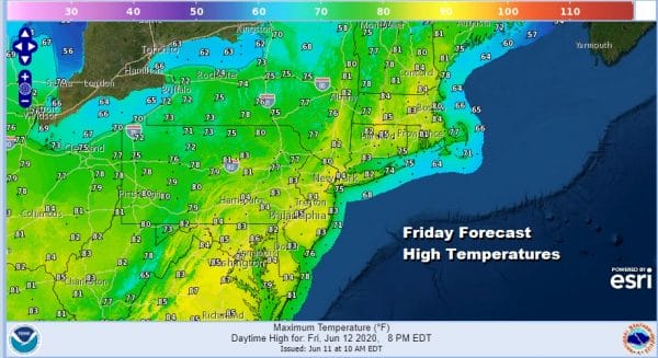
Friday should be a decent day with sunshine and a bit more comfortable. Highs will be in the low to middle 80s. A weak cold front will be moving through Friday night and there won’t be much with that front. However we are still going to see it stall offshore over the weekend.
Our original line of thinking was that Saturday would be the better of the two weekend days with some sunshine and few clouds around. High pressure will be moving to our north creating a bit of an onshore flow. That will be enough to keep temperatures in the 70s to near 80 or so for highs. The stalled front offshore will likely see low pressure spin up from this near north Carolina as a upper low drops southward from the Great Lakes into the Central Appalachians.
The positioning of the upper low is a little further west today which may bode well for a better Sunday. It won’t be perfect and there will be some clouds around. However the upper low and also the strong high to the northeast could suppress any showers to the south. So we will lean in that direction with highs mostly in the 70s. Then we will wait and see if there is enough lift in that upper low as it moves east to bring showers here on Monday though it is quite possible that they may stay south across Maryland Delaware and Virginia and not push further north into Southern New England and Southern NY.
BE SURE TO DOWNLOAD THE FREE METEOROLOGIST JOE CIOFFI WEATHER APP &
ANGRY BEN’S FREE WEATHER APP “THE ANGRY WEATHERMAN!
MANY THANKS TO TROPICAL TIDBITS FOR THE USE OF MAPS
Please note that with regards to any severe weather, tropical storms, or hurricanes, should a storm be threatening, please consult your local National Weather Service office or your local government officials about what action you should be taking to protect life and property.


