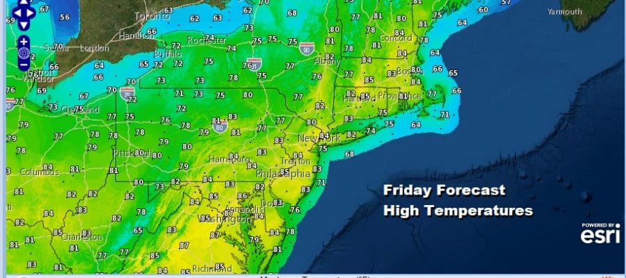
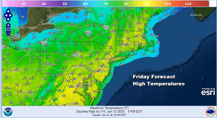
Improving Weather Conditions Tonight Dry Friday & Saturday Fingers Crossed For Sunday
Today’s cold front has been on a very slow crawl eastward. Weather conditions have improved across Northwest New Jersey, the Catskills and Pennsylvania where dew points have come off the steamy highs and some sunshine broke out this afternoon. To the east along the coast from Southern New England south to Southern New Jersey and into Delaware we are patiently waiting for the downpours to clear the coast which they are in the process of doing and then weather conditions can start improving in these zones.
SATELLITE

REGIONAL RADAR

Downpours and thunderstorms produced some flash flooding and heavy rains around NYC and in the areas surrounding it. These showers and thunderstorms are now mostly offshore though some linger in Eastern Connecticut. They should all be gone in another few hours.
LOCAL RADAR NEW YORK CITY

LOCAL RADAR PHILADELPHIA


Skies should clear out tonight and humidity levels will ease somewhat making it more comfortable. Temperatures by morning will settle in the mid 50s to lower 60s except middle 60s in the normally warmer urban settings. A weak cold front approaches Friday but it won’t have much to work on so it should be a nice finish to the week with sunshine. Highs will reach the 80s just about everywhere.
The weekend is shaping up a bit better. The concern was for Sunday but it appears that the next short wave trough dropping into the Ohio Valley and the Central Appalachians will stay far enough west to allow high pressure to spread from the Great Lakes to New England. Saturday looks like a nice day with sunshine and a light breeze from off the ocean.
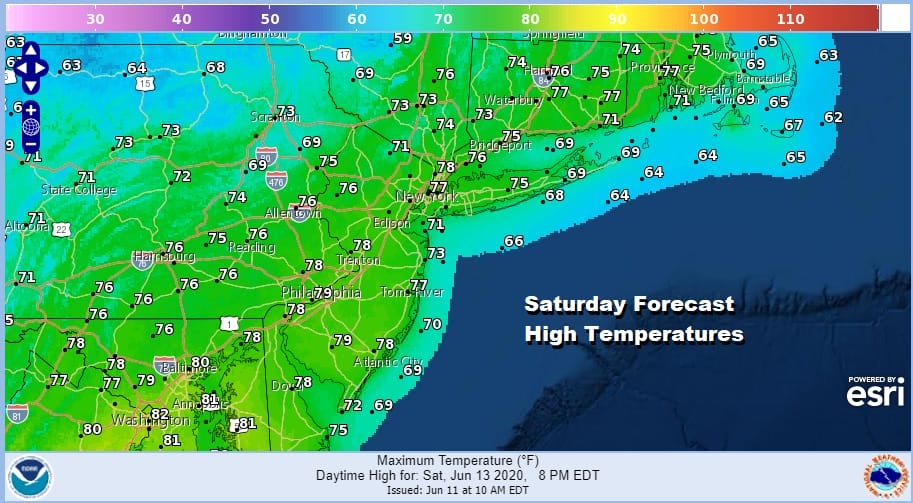
This is going to keep highs in the 70s with perhaps a few inland areas approaching 80 degrees. Sunday will likely see a continuing breeze from off the ocean with that strong high to the north. This should suppress any rain from the upper low to the south. There will probably be a few more clouds and that will keep temperatures lower than Saturday. It seems safe to say that we probably won’t see much of any rain this weekend.
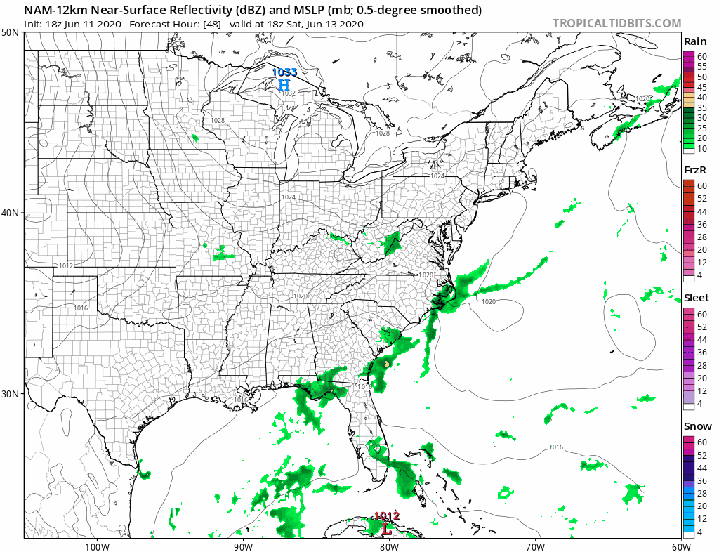
Even if a low spins up on a stalled frontal boundary offshore, it seems that the low will be suppressed southward and have a very difficult time moving northward. Should this be the case rain will be confined to areas in the Middle Atlantic States ( mainly Delaware south) and the areas to the north will likely stay dry. The high to the north will likely still be around into midweek. The onshore flow means probably some clouds in the mix but it also means temperatures will be reasonable for this time of year for at least the first half of next week. Right now next weekend which is Father’s Day weekend looks rather promising.
BE SURE TO DOWNLOAD THE FREE METEOROLOGIST JOE CIOFFI WEATHER APP &
ANGRY BEN’S FREE WEATHER APP “THE ANGRY WEATHERMAN!
MANY THANKS TO TROPICAL TIDBITS FOR THE USE OF MAPS
Please note that with regards to any severe weather, tropical storms, or hurricanes, should a storm be threatening, please consult your local National Weather Service office or your local government officials about what action you should be taking to protect life and property.


