DOWNLOAD MY NEW FREE JOESTRADAMUS WEATHER APP FOR ALL DEVICES
Warm Front Approaching Showers Well West. Weekend Outlook Remains Unclear for Sunday
Not much has changed in the outlook for Tonight through Friday and the weekend. A warm front is coming up from the south tonight. We have clouds around tonight but the warm front is rather weak so other than some spotty light rain or drizzle overnight, there should be no issues. Temperatures overnight will hold mostly in the 50s with some 40s in cool spots. Then we turn our attention to the west where a cold front approaches with some showers and thunderstorms. You already have showers and downpours going on from Northwest Pennsylvania through Upstate NY. That is where all the action is at the moment with rain and some of it coming down heavy at times.
SATELLITE

REGIONAL RADAR

For us I don’t see too much to worry about Friday other than some scattered downpours around, probably near midday and then again Friday evening as a cold front comes by. With this there could be a thunderstorm in the mix as well. For many of you not much will happen Friday and don’t be shocked if the sun pokes through from place to place. Highs away from the ocean will reach into the 70s.
LOCAL RADAR NEW YORK CITY

LOCAL RADAR PHILADELPHIA


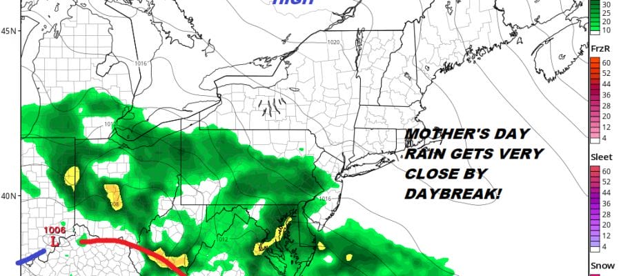
The front goes by and stalls to our south like so many others. Saturday however should be a decent day with mostly sunny skies for most of the day with highs in the upper 60s to some lower 70s. Then trouble brews Sunday as low pressure develops on the front and a wave swings east. There is still a question of when and where regarding rain. I think the best chances would be later in the day or Sunday evening. Even if rain holds off Sunday will likely be a cloudy day with highs just in the 50s to near 60.
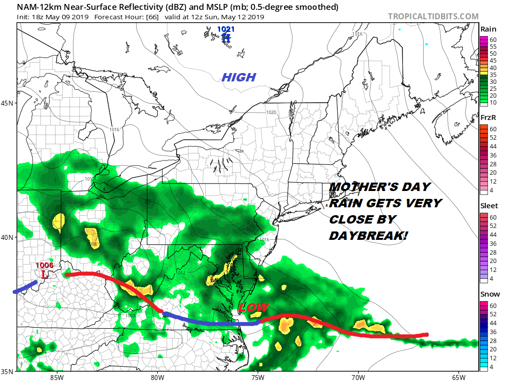
More on and off rain is possible Monday and it might linger into early Tuesday before weather conditions begin to improve. The complex blocky nature of our weather pattern continues for much of next week making forecasts rather difficult to say the least. We will discuss this further tomorrow once i get enough sleep after my long trip today. I haven’t missed is single day blog posting since I started doing this back in December of 2014 and I wasn’t going to kill the streak now.
MANY THANKS TO TROPICAL TIDBITS FOR THE USE OF MAPS
Please note that with regards to any tropical storms or hurricanes, should a storm be threatening, please consult your local National Weather Service office or your local government officials about what action you should be taking to protect life and property.


